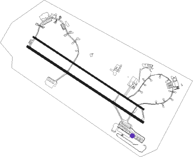
Trapani (tp) - Trapani Birgi
Airport details
| Country | Italy |
| State | Sicily |
| Region | LI |
| Airspace | Rome Ctr |
| Municipality | Misiliscemi |
| Elevation | 21ft (6m) |
| Timezone | GMT +1 |
| Coordinates | 37.91206, 12.49344 |
| Magnetic var | |
| Type | land |
| Available since | X-Plane v10.40 |
| ICAO code | LICT |
| IATA code | TPS |
| FAA code | n/a |
Communication
| Trapani Birgi Trapani Ground | 123.300 |
| Trapani Birgi Tower | 122.100 |
| Trapani Birgi Trapani Tower | 119.700 |
| Trapani Birgi Trapani Approach | 122.100 |
| Trapani Birgi Trapani Approach | 119.950 |
Approach frequencies
| ILS-cat-I | RW31L | 110.95 | 18.00mi |
| 3° GS | RW31L | 110.95 | 18.00mi |
Nearby Points of Interest:
Museo del Sale
-Porta Garibaldi
-Collegio dei Gesuiti
-Palazzo Comunale
-Castle of Ventimiglia
-Arab Fountain
-Ex Jesuits' College
-Palazzo De Ballis
Runway info
Nearby beacons
| code | identifier | dist | bearing | frequency |
|---|---|---|---|---|
| TRP | TRAPANI NDB | 0.1 | 348° | 317 |
| TRP | TRAPANI VORTAC | 1.3 | 129° | 108.80 |
| PRS | RAISI (PALERMO) VOR/DME | 31.8 | 66° | 113 |
| PAL | PALERMO VOR/DME | 33.1 | 80° | 112.30 |
Departure and arrival routes
| Transition altitude | 5000ft |
| SID end points | distance | outbound heading | |
|---|---|---|---|
| RW13R | |||
| MEGA1H, MEGA1D | 33mi | 233° | |
| KAPI1B | 32mi | 320° | |
| ADUK1B | 47mi | 320° | |
| GIAN1H | 58mi | 357° | |
| RW31L | |||
| MEGA1G | 33mi | 233° | |
| ADUK1A | 47mi | 320° | |
| KAPI1A | 32mi | 320° | |
| GIAN1G | 58mi | 357° | |
| STAR starting points | distance | inbound heading | |
|---|---|---|---|
| ALL | |||
| PAN1D | 70.5 | 26° | |
| MEGA1C, MEGA1F, MEGA1D | 32.5 | 53° | |
| ADUK1C, ADUK1D | 46.6 | 140° | |
| KAPI1D | 31.8 | 140° | |
| GIAN1D, GIAN1A | 57.5 | 177° | |
| PIVO1F | 41.6 | 301° | |
| RW13R | |||
| MEGA1B | 32.5 | 53° | |
| ADUK1E | 46.6 | 140° | |
| GIAN1B | 57.5 | 177° | |
| RW31L | |||
| MEGA1A | 32.5 | 53° | |
| PIVO1A | 41.6 | 301° | |
Disclaimer
The information on this website is not for real aviation. Use this data with the X-Plane flight simulator only! Data taken with kind consent from X-Plane 12 source code and data files. Content is subject to change without notice.

