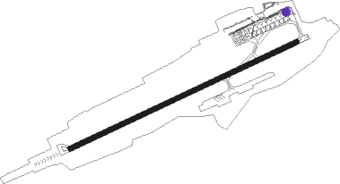
Treviso - Treviso Sant Angelo
Airport details
| Country | Italy |
| State | Veneto |
| Region | LI |
| Airspace | Milan Ctr |
| Municipality | Treviso |
| Elevation | 59ft (18m) |
| Timezone | GMT +1 |
| Coordinates | 45.65089, 12.19789 |
| Magnetic var | |
| Type | land |
| Available since | X-Plane v10.40 |
| ICAO code | LIPH |
| IATA code | TSF |
| FAA code | n/a |
Communication
| Treviso Sant Angelo Tower | 118.700 |
| Treviso Sant Angelo Approach | 120.405 |
| Treviso Sant Angelo Departure | 120.405 |
Approach frequencies
| ILS-cat-II | RW07 | 109.3 | 18.00mi |
| 3° GS | RW07 | 109.3 | 18.00mi |
Nearby Points of Interest:
Castello di Roncade
-Mercato delle Erbe
-Archivio di Stato di Venezia
-Museo Fortuny
-Bosco di Cavalier
-Le Colline del Prosecco di Conegliano e Valdobbiadene
-Padua's fourteenth-century fresco cycles
-Amphitheatre of Padua
-University Library of Padua
-Museum of Precinema
-Santo Spirito Church
-City of Vicenza and the Palladian Villas of the Veneto
-historic center of Vicenza
Nearby beacons
| code | identifier | dist | bearing | frequency |
|---|---|---|---|---|
| TEV | DME-ILS | 0.6 | 256° | 108.55 |
| ISA | ISTRANA TACAN | 4 | 294° | 111.70 |
| TRE | TREVISO NDB | 4.6 | 254° | 301 |
| TES | TESSERA VOR/DME | 10.6 | 128° | 115.30 |
| AVI | AVIANO NDB | 19 | 40° | 390 |
| IPD | DME-ILS | 21.4 | 234° | 111.30 |
| VIC | VICENZA NDB | 21.9 | 268° | 417 |
| AVI | AVIANO TACAN | 27.8 | 46° | 116.40 |
| CHI | CHIOGGIA NDB | 34.9 | 172° | 408 |
| RIV | RIVOLTO NDB | 35.5 | 69° | 371 |
| RIV | RIVOLTO TACAN | 42.6 | 69° | 110 |
| OZE | BOLZANO VOR/DME | 58.9 | 310° | 117.05 |
Departure and arrival routes
| Transition altitude | 6000ft |
| SID end points | distance | outbound heading | |
|---|---|---|---|
| RW07 | |||
| ROTA7F | 41mi | 116° | |
| ROSK6F | 34mi | 117° | |
| ALBE6F | 32mi | 252° | |
| VIC6F | 22mi | 269° | |
| RW25 | |||
| ROTA7F | 41mi | 116° | |
| ROSK6F | 34mi | 117° | |
| ALBE6F | 32mi | 252° | |
| VIC6F | 22mi | 269° | |
| STAR starting points | distance | inbound heading | |
|---|---|---|---|
| RW07 | |||
| ALBE1C | 31.9 | 72° | |
| VIC1C | 21.9 | 89° | |
Holding patterns
| STAR name | hold at | type | turn | heading* | altitude | leg | speed limit |
|---|---|---|---|---|---|---|---|
| ALBE1C | TRE | FIX | right | 246 (66)° | 3000ft - 60000ft | 1.0min timed | ICAO rules |
| CHI1C | CHI | NDB | right | 149 (329)° | > 5000ft | 1.0min timed | 210 |
| CHI1C | TRE | FIX | right | 246 (66)° | 3000ft - 60000ft | 1.0min timed | ICAO rules |
| VIC1C | TRE | FIX | right | 246 (66)° | 3000ft - 60000ft | 1.0min timed | ICAO rules |
| VIC1C | VIC | NDB | left | 242 (62)° | > 6000ft | 1.0min timed | 280 |
| *) magnetic outbound (inbound) holding course | |||||||
Disclaimer
The information on this website is not for real aviation. Use this data with the X-Plane flight simulator only! Data taken with kind consent from X-Plane 12 source code and data files. Content is subject to change without notice.
