Firenze - Firenze Peretola
Airport details
| Country | Italy |
| State | Tuscany |
| Region | LI |
| Airspace | Milan Ctr |
| Municipality | Florence |
| Elevation | 144ft (44m) |
| Timezone | GMT +1 |
| Coordinates | 43.80819, 11.19314 |
| Magnetic var | |
| Type | land |
| Available since | X-Plane v10.40 |
| ICAO code | LIRQ |
| IATA code | FLR |
| FAA code | n/a |
Communication
| Firenze Peretola FIRENZE ATIS | 129.350 |
| Firenze Peretola FIRENZE Tower | 118.300 |
| Firenze Peretola FIRENZE Approach | 125.825 |
| Firenze Peretola FIRENZE Departure | 118.300 |
Approach frequencies
| ILS-cat-I | RW05 | 110.3 | 18.00mi |
| 3° GS | RW05 | 110.3 | 18.00mi |
Nearby Points of Interest:
Villa Villoresi
-Parco Chico Mendes
-Palazzo Benini
-Palazzo Pretorio Spartaco Conti
-Villa Montalvo
-The Last Supper
-Museo Nazionale Alinari della Fotografia
-Biblioteca Riccardiana
-Biblioteca Medicea Laurenziana
-Cloister of the Scalzo
-Biblioteca Marucelliana
-Museo di Storia Naturale di Firenze
-Colonna dell'abbondanza
-Opificio delle pietre dure
-Palazzo delle Poste Centrali in Florence
-Brunelleschi's dome
-Historic Centre of Florence
-Galleria d'arte moderna di Firenze
-Tesoro dei Granduchi
-Hospital of Santa Maria Nuova
-Museo Franco Zeffirelli
-Uffizi Gallery
-San Pier Scheraggio (Church : Florence, Italy)
-Museo di Firenze com'era
-Villa Le Campora
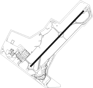
Runway info
| Runway 05 / 23 | ||
| length | 1565m (5135ft) | |
| bearing | 57° / 237° | |
| width | 30m (98ft) | |
| surface | asphalt | |
| displ threshold | 108m (354ft) / 586m (1923ft) | |
Nearby beacons
| code | identifier | dist | bearing | frequency |
|---|---|---|---|---|
| PRT | PERETOLA (FLORENCE) VOR/DME | 0.3 | 77° | 112.50 |
| PIN | PISA TACAN | 33.4 | 263° | 108.30 |
| PIS | PISA VOR/DME | 35.6 | 261° | 112.10 |
| PIS | PISA NDB | 41 | 256° | 379 |
| BOA | BOLOGNA VOR/DME | 43.9 | 8° | 117.10 |
| FOL | FORLI VOR/DME | 44.3 | 66° | 115.75 |
Departure and arrival routes
| Transition altitude | 6000ft |
| SID end points | distance | outbound heading | |
|---|---|---|---|
| RW05 | |||
| OKMA5H, OKMA5M | 15mi | 27° | |
| BIKT5H, BIKT5M | 19mi | 61° | |
| GAVR5H, GAVR5M | 27mi | 93° | |
| KUGI5M, KUGI5H | 17mi | 147° | |
| MARE5M, MARE5H | 39mi | 226° | |
| BALU5C, BALU5G, BALU5H, BALU5F, BALU5M | 29mi | 299° | |
| LOME5H, LOME5F | 16mi | 319° | |
| RW23 | |||
| OKMA5H, OKMA5M | 15mi | 27° | |
| BIKT5M, BIKT5H | 19mi | 61° | |
| GAVR5H, GAVR5M | 27mi | 93° | |
| KUGI5H, KUGI5M | 17mi | 147° | |
| MARE5M, MARE5H | 39mi | 226° | |
| BALU5H, BALU5F, BALU5M | 29mi | 299° | |
| LOME5H, LOME5F | 16mi | 319° | |
| STAR starting points | distance | inbound heading | |
|---|---|---|---|
| ALL | |||
| MARE1Q | 39.4 | 46° | |
| PIS3X | 35.6 | 81° | |
| BERO1D, BERO1V, BERO2P, BERO2X | 42.2 | 113° | |
| LOME1W, LOME1Q | 15.5 | 139° | |
| OKMA4P, OKMA3Q | 15.3 | 207° | |
| BIKT1W, BIKT3P, BIKT3Q | 18.9 | 241° | |
| GAVR1W, GAVR3Q, GAVR3P | 27.4 | 273° | |
| IBRI2X, IBRI2D | 17.0 | 327° | |
Instrument approach procedures
| runway | airway (heading) | route (dist, bearing) |
|---|---|---|
| RW05-Y | D169R (346°) | D169R (2682mi, 195°) D180P (2683mi, 14°) D214P (9mi, 284°) 3000ft UTUVI (4mi, 356°) 3000ft NIBTO (4mi, 57°) 3000ft |
| RW05-Y | GONGA (56°) | GONGA 5000ft UTUVI (5mi, 57°) 3000ft NIBTO (4mi, 57°) 3000ft |
| RW05-Y | NIBTO (55°) | NIBTO 3000ft |
| RNAV | NIBTO 3000ft RQ503 (8mi, 57°) 294ft RQ502 (17mi, 166°) 4000ft RQ502 (turn) 5000ft | |
| RW05-Z | D169R (346°) | D169R (2682mi, 195°) D180P (2683mi, 14°) D214P (9mi, 284°) 3000ft UTUVI (4mi, 356°) 3000ft NIBTO (4mi, 57°) 3000ft |
| RW05-Z | GONGA (56°) | GONGA 5000ft UTUVI (5mi, 57°) 3000ft NIBTO (4mi, 57°) 3000ft |
| RW05-Z | NIBTO (55°) | NIBTO 3000ft |
| RNAV | NIBTO 3000ft RQ501 (8mi, 57°) 574ft RQ502 (16mi, 162°) 4000ft RQ502 (turn) 5000ft |
Holding patterns
| STAR name | hold at | type | turn | heading* | altitude | leg | speed limit |
|---|---|---|---|---|---|---|---|
| AKUT2X | GONGA | VHF | right | 226 (46)° | 5000ft - 9000ft | DME 5.0mi | 210 |
| BERO1D | NIBTO | VHF | right | 226 (46)° | 3000ft - 9000ft | DME 4.0mi | 210 |
| BERO1V | GONGA | VHF | right | 226 (46)° | 5000ft - 9000ft | DME 5.0mi | 210 |
| BERO1V | NIBTO | VHF | right | 226 (46)° | 3000ft - 9000ft | DME 4.0mi | 210 |
| BERO2P | NIBTO | VHF | right | 226 (46)° | 3000ft - 9000ft | DME 4.0mi | 210 |
| BERO2X | GONGA | VHF | right | 226 (46)° | 5000ft - 9000ft | DME 5.0mi | 210 |
| BIKT1W | PRT | NDB | right | 31 (211)° | > 6000ft | 1.0min timed | ICAO rules |
| BIKT3P | NIBTO | VHF | right | 226 (46)° | 3000ft - 9000ft | DME 4.0mi | 210 |
| BIKT3Q | GONGA | VHF | right | 226 (46)° | 5000ft - 9000ft | DME 5.0mi | 210 |
| BIKT3Q | NIBTO | VHF | right | 226 (46)° | 3000ft - 9000ft | DME 4.0mi | 210 |
| GAVR1W | PRT | NDB | right | 31 (211)° | > 6000ft | 1.0min timed | ICAO rules |
| GAVR3P | NIBTO | VHF | right | 226 (46)° | 3000ft - 9000ft | DME 4.0mi | 210 |
| GAVR3Q | GONGA | VHF | right | 226 (46)° | 5000ft - 9000ft | DME 5.0mi | 210 |
| GAVR3Q | NIBTO | VHF | right | 226 (46)° | 3000ft - 9000ft | DME 4.0mi | 210 |
| IBRI1P | NIBTO | VHF | right | 226 (46)° | 3000ft - 9000ft | DME 4.0mi | 210 |
| IBRI1Q | GONGA | VHF | right | 226 (46)° | 5000ft - 9000ft | DME 5.0mi | 210 |
| IBRI1Q | NIBTO | VHF | right | 226 (46)° | 3000ft - 9000ft | DME 4.0mi | 210 |
| IBRI2D | NIBTO | VHF | right | 226 (46)° | 3000ft - 9000ft | DME 4.0mi | 210 |
| IBRI2X | GONGA | VHF | right | 226 (46)° | 5000ft - 9000ft | DME 5.0mi | 210 |
| LOME1Q | GONGA | VHF | right | 226 (46)° | 5000ft - 9000ft | DME 5.0mi | 210 |
| LOME1Q | NIBTO | VHF | right | 226 (46)° | 3000ft - 9000ft | DME 4.0mi | 210 |
| LOME1W | PRT | NDB | right | 31 (211)° | > 6000ft | 1.0min timed | ICAO rules |
| MARE1Q | GONGA | VHF | right | 226 (46)° | 5000ft - 9000ft | DME 5.0mi | 210 |
| MARE1Q | NIBTO | VHF | right | 226 (46)° | 3000ft - 9000ft | DME 4.0mi | 210 |
| OKMA3Q | GONGA | VHF | right | 226 (46)° | 5000ft - 9000ft | DME 5.0mi | 210 |
| OKMA3Q | NIBTO | VHF | right | 226 (46)° | 3000ft - 9000ft | DME 4.0mi | 210 |
| OKMA4P | NIBTO | VHF | right | 226 (46)° | 3000ft - 9000ft | DME 4.0mi | 210 |
| PIS3X | GONGA | VHF | right | 226 (46)° | 5000ft - 9000ft | DME 5.0mi | 210 |
| PRT1X | GONGA | VHF | right | 226 (46)° | 5000ft - 9000ft | DME 5.0mi | 210 |
| *) magnetic outbound (inbound) holding course | |||||||
Disclaimer
The information on this website is not for real aviation. Use this data with the X-Plane flight simulator only! Data taken with kind consent from X-Plane 12 source code and data files. Content is subject to change without notice.