Roma - Roma Urbe
Airport details
| Country | Italy |
| State | Lazio |
| Region | LI |
| Airspace | Rome Ctr |
| Municipality | Rome |
| Elevation | 55ft (17m) |
| Timezone | GMT +1 |
| Coordinates | 41.95438, 12.50256 |
| Magnetic var | |
| Type | land |
| Available since | X-Plane v10.40 |
| ICAO code | LIRU |
| IATA code | n/a |
| FAA code | n/a |
Communication
| ROMA Urbe URBE Ground Control | 122.700 |
| ROMA Urbe URBE Tower | 123.800 |
Nearby Points of Interest:
Palazzo Giustiniani
-Museum Venanzo Crocetti
-Villa Giulia
-Villa Madama
-Biblioteca Nazionale Centrale di Roma
-Biblioteca medica statale Rome
-Galleria d'arte moderna di Roma Capitale
-Museum of the Baths of Diocletian
-Giorgio De Chirico House
-Biblioteca universitaria Alessandrina
-Palazzo Barberini Mithraeum
-Capella dei Re Magi
-Palazzo del Tritone
-Palazzo Massimo alle Terme
-Palazzo Leoni, Bologna
-Istituto centrale per la grafica
-Palazzo Firenze
-Palazzo Chigi
-Palazzo della Consulta
-Palazzo Casali
-Museo Mario Praz
-Madonna dell'Archetto
-Palazzo Baldassini
-Biblioteca Angelica
-Palazzo Brancaccio
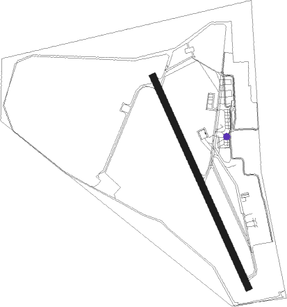
Runway info
| Runway 16 / 34 | ||
| length | 1085m (3560ft) | |
| bearing | 154° / 334° | |
| width | 31m (100ft) | |
| surface | asphalt | |
| displ threshold | 107m (351ft) / 247m (810ft) | |
Nearby beacons
| code | identifier | dist | bearing | frequency |
|---|---|---|---|---|
| URB | URBE (ROME) NDB | 0.8 | 232° | 285 |
| ROM | ROME VOR/DME | 9.7 | 150° | 110.80 |
| CMP | CAMPAGNANO VOR/DME | 11.5 | 324° | 111.40 |
| OST | OSTIA NDB | 14.8 | 241° | 327 |
| OST | OSTIA VOR/DME | 14.9 | 240° | 114.90 |
| TPR | PRATICA DI MARE TACAN | 19.9 | 182° | 108.70 |
| LAT | LATINA VOR/DME | 31 | 135° | 111.20 |
| VIB | VITERBO NDB | 35.2 | 317° | 480 |
| TAQ | TARQUINIA VOR/DME | 37.7 | 289° | 111.80 |
| FRS | FROSINONE VOR/DME | 40 | 112° | 115.60 |
Disclaimer
The information on this website is not for real aviation. Use this data with the X-Plane flight simulator only! Data taken with kind consent from X-Plane 12 source code and data files. Content is subject to change without notice.