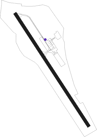
Portoroz
Airport details
| Country | Slovenia |
| State | Piran |
| Region | LJ |
| Airspace | Ljubljana Ctr |
| Municipality | Piran / Pirano |
| Elevation | 3ft (1m) |
| Timezone | GMT +1 |
| Coordinates | 45.47333, 13.61500 |
| Magnetic var | |
| Type | land |
| Available since | X-Plane v10.40 |
| ICAO code | LJPZ |
| IATA code | POW |
| FAA code | n/a |
Communication
| Portoroz Portoroz Tower | 124.880 |
| Portoroz Portoroz Approach | 124.880 |
Nearby beacons
| code | identifier | dist | bearing | frequency |
|---|---|---|---|---|
| POR | PORTOROZ VOR/DME | 0.1 | 296° | 115.15 |
| PZ | PORTOROZ NDB | 0.2 | 359° | 388 |
| VRS | VRSAR NDB | 15.8 | 173° | 369 |
| RCH | RONCHI DEI LEGIONARI VOR/DME | 22.1 | 339° | 114.20 |
| RON | RONCHI DEI LEGIONARI NDB | 23.8 | 324° | 396 |
| ILB | BISTRICA VOR/DME | 24 | 81° | 114.80 |
| BRZ | BREZA NDB | 30.9 | 94° | 400 |
| PLA | PULA NDB | 35.5 | 167° | 351 |
| KO | KOZALA (RIJEKA) NDB | 36 | 99° | 438 |
| GS | PULA NDB | 36.3 | 158° | 420 |
| VL | VALTURA NDB | 36.7 | 155° | 320 |
| PUL | PULA VOR/DME | 37.1 | 152° | 111.25 |
| RIV | RIVOLTO TACAN | 38.3 | 315° | 110 |
| KAV | KAVRAN NDB | 38.4 | 146° | 265 |
| RIV | RIVOLTO NDB | 39.5 | 304° | 371 |
| RJK | RIJEKA VOR/DME | 42.8 | 105° | 117.80 |
| CRE | CRES NDB | 48.2 | 125° | 433 |
| LBL | LJUBLJANA VOR/DME | 57.1 | 47° | 117.20 |
| MG | LJUBLJANA NDB | 57.5 | 53° | 296 |
| NTL | LOSINJ VOR/DME | 63.6 | 139° | 117.35 |
| LOS | LOSINJ NDB | 67.5 | 138° | 429 |
| LSJ | DME | 68.4 | 138° | 108.45 |
Departure and arrival routes
| Transition altitude | 10500ft |
| SID end points | distance | outbound heading | |
|---|---|---|---|
| RW15 | |||
| ILB1J, ILB1R | 24mi | 81° | |
| ROTA1J | 29mi | 251° | |
| RW33 | |||
| ILB2K, ILB2S | 24mi | 81° | |
| ROTA2K | 29mi | 251° | |
| STAR starting points | distance | inbound heading | |
|---|---|---|---|
| RW15 | |||
| ROTA1A | 29.0 | 71° | |
| ILB1A, ILB2P | 24.0 | 261° | |
Holding patterns
| STAR name | hold at | type | turn | heading* | altitude | leg | speed limit |
|---|---|---|---|---|---|---|---|
| ABLA2A | PZ | FIX | right | 107 (287)° | > 2700ft | 1.0min timed | ICAO rules |
| ABLA2P | POR | NDB | right | 107 (287)° | > 2700ft | 1.0min timed | ICAO rules |
| BARP1A | PZ | FIX | right | 107 (287)° | > 2700ft | 1.0min timed | ICAO rules |
| BARP2P | POR | NDB | right | 107 (287)° | > 2700ft | 1.0min timed | ICAO rules |
| ILB1A | PZ | FIX | right | 107 (287)° | > 2700ft | 1.0min timed | ICAO rules |
| ILB2P | POR | NDB | right | 107 (287)° | > 2700ft | 1.0min timed | ICAO rules |
| ROTA1A | PZ | FIX | right | 107 (287)° | > 2700ft | 1.0min timed | ICAO rules |
| *) magnetic outbound (inbound) holding course | |||||||
Disclaimer
The information on this website is not for real aviation. Use this data with the X-Plane flight simulator only! Data taken with kind consent from X-Plane 12 source code and data files. Content is subject to change without notice.
