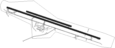
Karlovy Vary
Airport details
| Country | Czechia |
| State | Northwest |
| Region | LK |
| Airspace | Prague Ctr |
| Municipality | Karlovy Vary |
| Elevation | 1985ft (605m) |
| Timezone | GMT +1 |
| Coordinates | 50.20306, 12.91500 |
| Magnetic var | |
| Type | land |
| Available since | X-Plane v10.40 |
| ICAO code | LKKV |
| IATA code | KLV |
| FAA code | n/a |
Communication
| Karlovy Vary ATIS | 118.950 |
| Karlovy Vary Tower | 122.900 |
| Karlovy Vary Tower | 121.250 |
| Karlovy Vary Approach | 119.950 |
| Karlovy Vary Approach | 118.650 |
| Karlovy Vary Approach | 118.375 |
Approach frequencies
| ILS-cat-I | RW29 | 111.55 | 18.00mi |
| 3° GS | RW29 | 111.55 | 18.00mi |
Nearby Points of Interest:
Church of Saint Catherine in Olšová Vrata
-Vila Pupp
-Friedrich Schiller memorial in Karlovy Vary
-Vila Marghareta
-Chrámek kněžny Kuronské – Dorotein
-Penitence cross in Karlovy Vary – Na Milíři
-Protestant church of Saints Peter and Paul in Karlovy Vary
-Findlaterův altán
-Poštovní dvůr
-Olympia House
-Church of Holy Trinity (Andělská Hora)
-Statue of John of Nepomuk at Church of Maria Magdalena in Karlovy Vary
-Column of Charles IV in Karlovy Vary
-Olomouc City House
-Sophia House
-Mickiewicz House
-Jiskra Spa House
-Lützowova vila
-Hotel Felix Zawojski
-The Elefant House
-The Börse House
-U tří mouřenínů
-Holy Trinity Column in Karlovy Vary
-Peter the Great House
-Orange Tree House

Nearby beacons
| code | identifier | dist | bearing | frequency |
|---|---|---|---|---|
| L | VRATA (KARLOVY VARY) NDB | 1.1 | 105° | 365 |
| OKG | CHEB VOR/DME | 21.2 | 255° | 115.70 |
| GRW | GRAFENWOHR NDB | 48.4 | 242° | 405 |
| GRF | GRAFENWOHR TACAN | 48.6 | 242° | 111.80 |
| AGD | DME | 49.2 | 333° | 115.30 |
| ABU | ALTENBURG NDB | 49.8 | 334° | 330 |
| DRN | DRESDEN VOR/DME | 55.3 | 40° | 114.35 |
| DND | DME | 64.2 | 42° | 115.40 |
| FS | DRESDEN NDB | 69.2 | 43° | 374 |
Departure and arrival routes
| Transition altitude | 5000ft |
| SID end points | distance | outbound heading | |
|---|---|---|---|
| RW11 | |||
| ODPA3Z, ODPA3W | 38mi | 70° | |
| BALT1Z | 17mi | 105° | |
| LOMK1Z | 22mi | 132° | |
| OKG3Z | 21mi | 255° | |
| RAPE6Z | 22mi | 269° | |
| VARI8Z | 21mi | 279° | |
| KILN4Z | 16mi | 359° | |
| RW29 | |||
| ODPA3F | 38mi | 70° | |
| BALT2F | 17mi | 105° | |
| LOMK1F | 22mi | 132° | |
| OKG2F | 21mi | 255° | |
| RAPE2F | 22mi | 269° | |
| VARI2F | 21mi | 279° | |
| KILN3F | 16mi | 359° | |
| STAR starting points | distance | inbound heading | |
|---|---|---|---|
| RW11 | |||
| BEKT5K | 16.2 | 41° | |
| OKG8K | 21.2 | 75° | |
| GOPS3K, GOPS4V | 33.2 | 241° | |
| BALT9K | 17.2 | 285° | |
| RW29 | |||
| BEKT3P | 16.2 | 41° | |
| OKG2P | 21.2 | 75° | |
| GOPS2N, GOPS3P | 33.2 | 241° | |
| BALT2P | 17.2 | 285° | |
Instrument approach procedures
| runway | airway (heading) | route (dist, bearing) |
|---|---|---|
| RW11 | L (285°) | L KV110 (6mi, 330°) 4500ft KV111 (11mi, 285°) 4500ft ROTVA (4mi, 213°) 4500ft KV11G (6mi, 105°) 4500ft |
| RW11 | ROTVA (105°) | ROTVA KV11G (6mi, 105°) 4500ft |
| RNAV | KV11G 4500ft LKKV (8mi, 105°) 2037ft (3087mi, 194°) 5000ft (turn) | |
| RW29 | ARMOV (273°) | ARMOV KV292 (4mi, 217°) 4500ft |
| RW29 | BALTU (285°) | BALTU KV292 (4mi, 286°) 4500ft |
| RW29 | DONAD (325°) | DONAD KV291 (7mi, 105°) 4500ft KV292 (5mi, 34°) 4500ft |
| RW29 | L (285°) | L DONAD (7mi, 153°) 4500ft KV291 (7mi, 105°) 4500ft KV292 (5mi, 34°) 4500ft |
| RNAV | KV292 4500ft KV29F (5mi, 285°) 4500ft LKKV (8mi, 285°) 2034ft (3087mi, 194°) 5000ft (turn) |
Holding patterns
| STAR name | hold at | type | turn | heading* | altitude | leg | speed limit |
|---|---|---|---|---|---|---|---|
| BALT2P | DONAD | VHF | right | 289 (109)° | > 4500ft | 1.0min timed | ICAO rules |
| BEKT3P | DONAD | VHF | right | 289 (109)° | > 4500ft | 1.0min timed | ICAO rules |
| GOPS2N | DONAD | VHF | right | 289 (109)° | > 4500ft | 1.0min timed | ICAO rules |
| GOPS2N | L | FIX | right | 289 (109)° | > 5000ft | 1.0min timed | ICAO rules |
| OKG2P | DONAD | VHF | right | 289 (109)° | > 4500ft | 1.0min timed | ICAO rules |
| *) magnetic outbound (inbound) holding course | |||||||
Disclaimer
The information on this website is not for real aviation. Use this data with the X-Plane flight simulator only! Data taken with kind consent from X-Plane 12 source code and data files. Content is subject to change without notice.