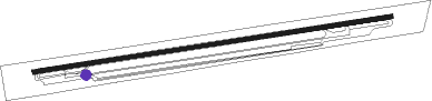
Panensky Tynec
Airport details
| Country | Czechia |
| State | Northwest |
| Region | LK |
| Airspace | Prague Ctr |
| Municipality | Úherce |
| Elevation | 1207ft (368m) |
| Timezone | GMT +1 |
| Coordinates | 50.30639, 13.93500 |
| Magnetic var | |
| Type | land |
| Available since | X-Plane v10.40 |
| ICAO code | LKPC |
| IATA code | n/a |
| FAA code | n/a |
Communication
| Panensky Tynec INFO | 118.500 |
Nearby Points of Interest:
Church of Saint Blaise in Žerotín
-Church of the Assumption
-Windmill in Donín
-Žerotín
-Toužetín Castle
-Church of Saints Peter and Paul in Peruc
-Vraný
-Křížová cesta (Vraný)
-Villa of Antonín Wiehl
-Bell tower in Kvílice
-Church of Saint Vitus
-Blšany Castle
-Church of Saint Gall
-Zvonice
-Church of Saint James the Greater
-Chapel of Saint Anne
-Church of Saint Nicholas
-Cítoliby Castle
-Šebín
-Church of Saint Wenceslaus
-Church of Saint Anthony of Padua
-Former fortress in Malíkovice
-Žatec gate (Louny)
-Church of Saint Isidore the Laborer
-Kinsky's funeral chapel in Budenice
Nearby beacons
| code | identifier | dist | bearing | frequency |
|---|---|---|---|---|
| L | LIBOC (PRAGUE) NDB | 17.5 | 118° | 372 |
| V | MASLOVICE (VODOCHODY) NDB | 17.6 | 101° | 416 |
| OKL | PRAGUE VOR/DME | 17.9 | 122° | 112.60 |
| K | KBELY NDB | 26.5 | 106° | 438 |
| NER | NERATOVICE VOR/DME | 26.5 | 85° | 112.25 |
| KD | KBELY NDB | 28.4 | 102° | 300 |
| PSK | DME | 31.5 | 169° | 117.60 |
| L | VRATA (KARLOVY VARY) NDB | 38.7 | 264° | 365 |
| HDO | HERMSDORF VOR/DME | 40.8 | 35° | 108.65 |
| DRN | DRESDEN VOR/DME | 44.4 | 335° | 114.35 |
| DND | DME | 49.8 | 348° | 115.40 |
| FS | DRESDEN NDB | 53.3 | 355° | 374 |
| VOZ | VOZICE VOR/DME | 59 | 129° | 116.95 |
Disclaimer
The information on this website is not for real aviation. Use this data with the X-Plane flight simulator only! Data taken with kind consent from X-Plane 12 source code and data files. Content is subject to change without notice.