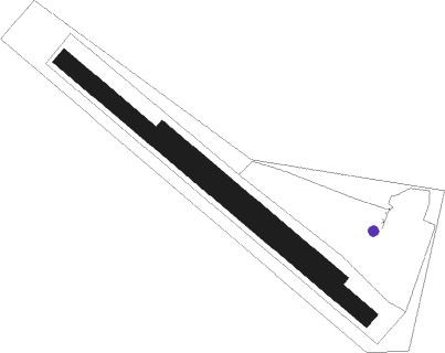
Roudnice Nad Labem - Roudnice
Airport details
| Country | Czechia |
| State | Northwest |
| Region | LK |
| Airspace | Prague Ctr |
| Municipality | Roudnice nad Labem |
| Elevation | 728ft (222m) |
| Timezone | GMT +1 |
| Coordinates | 50.41056, 14.22611 |
| Magnetic var | |
| Type | land |
| Available since | X-Plane v10.40 |
| ICAO code | LKRO |
| IATA code | n/a |
| FAA code | n/a |
Communication
| Roudnice INFO | 122.200 |
Nearby Points of Interest:
Žižkova 757
-Vila čp. 1414
-Augustiniánský klášter v Roudnici
-Town hall in Roudnice nad Labem
-Watermill in Roudnice nad Labem
-Městská hláska, Roudnice nad Labem
-Vladimírov
-Church of Saint Wenceslaus
-klášter kapucínů
-Brewery
-Church of Saint Procopius
-Church of Saint Clemens
-Synagogue in Budyně nad Ohří
-Church of Saints Peter and Paul
-Church of Saint Godehard
-Church of Saint Nicholas
-Church of the Assumption of the Virgin Mary (Charvatce)
-Church of Saint Bartholomew
-Church of Saint Giles
-Church of Saint James the Greater
-Kaple Panny Marie
-Hrdly
-Brňany Castle
-Železniční most
-Saints Procopius and Nicholas church
Nearby beacons
| code | identifier | dist | bearing | frequency |
|---|---|---|---|---|
| V | MASLOVICE (VODOCHODY) NDB | 12.7 | 142° | 416 |
| NER | NERATOVICE VOR/DME | 15.3 | 96° | 112.25 |
| L | LIBOC (PRAGUE) NDB | 17.6 | 168° | 372 |
| OKL | PRAGUE VOR/DME | 18.9 | 173° | 112.60 |
| K | KBELY NDB | 21.3 | 129° | 438 |
| KD | KBELY NDB | 22 | 122° | 300 |
| HDO | HERMSDORF VOR/DME | 31.5 | 15° | 108.65 |
| PSK | DME | 38.2 | 197° | 117.60 |
| OKX | FRYDLANT VOR/DME | 42.5 | 59° | 114.85 |
| DRN | DRESDEN VOR/DME | 43.4 | 314° | 114.35 |
| DND | DME | 46.7 | 327° | 115.40 |
| FS | DRESDEN NDB | 49.1 | 334° | 374 |
| VLM | VLASIM VOR/DME | 53.3 | 130° | 114.30 |
| VOZ | VOZICE VOR/DME | 58.3 | 144° | 116.95 |
Disclaimer
The information on this website is not for real aviation. Use this data with the X-Plane flight simulator only! Data taken with kind consent from X-Plane 12 source code and data files. Content is subject to change without notice.

