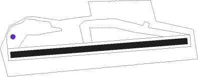
Tocna
Airport details
| Country | Czechia |
| State | Prague |
| Region | LK |
| Airspace | Prague Ctr |
| Elevation | 1024ft (312m) |
| Timezone | GMT +1 |
| Coordinates | 49.98652, 14.42436 |
| Magnetic var | |
| Type | land |
| Available since | X-Plane v10.40 |
| ICAO code | LKTC |
| IATA code | n/a |
| FAA code | n/a |
Communication
| Tocna INFO | 123.400 |
Nearby Points of Interest:
Zámek Komořany
-Vila Růže
-Vila Planá růže
-Villa Otto
-Storchova vila
-Vila Vladislava Vančury
-Church of Saint Gall in Zbraslav
-Hradišťátko
-Dolní Břežany Castle
-Chapel of Saints Peter and Paul in Lhotka
-Hořanovského vila
-Martin Frič House
-Church of Saints Peter and Paul
-Braník Brewery
-Šimsovo sanatorium
-Vila Kamila
-Vila Barrandovská 25
-Barrandovská 46
-Vila Barrandovská 60
-Skalní 10
-Chapel of Saint Anne in Krč
-Zámeček Na Křížku
-Usedlost Zemanka
-Barrandovská 22
-Skalní 17
Nearby beacons
| code | identifier | dist | bearing | frequency |
|---|---|---|---|---|
| OKL | PRAGUE VOR/DME | 8.9 | 305° | 112.60 |
| L | LIBOC (PRAGUE) NDB | 9.6 | 314° | 372 |
| K | KBELY NDB | 10.2 | 45° | 438 |
| KD | KBELY NDB | 12.9 | 52° | 300 |
| V | MASLOVICE (VODOCHODY) NDB | 14.1 | 348° | 416 |
| PSK | DME | 19.3 | 243° | 117.60 |
| NER | NERATOVICE VOR/DME | 24 | 27° | 112.25 |
| VLM | VLASIM VOR/DME | 30.1 | 114° | 114.30 |
| VOZ | VOZICE VOR/DME | 32.3 | 135° | 116.95 |
| F | CASLAV NDB | 36 | 92° | 715 |
| C | CASLAV NDB | 38 | 94° | 715 |
| HDO | HERMSDORF VOR/DME | 56.5 | 357° | 108.65 |
| OKX | FRYDLANT VOR/DME | 59.7 | 34° | 114.85 |
Disclaimer
The information on this website is not for real aviation. Use this data with the X-Plane flight simulator only! Data taken with kind consent from X-Plane 12 source code and data files. Content is subject to change without notice.