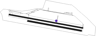
Vodochody
Airport details
| Country | Czechia |
| State | Central Bohemia |
| Region | LK |
| Airspace | Prague Ctr |
| Municipality | Máslovice |
| Elevation | 916ft (279m) |
| Timezone | GMT +1 |
| Coordinates | 50.22082, 14.37866 |
| Magnetic var | |
| Type | land |
| Available since | X-Plane v10.40 |
| ICAO code | LKVO |
| IATA code | VOD |
| FAA code | n/a |
Communication
| Vodochody ATIS | 123.030 |
| Vodochody Tower | 133.080 |
| Vodochody RADAR | 127.480 |
Approach frequencies
| ILS-cat-I | RW28 | 110.75 | 18.00mi |
| 3° GS | RW28 | 110.75 | 18.00mi |
Nearby Points of Interest:
zámek Odolena Voda
-most T. G. Masaryka
-Pravý Hradec
-Minice
-Rotunda of the Nativity of the Virgin Mary in Holubice
-Tvrz v Předboji
-Castle in Roztoky
-Church of Saint Andrew in Nelahozeves
-Zámek Zdiby
-Zájezdní hostinec na Výhledech
-Čimická tvrz
-Hospic Štrasburk
-Kaple Nejsvětější Trojice (Sedlec, Prague)
-Rectory in Bohnice
-Statek Vraných
-Church of St Peter and St Paul, Budeč
-Belfry in Vepřek
-Měšice Castle
-Fuchsův statek
-Vila V Podbabě 20
-Pazderka
-Ďáblice Castle
-Sklenářka
-Hradiště Baba
-Purkrábka
Nearby beacons
| code | identifier | dist | bearing | frequency |
|---|---|---|---|---|
| V | MASLOVICE (VODOCHODY) NDB | 0.1 | 261° | 416 |
| L | LIBOC (PRAGUE) NDB | 7 | 222° | 372 |
| OKL | PRAGUE VOR/DME | 8.6 | 222° | 112.60 |
| K | KBELY NDB | 9.1 | 116° | 438 |
| KD | KBELY NDB | 10.7 | 105° | 300 |
| NER | NERATOVICE VOR/DME | 12.7 | 59° | 112.25 |
| PSK | DME | 29.3 | 218° | 117.60 |
| F | CASLAV NDB | 40.8 | 105° | 715 |
| VLM | VLASIM VOR/DME | 40.8 | 127° | 114.30 |
| HDO | HERMSDORF VOR/DME | 42.4 | 359° | 108.65 |
| VOZ | VOZICE VOR/DME | 45.5 | 144° | 116.95 |
| OKX | FRYDLANT VOR/DME | 47.9 | 44° | 114.85 |
| DRN | DRESDEN VOR/DME | 56.2 | 316° | 114.35 |
| DND | DME | 59.4 | 326° | 115.40 |
| FS | DRESDEN NDB | 61.7 | 331° | 374 |
Departure and arrival routes
| Transition altitude | 5000ft |
| STAR starting points | distance | inbound heading | |
|---|---|---|---|
| RW10 | |||
| VLM5Z | 30.2 | 311° | |
| APRA1Z | 20.0 | 321° | |
| RW28 | |||
| APRA1Z | 20.0 | 321° | |
Instrument approach procedures
| runway | airway (heading) | route (dist, bearing) |
|---|---|---|
| RW10 | EKROT (287°) | EKROT VO281 (4mi, 1°) 3100ft VO282 (8mi, 280°) 3000ft VO284 (3mi, 280°) 2500ft VO28F (4mi, 280°) VO430 (7mi, 302°) VO102 (8mi, 280°) VO103 (3mi, 202°) 2500ft |
| RW10 | SULOV (248°) | SULOV VO283 (5mi, 128°) 2500ft VO284 (3mi, 203°) VO28F (4mi, 280°) VO430 (7mi, 302°) VO102 (8mi, 280°) VO103 (3mi, 202°) 2500ft |
| RNAV | VO103 2500ft VO10F (4mi, 100°) 2500ft LKVO (5mi, 99°) 929ft LKVO (turn) 2500ft (3105mi, 196°) 2500ft | |
| RW28 | EKROT (287°) | EKROT VO281 (4mi, 1°) 3100ft VO282 (8mi, 280°) 3000ft VO284 (3mi, 280°) 2500ft |
| RW28 | SULOV (248°) | SULOV VO283 (5mi, 128°) 2500ft VO284 (3mi, 203°) 2500ft |
| RNAV | VO284 2500ft VO28F (4mi, 280°) 2500ft LKVO (6mi, 280°) 964ft LKVO (turn) 2500ft (3105mi, 196°) 2500ft |
Holding patterns
| STAR name | hold at | type | turn | heading* | altitude | leg | speed limit |
|---|---|---|---|---|---|---|---|
| APRA1Z | APRAQ | VHF | left | 217 (37)° | > 5500ft | 1.0min timed | ICAO rules |
| APRA1Z | EKROT | VHF | left | 177 (357)° | > 3000ft | 1.0min timed | ICAO rules |
| GOLO3Z | ERASU | VHF | left | 241 (61)° | > 4000ft | 1.0min timed | ICAO rules |
| GOLO3Z | GOLOP | VHF | left | 350 (170)° | > 5500ft | 1.0min timed | ICAO rules |
| LOMK3Z | ERASU | VHF | left | 241 (61)° | > 4000ft | 1.0min timed | ICAO rules |
| LOMK3Z | LOMKI | VHF | right | 269 (89)° | > 5500ft | 1.0min timed | ICAO rules |
| VLM5Z | EKROT | VHF | left | 177 (357)° | > 3000ft | 1.0min timed | ICAO rules |
| VLM5Z | VLM | NDB | left | 123 (303)° | > 5500ft | 1.0min timed | ICAO rules |
| *) magnetic outbound (inbound) holding course | |||||||
Disclaimer
The information on this website is not for real aviation. Use this data with the X-Plane flight simulator only! Data taken with kind consent from X-Plane 12 source code and data files. Content is subject to change without notice.

