Dobersberg
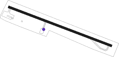
Airport details
| Country | Austria |
| State | Lower Austria |
| Region | LO |
| Airspace | Vienna Ctr |
| Municipality | Dobersberg |
| Elevation | 1720ft (524m) |
| Timezone | GMT +1 |
| Coordinates | 48.92222, 15.29694 |
| Magnetic var | |
| Type | land |
| Available since | X-Plane v10.40 |
| ICAO code | LOAB |
| IATA code | n/a |
| FAA code | n/a |
Communication
| Dobersberg Dobersberg Flugplatz | 122.505 |
Nearby Points of Interest:
Schloss Illmau
-Kath. Pfarrkirche hl. Bartholomäus
-Wehrkirche Kleinzwettl
-Zámek Dobrohoř
-Chapel of the Holy Cross
-Chapel of Saint John of Nepomuk
-Synagogue in Slavonice
-City walls of Slavonice
-Pfarrkirche Puch, Waidhofen an der Thaya
-Stations of the Cross in Slavonice
-City wall, Waidhofen a. d. Thaya
-Ortskapelle Leopoldsdorf
-Friedhof, jüdisch in Waidhofen an der Thaya
-Jewish cemetery in Písečné
-Kostel Panny Marie Bolestné
-Pfarrkirche Buchbach
-Rathaus Weikertschlag an der Thaya
-Klafferkapelle
-Jewish cemetery in Dolní Bolíkov
-Hängender Stein
-Church of Saints Peter and Paul
-Stadtpfarrkirche Heidenreichstein
-Kollegiatstift Eisgarn
-Saint John the Baptist Church
-Church of the Assumption
Nearby beacons
| code | identifier | dist | bearing | frequency |
|---|---|---|---|---|
| OKF | DESNA VOR/DME | 10.2 | 79° | 113.15 |
| XU | NAMEST NDB | 34.5 | 70° | 563 |
| X | NAMEST NDB | 35.1 | 72° | 362 |
| L | NAMEST NDB | 36.4 | 75° | 362 |
| LA | NAMEST NDB | 37 | 76° | 514 |
| VOZ | VOZICE VOR/DME | 40.2 | 325° | 116.95 |
| STO | STOCKERAU VOR/DME | 41.7 | 125° | 113 |
| TUN | TULLN NDB | 45.7 | 132° | 358 |
| VLM | VLASIM VOR/DME | 47.8 | 344° | 114.30 |
| LNZ | LINZ NDB | 56.5 | 235° | 327 |
| STE | STEINHOF NDB | 57 | 127° | 293 |
| CF | CASLAV NDB | 59.2 | 8° | 345 |
Disclaimer
The information on this website is not for real aviation. Use this data with the X-Plane flight simulator only! Data taken with kind consent from X-Plane 12 source code and data files. Content is subject to change without notice.