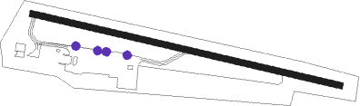
Krems - Krems Langenlois
Airport details
| Country | Austria |
| State | Lower Austria |
| Region | LO |
| Airspace | Vienna Ctr |
| Municipality | Krems an der Donau |
| Elevation | 1020ft (311m) |
| Timezone | GMT +1 |
| Coordinates | 48.44655, 15.62853 |
| Magnetic var | |
| Type | land |
| Available since | X-Plane v10.40 |
| ICAO code | LOAG |
| IATA code | n/a |
| FAA code | n/a |
Communication
| Krems Langenlois Krems Flugplatz | 122.705 |
Nearby Points of Interest:
Beethoven-Haus
-Venus of Galgenberg
-Hauerhaus mit Rauchküche
-Pulverturm
-Filialkirche Gedersdorf
-Schloss Droß
-Schlosskapelle Droß
-Saint James the Greater Church
-Holzingerhaus
-Mauterner Donaubrücke
-Nikolaihof Mautern
-Schloss Mautern
-Förthof
-Ausstellungshaus Spoerri
-Hausberg Zorimauer
-Pfarrkirche Etsdorf
-Burgruine Bertholdstein
-Pfarrkirche Straß im Straßertale
-Kellerschlössl Dürnstein
-Filialkirche St. Blasius, Kleinwien
-Pfarrkirche Engabrunn
-Pfarrkirche Feuersbrunn
-Pfarrkirche hl. Andreas Grafenwörth
-Saint Nicholas Church
-Pfarrkirche Gföhl
Nearby beacons
| code | identifier | dist | bearing | frequency |
|---|---|---|---|---|
| STO | STOCKERAU VOR/DME | 15.6 | 94° | 113 |
| TUN | TULLN NDB | 16.2 | 111° | 358 |
| STE | STEINHOF NDB | 28.4 | 111° | 293 |
| OKF | DESNA VOR/DME | 31.5 | 351° | 113.15 |
| WGM | WAGRAM VOR/DME | 35.1 | 98° | 112.20 |
| SNU | SOLLENAU VOR/DME | 43.3 | 131° | 115.50 |
| LA | NAMEST NDB | 46.8 | 39° | 514 |
| L | NAMEST NDB | 47.1 | 37° | 362 |
| X | NAMEST NDB | 47.8 | 33° | 362 |
| XU | NAMEST NDB | 48.3 | 30° | 563 |
Disclaimer
The information on this website is not for real aviation. Use this data with the X-Plane flight simulator only! Data taken with kind consent from X-Plane 12 source code and data files. Content is subject to change without notice.