Punitz
Airport details
| Country | Austria |
| State | Burgenland |
| Region | LO |
| Airspace | Vienna Ctr |
| Municipality | Tobaj |
| Elevation | 950ft (290m) |
| Timezone | GMT +1 |
| Coordinates | 47.14833, 16.31833 |
| Magnetic var | |
| Type | land |
| Available since | X-Plane v10.40 |
| ICAO code | LOGG |
| IATA code | n/a |
| FAA code | n/a |
Communication
| Punitz Punitz Flugplatz | 123.205 |
Nearby Points of Interest:
Alte Hofmühle
-Synagoge Oberwart
-Pfarrkirche Wörth an der Lafnitz
-Schüttkasten Rechnitz
-Synagoge Stadtschlaining
-Potyondi-mocsár
-Saint Florian Church
-Mary Magdalene Church
-Wegkapelle
-Pfarrkirche Unterlamm
-Turmschule Schreibersdorf
-Salvator Church
-Florianikapelle
-Pfarrkirche Großsteinbach
-St. Nicholas's Parish Church
-Jost-Mühle
-Schloss Reitenau
-Austrian-Slovenian-Hungarian tripoint
-Hodoš Lutheran Church
-Kloster Marienberg, Burgenland
-Kapela, Adrijanci
-Vaški zvonik, Dolič
-Alsó-Rába-völgy
-Saint Nicholas Church
-Villa Hold (Feldbach)
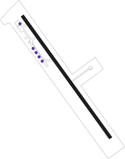
Runway info
| Runway 15 / 33 | ||
| length | 821m (2694ft) | |
| bearing | 138° / 318° | |
| width | 18m (59ft) | |
| surface | asphalt | |
| displ threshold | 10m (33ft) / 0m (0ft) | |
Nearby beacons
| code | identifier | dist | bearing | frequency |
|---|---|---|---|---|
| RAW | DME | 23.6 | 284° | 112.15 |
| STK | KOGEL DME | 24.1 | 232° | 114.55 |
| GBG | GLEICHENBERG NDB | 26.3 | 243° | 426 |
| GRZ | GRAZ VOR/DME | 37.3 | 257° | 116.20 |
| GRZ | GRAZ NDB | 37.7 | 255° | 290 |
| SNU | SOLLENAU VOR/DME | 43.6 | 358° | 115.50 |
| SME | SARMELLEK NDB | 45.2 | 120° | 436 |
| MI | OREHOVA VAS (MARIBOR) NDB | 48.3 | 222° | 355 |
| VAR | VARAZDIN NDB | 50.3 | 176° | 344 |
| MR | MARIBOR NDB | 51.4 | 214° | 334 |
| BRK | BRUCK NDB | 57.2 | 24° | 408 |
| FMD | FISCHAMEND VOR/DME | 58.8 | 18° | 110.40 |
| OB | STEFANIK SOUTH NDB | 70.3 | 45° | 330 |
Disclaimer
The information on this website is not for real aviation. Use this data with the X-Plane flight simulator only! Data taken with kind consent from X-Plane 12 source code and data files. Content is subject to change without notice.