Airports for X-Plane offers a convenient way to explore airports and their related communication information for the X-Plane flight simulator. It only uses data from the X-Plane flight simulator itself, and is therefore more reliable than the data that comes from real aviation websites. You can search for airports by using the ICAO code, or browse for airports per country and state. The information displayed is categorized by airport details, runway information, airport communication, approach frequencies (ILS and Glidepath details), details of nearby beacons, SIDs, STARs and approach procedures.

helipad outskirts airdrome arriving international airport ferry flight plane transit stopover airport apron aviation landing luggage tarmac grass automated airport weather station hotel airplane airstrip

Ried - Ried-kirchheim

Airport details

CountryAustria
StateUpper Austria
RegionLO
AirspaceVienna Ctr
MunicipalityKirchheim im Innkreis
Elevation1376ft (419m)
TimezoneGMT +1
Coordinates48.21250, 13.34500
Magnetic var
Typeland
Available sinceX-Plane v10.40
ICAO codeLOLK
IATA coden/a
FAA coden/a

Communication

Ried-Kirchheim Kirchheim Flugplatz122.650
Nearby Points of Interest:
Pfarrkirche Heiliger Nikolaus
-
Holy Name of Mary Church
-
Schloss Hueb
-
Pfarrkirche Aspach
-
Pfarrkirche Mettmach
-
Pfarrkirche Mariä Himmelfahrt, Eitzing
-
Pfarrkirche Roßbach
-
Holy Cross Church
-
Pfarrkirche Höhnhart
-
Pfarrkirche Sankt Georgen bei Obernberg am Inn
-
Saint Maurice Church
-
Filialkirche Kleinmurham
-
Pfarrkirche Treubach
-
Pfarrkirche Waldzell
-
Christ Church (Ried im Innkreis)
-
Saints Peter and Paul Church
-
Museum Innviertler Volkskundehaus
-
Pfarrkirche Mariä Himmelfahrt, Utzenaich
-
Pfarrkirche Tumeltsham
-
Katholische Pfarrkirche, Schildorn
-
Saint Lawrence Church (Pattigham)
-
Pflegerkasten
-
Ehemaliges Fürstbischöfliches Schloss
-
Church of the Assumption (Mühlheim am Inn)
-
Mariä Himmelfahrt zu St. Leonhard

Runway info

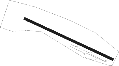
Runway 12 / 30
 length744m (2441ft)
 bearing111° / 291°
 width18m (59ft)
 surfaceasphalt

Airport layout


Parking locations

Nearby beacons

codeidentifierdistbearingfrequency
SBGSALZBURG VOR/DME22245°113.80
SBGSALZBURG NDB23.3241°382
GSBDME26.2210°109.45
SISALZBURG NDB27.6222°410
LNZLINZ VOR/DME30.389°116.60
FREDME33.974°113.50
LNZLINZ NDB39.189°327
RDGRODING VOR/DME59.3315°114.70

Disclaimer

The information on this website is not for real aviation. Use this data with the X-Plane flight simulator only! Data taken with kind consent from X-Plane 12 source code and data files. Content is subject to change without notice.