Airports for X-Plane offers a convenient way to explore airports and their related communication information for the X-Plane flight simulator. It only uses data from the X-Plane flight simulator itself, and is therefore more reliable than the data that comes from real aviation websites. You can search for airports by using the ICAO code, or browse for airports per country and state. The information displayed is categorized by airport details, runway information, airport communication, approach frequencies (ILS and Glidepath details), details of nearby beacons, SIDs, STARs and approach procedures.

international tarmac bus gravel airbase air traffic control buildings frankfurt airport runway lighting helipad railway station automated airport weather station near airplane customs aircraft newark kennedy airdock international airport

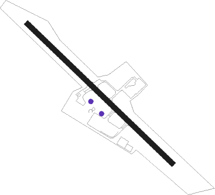
Schärding / Suben - Schärding-suben

Airport details

CountryAustria
StateUpper Austria
RegionLO
AirspaceVienna Ctr
MunicipalitySankt Marienkirchen bei Schärding
Elevation1068ft (326m)
TimezoneGMT +1
Coordinates48.40083, 13.44972
Magnetic var
Typeland
Available sinceX-Plane v10.40
ICAO codeLOLS
IATA coden/a
FAA coden/a

Communication

Schärding-Suben Schärding Suben Flugplatz122.705
Nearby Points of Interest:
Pfarrkirche Sankt Marienkirchen bei Schärding
-
Suben Penitentiary
-
Pfarrkirche hl. Lambert, Suben
-
Pfarrkirche Eggerding
-
Burg Schärding
-
Pfarrkirche Taufkirchen an der Pram
-
Pfarrkirche hl. Ägidius und Friedhof, Antiesenhofen
-
Pfarr- und Wallfahrtskirche Mariä Heimsuchung
-
St. Stephan (Sulzbach am Inn)
-
Pfarrkirche hl. Petrus, Rainbach im Innkreis
-
Pfarrkirche Diersbach
-
Stiftskirche Reichersberg
-
Pfarrkirche Ort im Innkreis
-
Saint Pancratius Church
-
Schloss Sigharting
-
Filialkirche Kleinmurham
-
Schloss Schönburg
-
Pfarrkirche Mariä Himmelfahrt, Utzenaich
-
Pfarrkirche Sankt Georgen bei Obernberg am Inn
-
Burg Rohr
-
Burgstall Straßwitraun
-
Holy Cross Church
-
Schloss Raab
-
Pfarrkirche Kopfing
-
Holy Trinity Church (Andrichsfurt)

Runway info

Runway 14 / 32
 length804m (2638ft)
 bearing127° / 307°
 width21m (69ft)
 surfaceasphalt

Airport layout - parking location Grass


Parking locations

Nearby beacons

codeidentifierdistbearingfrequency
FREDME27.187°113.50
LNZLINZ VOR/DME28105°116.60
SBGSALZBURG VOR/DME32.6234°113.80
SBGSALZBURG NDB34.2232°382
LNZLINZ NDB36.1101°327
GSBDME38.2210°109.45
SISALZBURG NDB39.5218°410
RDGRODING VOR/DME53305°114.70

Disclaimer

The information on this website is not for real aviation. Use this data with the X-Plane flight simulator only! Data taken with kind consent from X-Plane 12 source code and data files. Content is subject to change without notice.