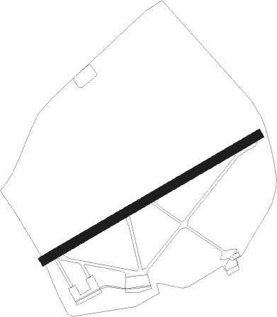
Airports for X-Plane offers a convenient way to explore airports and their related communication information for the X-Plane flight simulator. It only uses data from the X-Plane flight simulator itself, and is therefore more reliable than the data that comes from real aviation websites. You can search for airports by using the ICAO code, or browse for airports per country and state. The information displayed is categorized by airport details, runway information, airport communication, approach frequencies (ILS and Glidepath details), details of nearby beacons, SIDs, STARs and approach procedures.

hangar railway station kennedy nearby capital metro warfare gravel city local government rail transport airplane stol station helipad aircraft carrier hospital airfield airliner train station

Aigen Im Ennstal

Airport details

CountryAustria
StateStyria
RegionLO
AirspaceVienna Ctr
MunicipalityAigen im Ennstal
Elevation2091ft (637m)
TimezoneGMT +1
Coordinates47.53778, 14.13889
Magnetic var
Typeland
Available sinceX-Plane v10.30
ICAO codeLOXA
IATA coden/a
FAA coden/a

Communication

Aigen im Ennstal Aigen Tower118.000
Nearby Points of Interest:
Schloss Grubegg
-
Rathaus Rottenmann
-
Ehemaliges Augustinerchorherrenstift Rottenmann
-
Kollegiatstift Spital am Pyhrn
-
Schloss Thannegg
-
Höhensiedlung Kaiserköpperl
-
Admont Abbey
-
Pfarrkirche hl. Jakob, Windischgarsten
-
Kaiserlicher Stall
-
Pfarrkirche hl. Pankraz, St. Pankraz, Upper Austria
-
Schloss Kaiserau
-
Pfarrkirche hll. Kosmas und Damian, Weng im Gesäuse
-
Glaubenskirche (St. Johann am Tauern)
-
Pfarrkirche Unbefleckte Empfängnis Mariä, Steyrling
-
Pfarrkirche Bretstein
-
Pfarrkirche Klaus an der Pyhrnbahn
-
Altaussee salt mine
-
Lodenwalker
-
Pfarrkirche Obertraun
-
Evangelisches Bethaus Obertraun
-
Hallstatt-Dachstein Salzkammergut cultural landscape
-
Sensenschmiede an der Zinne
-
Pfarrkirche hl. Josef, Mittermicheldorf
-
Steinhuberhammer
-
Wallfahrtskirche Maria Altötting, Winklern bei Oberwölz

Runway info

Runway 06 / 24
 length1076m (3530ft)
 bearing72° / 252°
 width40m (131ft)
 surfacegrass
 displ threshold50m (164ft) / 100m (328ft)

Airport layout


Taxiway locations
Parking locations

Nearby beacons

codeidentifierdistbearingfrequency
ZWZELTWEG NDB32.3119°418
LNZLINZ VOR/DME41.5357°116.60
LNZLINZ NDB42.615°327
VIWDME51.3195°112.90
FREDME53.6359°113.50
KIKLAGENFURT NDB55.2165°313
KORDME56.4132°109.40
KFTKLAGENFURT NDB57.1157°374
KFTKLAGENFURT VOR/DME59156°113.10

Disclaimer

The information on this website is not for real aviation. Use this data with the X-Plane flight simulator only! Data taken with kind consent from X-Plane 12 source code and data files. Content is subject to change without notice.