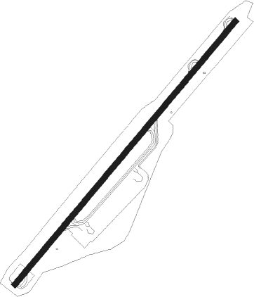
Funchal - Madeira
Airport details
| Country | Portugal |
| State | Autonomous Region of Madeira |
| Region | LP |
| Airspace | Lisbon Ctr |
| Municipality | Santa Cruz |
| Elevation | 187ft (57m) |
| Timezone | GMT +0 |
| Coordinates | 32.69425, -16.77806 |
| Magnetic var | |
| Type | land |
| Available since | X-Plane v10.40 |
| ICAO code | LPMA |
| IATA code | FNC |
| FAA code | n/a |
Communication
| Madeira ATIS | 130.355 |
| Madeira Tower | 118.355 |
| Madeira Approach | 119.605 |
Nearby Points of Interest:
Edifício da Santa Casa da Misericórdia de Santa Cruz
-Levada do Furado
-Jewish Cemetery of Funchal
-Quinta Mirabela
-Quinta do Monte
-Edifício na Rua do Carmo, n.º 33
-Funchal City Hall
-Casa da Alfândega do Funchal
-Colégio dos Jesuítas do Funchal
-Quinta Vigia
-Fortaleza de Nossa Senhora da Conceição do Ilhéu
-Câmara de Lobos
-Laurisilva of Madeira
-Solar do Aposento
-São Vicente
-Palacete dos Zinos
-Capela do Espírito Santo
-Solar dos Esmeraldos
-Capela de Nossa Senhora do Livramento
-Capela de São João Baptista
-Capela de Nossa Senhora dos Anjos (Canhas)
-Windmills of Porto Santo
Nearby beacons
| code | identifier | dist | bearing | frequency |
|---|---|---|---|---|
| FUN | FUNCHAL VOR/DME | 4.8 | 54° | 112.20 |
| PST | PORTO SANTO NDB | 30.8 | 48° | 338 |
| STO | PORTO SANTO TACAN | 30.9 | 47° | 116.30 |
| SNT | PORTO SANTO VOR/DME | 32.1 | 47° | 114.90 |
Departure and arrival routes
| Transition altitude | 5000ft |
| SID end points | distance | outbound heading | |
|---|---|---|---|
| RW05 | |||
| LAPA1E | 42mi | 35° | |
| DEGU1E | 71mi | 57° | |
| MARC1E | 24mi | 70° | |
| XEGE2Z | 45mi | 116° | |
| GOSG1E, GOSG2Z | 38mi | 166° | |
| MADA2Z | 36mi | 210° | |
| NIDU1E | 35mi | 240° | |
| GALO1E | 38mi | 298° | |
| DEMZ1Z | 40mi | 318° | |
| RW23 | |||
| LAPA1W | 42mi | 35° | |
| DEGU1W | 71mi | 57° | |
| MARC1W | 24mi | 70° | |
| XEGE2Y | 45mi | 116° | |
| GOSG1W, GOSG2Y | 38mi | 166° | |
| MADA2Y | 36mi | 210° | |
| NIDU1W | 35mi | 240° | |
| GALO1W | 38mi | 298° | |
| DEMZ1Y | 40mi | 318° | |
| STAR starting points | distance | inbound heading | |
|---|---|---|---|
| ALL | |||
| BIGP2X | 50.5 | 32° | |
| NIDU2X, NIDU1P | 35.1 | 60° | |
| DEMZ1X | 30.1 | 141° | |
| IBAN1P | 43.0 | 151° | |
| KICA1P | 65.2 | 196° | |
| EPAK2X | 70.3 | 212° | |
| LIDR1P | 71.7 | 220° | |
| RAKU1P | 72.0 | 229° | |
| RW05 | |||
| NIDU2R | 35.1 | 60° | |
Instrument approach procedures
| runway | airway (heading) | route (dist, bearing) |
|---|---|---|
| RW05-Y | MONEC (12°) | MONEC 3000ft MA512 (3mi, 23°) MA510 (2mi, 12°) 2000ft MA508 (4mi, 0°) 2000ft |
| RNAV | MA508 2000ft MA504 (4mi, 0°) 890ft MA502 (2mi, 26°) 390ft LPMA (turn) 196ft MA550 (turn) MA552 (2mi, 63°) MA554 (9mi, 148°) MONEC (12mi, 236°) 3000ft MONEC (turn) 3000ft | |
| RW05-Z | PILIM (229°) | PILIM 3000ft MA530 (2mi, 227°) 2000ft MA528 (2mi, 215°) 2000ft MA526 (10mi, 202°) 2000ft MA522 (4mi, 247°) 2000ft |
| RNAV | MA522 2000ft MA520 (2mi, 319°) 1200ft MA504 (turn) 890ft MA502 (2mi, 26°) 390ft LPMA (turn) 196ft MA550 (turn) MA552 (2mi, 63°) MA554 (9mi, 148°) MONEC (12mi, 236°) 3000ft MONEC (turn) 3000ft | |
| RW23 | MONEC (12°) | MONEC 3000ft MA416 (4mi, 23°) 2000ft MA414 (2mi, 36°) 2000ft MA413 (6mi, 49°) 2000ft MA412 (7mi, 49°) 2000ft MA408 (6mi, 310°) 2000ft |
| RW23 | PILIM (229°) | PILIM 3000ft MA410 (4mi, 230°) 2000ft MA408 (3mi, 230°) 2000ft |
| RNAV | MA408 2000ft LPMA (6mi, 229°) 241ft MA407 (turn) MA406 (2mi, 210°) MONEC (12mi, 188°) 3000ft MONEC (turn) 3000ft | |
| RWNVA | PILIM (229°) | PILIM 3000ft MA563 (4mi, 220°) 3000ft |
| RNAV | MA563 3000ft MA564 (2mi, 220°) 3000ft MA565 (3mi, 220°) 1430ft MA566 (4mi, 220°) 940ft MONEC (14mi, 203°) 3000ft MONEC (turn) 3000ft | |
| RWNVB | PILIM (229°) | PILIM 3000ft MA561 (4mi, 227°) 2800ft |
| RNAV | MA561 2800ft MA562 (5mi, 227°) 1390ft MONEC (19mi, 203°) 3000ft MONEC (turn) 3000ft |
Holding patterns
| STAR name | hold at | type | turn | heading* | altitude | leg | speed limit |
|---|---|---|---|---|---|---|---|
| BIGP2X | ABUSU | VHF | right | 31 (211)° | 15000ft - 60000ft | DME 11.0mi | 280 |
| DEMZ1X | ABUSU | VHF | right | 31 (211)° | 15000ft - 60000ft | DME 11.0mi | 280 |
| EKNO1P | PILIM | VHF | right | 46 (226)° | 3000ft - 10000ft | 1.0min timed | 230 |
| EPAK2X | ABUSU | VHF | right | 31 (211)° | 15000ft - 60000ft | DME 11.0mi | 280 |
| IBAN1P | PILIM | VHF | right | 46 (226)° | 3000ft - 10000ft | 1.0min timed | 230 |
| KICA1P | PILIM | VHF | right | 46 (226)° | 3000ft - 10000ft | 1.0min timed | 230 |
| LIDR1P | PILIM | VHF | right | 46 (226)° | 3000ft - 10000ft | 1.0min timed | 230 |
| NIDU1P | PILIM | VHF | right | 46 (226)° | 3000ft - 10000ft | 1.0min timed | 230 |
| NIDU2R | MONEC | VHF | left | 204 (24)° | 3000ft - 10000ft | 1.0min timed | 230 |
| NIDU2X | ABUSU | VHF | right | 31 (211)° | 15000ft - 60000ft | DME 11.0mi | 280 |
| RAKU1P | PILIM | VHF | right | 46 (226)° | 3000ft - 10000ft | 1.0min timed | 230 |
| *) magnetic outbound (inbound) holding course | |||||||
Disclaimer
The information on this website is not for real aviation. Use this data with the X-Plane flight simulator only! Data taken with kind consent from X-Plane 12 source code and data files. Content is subject to change without notice.