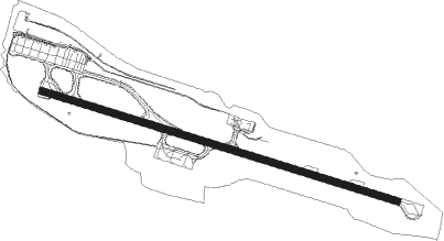
Ponta Delgada
Airport details
| Country | Portugal |
| State | Autonomous Region of Azores |
| Region | LP |
| Airspace | Santa Maria Oceanic Ctr |
| Municipality | Ponta Delgada |
| Elevation | 252ft (77m) |
| Timezone | GMT -1 |
| Coordinates | 37.74197, -25.69765 |
| Magnetic var | |
| Type | land |
| Available since | X-Plane v10.40 |
| ICAO code | LPPD |
| IATA code | PDL |
| FAA code | n/a |
Communication
| Ponta Delgada ATIS | 123.900 |
| Ponta Delgada Tower | 118.300 |
| Ponta Delgada Approach | 119.400 |
Approach frequencies
| ILS-cat-I | RW30 | 109.5 | 18.00mi |
| 3° GS | RW30 | 109.5 | 18.00mi |
Nearby Points of Interest:
Conceição Palace
-convent of São Francisco
Nearby beacons
| code | identifier | dist | bearing | frequency |
|---|---|---|---|---|
| PD | PONTA DELGADA NDB | 1.1 | 107° | 351 |
| VMG | SAO MIGUEL VOR/DME | 6.8 | 330° | 111.20 |
| VSM | SANTA MARIA VOR/DME | 53.2 | 146° | 112 |
Departure and arrival routes
| Transition altitude | 6000ft |
| Transition level | 6000ft |
| SID end points | distance | outbound heading | |
|---|---|---|---|
| RW12 | |||
| BAVA9V | 121mi | 58° | |
| BEKU9V, BEKU5Y | 117mi | 85° | |
| VSM8V | 18mi | 145° | |
| SOMU5Y, SOMU9V | 82mi | 287° | |
| TIMT9V, TIMT5Y | 86mi | 292° | |
| MIPR9V, MIPR5Y | 45mi | 309° | |
| RW30 | |||
| BAVA1R | 121mi | 58° | |
| BEKU5X, BEKU1R | 117mi | 85° | |
| VSM9R | 53mi | 146° | |
| SOMU2X, SOMU9R | 82mi | 287° | |
| TIMT2X, TIMT9R | 86mi | 292° | |
| MIPR2X, MIPR9R | 45mi | 309° | |
| STAR starting points | distance | inbound heading | |
|---|---|---|---|
| ALL | |||
| SOMU6A, SOMU2N | 81.9 | 107° | |
| MIPR2N, MIPR6A | 44.8 | 129° | |
| BAVA2N, BAVA5A, BAVA2S | 121.4 | 238° | |
| BEKU2S, BEKU2N | 117.4 | 265° | |
| VSM8B, VSM8A, VSM3S | 53.2 | 326° | |
| RW12 | |||
| ETRO2A | 113.5 | 309° | |
| RW30 | |||
| BAVA7B | 121.4 | 238° | |
| BEKU7A, BEKU7B | 117.4 | 265° | |
| ETRO2B | 113.5 | 309° | |
Instrument approach procedures
| runway | airway (heading) | route (dist, bearing) |
|---|---|---|
| RW12-X | PETUD (24°) | PETUD 3000ft SM634 (2mi, 8°) SM555 (3mi, 352°) SM539 (8mi, 337°) SM538 (4mi, 30°) 2200ft |
| RW12-X | XUVAP (288°) | XUVAP 4500ft SM545 (2mi, 296°) SM544 (3mi, 286°) SM540 (24mi, 276°) SM539 (3mi, 303°) SM538 (4mi, 30°) 2200ft |
| RNAV | SM538 2200ft SM525 (2mi, 89°) LPPD (5mi, 107°) 309ft SM504 (2mi, 107°) SM502 (8mi, 171°) PETUD (10mi, 240°) 3000ft PETUD (turn) 3000ft | |
| RW12-Y | PETUD (24°) | PETUD 3000ft SM634 (2mi, 8°) SM555 (3mi, 352°) SM553 (7mi, 303°) SM453 (3mi, 288°) SM550 (2mi, 303°) SM514 (9mi, 37°) SM508 (4mi, 107°) 2200ft |
| RW12-Y | SM700 (107°) | SM700 4500ft SM514 (17mi, 107°) SM508 (4mi, 107°) 2200ft |
| RW12-Y | SM800 (126°) | SM800 4500ft SM512 (18mi, 133°) SM510 (3mi, 133°) SM508 (2mi, 120°) 2200ft |
| RW12-Y | SM900 (205°) | SM900 4500ft SM523 (9mi, 269°) SM520 (7mi, 229°) SM510 (3mi, 153°) SM508 (2mi, 120°) 2200ft |
| RNAV | SM508 2200ft LPPD (7mi, 107°) 309ft SM504 (2mi, 107°) SM502 (8mi, 171°) PETUD (10mi, 240°) 3000ft PETUD (turn) 3000ft | |
| RW12-Z | SM452 (132°) | SM452 4500ft SM454 (8mi, 198°) 2200ft |
| RW12-Z | SM453 (75°) | SM453 4500ft SM454 (8mi, 18°) 2200ft |
| RW12-Z | TUSEX (102°) | TUSEX 4500ft SM454 (8mi, 101°) 2200ft |
| RNAV | SM454 2200ft SM455 (5mi, 101°) 2200ft SM456 (5mi, 101°) 554ft PETUD (16mi, 198°) 3000ft PETUD (turn) 3000ft | |
| RW30 | AMIXI (325°) | AMIXI 4500ft SM624 (2mi, 326°) SM622 (3mi, 347°) SM620 (5mi, 10°) SM608 (4mi, 324°) 2200ft |
| RW30 | PETUD (24°) | PETUD 3000ft SM634 (2mi, 8°) SM632 (9mi, 64°) SM630 (turn) SM620 (5mi, 65°) SM608 (4mi, 324°) 2200ft |
| RW30 | SM700 (107°) | SM700 4500ft SM646 (10mi, 107°) SM644 (5mi, 121°) SM642 (7mi, 136°) SM640 (3mi, 121°) SM632 (10mi, 107°) SM630 (turn) SM620 (5mi, 65°) SM608 (4mi, 324°) 2200ft |
| RW30 | SM800 (126°) | SM800 4500ft SM652 (3mi, 133°) SM650 (21mi, 145°) SM642 (2mi, 147°) SM640 (3mi, 121°) SM632 (10mi, 107°) SM630 (turn) SM620 (5mi, 65°) SM608 (4mi, 324°) 2200ft |
| RW30 | XUVAP (288°) | XUVAP 4500ft SM545 (2mi, 296°) SM613 (2mi, 287°) SM611 (4mi, 284°) SM610 (5mi, 288°) SM608 (5mi, 288°) 2200ft |
| RNAV | SM608 2200ft LPPD (7mi, 288°) 237ft SM506 (3mi, 287°) SM670 (9mi, 232°) PETUD (10mi, 154°) 3000ft PETUD (turn) 3000ft |
Holding patterns
| STAR name | hold at | type | turn | heading* | altitude | leg | speed limit |
|---|---|---|---|---|---|---|---|
| BAVA2N | SM900 | VHF | right | 96 (276)° | > 4500ft | 1.0min timed | 230 |
| BAVA2S | XUVAP | VHF | right | 127 (307)° | 15000ft - 60000ft | DME 12.0mi | 280 |
| BAVA5A | VMG | NDB | left | 336 (156)° | 15000ft - 60000ft | 1.5min timed | 280 |
| BAVA7B | XUVAP | VHF | right | 127 (307)° | 15000ft - 60000ft | DME 12.0mi | 280 |
| BEKU2N | SM900 | VHF | right | 96 (276)° | > 4500ft | 1.0min timed | 230 |
| BEKU2S | XUVAP | VHF | right | 127 (307)° | 15000ft - 60000ft | DME 12.0mi | 280 |
| BEKU7A | XUVAP | VHF | right | 127 (307)° | 15000ft - 60000ft | DME 12.0mi | 280 |
| BEKU7B | XUVAP | VHF | right | 127 (307)° | 15000ft - 60000ft | DME 12.0mi | 280 |
| ETRO2A | TUSEX | VHF | right | 272 (92)° | 4500ft - 14000ft | 1.0min timed | 230 |
| ETRO2B | XUVAP | VHF | right | 127 (307)° | 15000ft - 60000ft | DME 12.0mi | 280 |
| MIPR2N | SM800 | VHF | left | 326 (146)° | > 4500ft | 1.0min timed | 230 |
| MIPR6A | VMG | NDB | left | 336 (156)° | 15000ft - 60000ft | 1.5min timed | 280 |
| SOMU2N | SM700 | VHF | right | 298 (118)° | > 4500ft | 1.0min timed | 230 |
| SOMU6A | VMG | NDB | left | 336 (156)° | 15000ft - 60000ft | 1.5min timed | 280 |
| VSM3S | PETUD | VHF | right | 193 (13)° | 3000ft - 14000ft | 1.0min timed | 230 |
| VSM8A | VMG | NDB | left | 336 (156)° | 15000ft - 60000ft | 1.5min timed | 280 |
| VSM8B | XUVAP | VHF | right | 127 (307)° | 15000ft - 60000ft | DME 12.0mi | 280 |
| *) magnetic outbound (inbound) holding course | |||||||
Disclaimer
The information on this website is not for real aviation. Use this data with the X-Plane flight simulator only! Data taken with kind consent from X-Plane 12 source code and data files. Content is subject to change without notice.