Pico Island - Pico
Airport details
| Country | Portugal |
| State | Autonomous Region of Azores |
| Region | LP |
| Airspace | Santa Maria Oceanic Ctr |
| Municipality | São Roque do Pico |
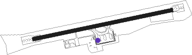
| Elevation | 109ft (33m) |
| Timezone | GMT -1 |
| Coordinates | 38.55444, -28.44139 |
| Magnetic var | |
| Type | land |
| Available since | X-Plane v10.40 |
| ICAO code | LPPI |
| IATA code | PIX |
| FAA code | n/a |
Communication
Approach frequencies
| ILS-cat-I | RW27 | 111.7 | 18.00mi |
| 3° GS | RW27 | 111.7 | 18.00mi |
Nearby Points of Interest:
Landscape of the Pico Island Vineyard Culture
-Mid-Atlantic Ridge
-Colégio dos Jesuítas da Horta e sua igreja (Santíssimo Salvador, hoje igreja matriz da Horta)
-Forte de Porto Pim
-Nature Park of Santa Maria
-Fajã dos Cubres
-Nature Park of Flores
Nearby beacons
| code | identifier | dist | bearing | frequency |
|---|---|---|---|---|
| PI | PICO NDB | 1.8 | 84° | 420 |
| VFL | HORTA VORTAC | 8.8 | 259° | 112.70 |
| DHT | DA GUIA DME | 9 | 260° | 113.60 |
| HT | HORTA NDB | 9 | 260° | 360 |
| FIL | HORTA NDB | 11.6 | 263° | 380 |
| VAP | SAO JORGE VOR/DME | 16.1 | 68° | 113 |
| GC | GRACIOSA NDB | 37.6 | 37° | 428 |
Disclaimer
The information on this website is not for real aviation. Use this data with the X-Plane flight simulator only! Data taken with kind consent from X-Plane 12 source code and data files. Content is subject to change without notice.