Emmen
Airport details
| Country | Switzerland |
| State | Lucerne |
| Region | LS |
| Airspace | Switzerland Ctr |
| Municipality | Emmen |
| Elevation | 1398ft (426m) |
| Timezone | GMT +1 |
| Coordinates | 47.08902, 8.30735 |
| Magnetic var | |
| Type | land |
| Available since | X-Plane v10.40 |
| ICAO code | LSME |
| IATA code | EML |
| FAA code | n/a |
Communication
| Emmen Emmen Tower | 120.425 |
| Emmen Emmen ARR | 119.500 |
| Emmen Emmen Departure | 119.500 |
Approach frequencies
| ILS-cat-I | RW22 | 110.35 | 18.00mi |
| 3.5° GS | RW22 | 110.35 | 18.00mi |
Nearby Points of Interest:
Friedhof Friedental
-Gotthardgebäude
-Kloster St. Anna
-Lucerne
-Reussbrücke
-Anderallmend-Haus
-Staatsarchiv Luzern
-Lucerne Central and University Library
-Unterwalden
-Gallia
-Stadt Luzern
-Schiller
-Uri (ship, 1901)
-Schweizer Schachmuseum
-roman catholic parsonage
-former Amthaus
-Eligius chapel
-town hall (former parsonage)
-catholic parish church
-old mill
-Beromünster
-Landessender Beromünster
-Pilatus railway
-Fadenbrücke
-Stans
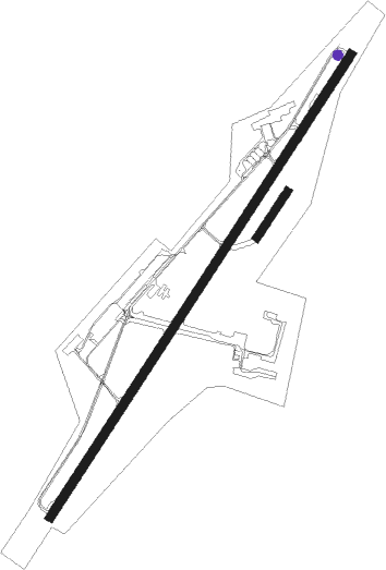
Runway info
Runway 04 / 22  | ||
| length | 2500m (8202ft) | |
| bearing | 48° / 228° | |
| width | 40m (130ft) | |
| surface | asphalt | |
| displ threshold | 111m (364ft) / 179m (587ft) | |
| blast zone | 255m (837ft) / 228m (748ft) | |
| Runway 04R / 22L | ||
| length | 250m (820ft) | |
| bearing | 48° / 228° | |
| width | 35m (115ft) | |
| surface | grass | |
Nearby beacons
| code | identifier | dist | bearing | frequency |
|---|---|---|---|---|
| WIL | WILLISAU VOR/DME | 17.2 | 283° | 116.90 |
| KLO | KLOTEN (ZURICH) VOR/DME | 24.1 | 33° | 114.85 |
| HOC | DME | 34.6 | 300° | 113.20 |
| TRA | DME | 36.4 | 12° | 114.30 |
| ZUE | ZURICH EAST VOR/DME | 36.6 | 45° | 110.05 |
| GRE | GRENCHEN VOR/DME | 36.7 | 276° | 115.45 |
| BS | BASLE-MULHOUSE NDB | 43 | 302° | 376 |
| BLM | BASLE-MULHOUSE VOR/DME | 46.3 | 304° | 117.45 |
| BN | BASLE-MULHOUSE NDB | 48.1 | 305° | 353 |
Departure and arrival routes
| Transition altitude | 7000ft |
| SID end points | distance | outbound heading | |
|---|---|---|---|
| RW04 | |||
| ASGE1L | 14mi | 61° | |
| ELMU2L | 25mi | 84° | |
| FRI2L | 48mi | 254° | |
| WIL5L | 17mi | 283° | |
| RW22 | |||
| ASGE1R | 14mi | 61° | |
| ELMU3R | 25mi | 84° | |
| FRI2R | 48mi | 254° | |
| WIL5R | 17mi | 283° | |
| STAR starting points | distance | inbound heading | |
|---|---|---|---|
| ALL | |||
| WIL5E | 17.2 | 103° | |
| ASGE1E | 13.8 | 241° | |
Instrument approach procedures
| runway | airway (heading) | route (dist, bearing) |
|---|---|---|
| RW22-Z | RONIX (227°) | RONIX 6000ft RONIX (turn) 5000ft |
| RNAV | RONIX 5000ft LSME (10mi, 227°) 1440ft ME751 (turn) ME752 (7mi, 292°) ME753 (6mi, 51°) RONIX (9mi, 86°) 6000ft RONIX (turn) 6000ft |
Holding patterns
| STAR name | hold at | type | turn | heading* | altitude | leg | speed limit |
|---|---|---|---|---|---|---|---|
| ASGE1E | RONIX | VHF | left | 36 (216)° | 7000ft - 9000ft | 1.0min timed | 180 |
| WIL5E | RONIX | VHF | left | 36 (216)° | 7000ft - 9000ft | 1.0min timed | 180 |
| *) magnetic outbound (inbound) holding course | |||||||
Disclaimer
The information on this website is not for real aviation. Use this data with the X-Plane flight simulator only! Data taken with kind consent from X-Plane 12 source code and data files. Content is subject to change without notice.