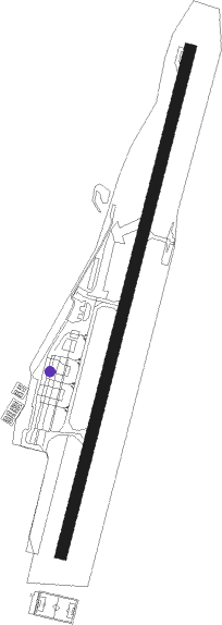
Lugano
Airport details
| Country | Switzerland |
| State | Ticino |
| Region | LS |
| Airspace | Switzerland Ctr |
| Municipality | Bioggio |
| Elevation | 915ft (279m) |
| Timezone | GMT +1 |
| Coordinates | 46.00446, 8.90915 |
| Magnetic var | |
| Type | land |
| Available since | X-Plane v10.40 |
| ICAO code | LSZA |
| IATA code | LUG |
| FAA code | n/a |
Communication
| Lugano ATIS | 121.175 |
| Lugano Ground Control | 121.775 |
| Lugano Tower | 119.700 |
| Lugano Tower | 120.250 |
| Lugano Tower | 122.550 |
Approach frequencies
| IGS | RW01 | 108.9 | 18.00mi |
| 6.6° GS | RW01 | 108.9 | 18.00mi |
Nearby Points of Interest:
S. Maurizio, Bioggio
-Sant'Ambrogio vecchio di Cademario
-Swiss National Sound Archives
-Casa Camuzzi
-Casa d'appartamenti Albairone, Massagno
-Kunstmuseum Lugano
-Villa Negroni con parco
-Museo Cantonale d’Arte
-Castello Cattaneo
-cantonal library Lugano (building)
-Museum of natural history
-San Tommaso Church
-Lugano
-Villa Favorita
-Brusimpiano
-Cadegliano-Viconago
-Val Veddasca
-Casa Balmelli
-Casa Bianchi
-San Martino (Valsolda)
-Cunardo
-Porto Ceresio
-Luino
-Ferrera di Varese
-Monte San Giorgio site fossils
Runway info
| Runway 01 / 19 | ||
| length | 1416m (4646ft) | |
| bearing | 26° / 206° | |
| width | 31m (103ft) | |
| surface | asphalt | |
| displ threshold | 110m (361ft) / 280m (919ft) | |
Nearby beacons
| code | identifier | dist | bearing | frequency |
|---|---|---|---|---|
| SRN | SARONNO NDB | 22 | 162° | 330 |
| MMP | MALPENSA (MILAN) VOR/DME | 23 | 206° | 113.35 |
| MMP | MALPENSA (MILAN) NDB | 23.1 | 205° | 425 |
| CAM | CAMERI TACAN | 28.1 | 210° | 115 |
| MAL | MALPENSA (MILAN) NDB | 28.2 | 198° | 364 |
| NOV | NOVARA (MILAN) NDB | 35.1 | 191° | 292 |
| LIN | LINATE (MILAN) VOR/DME | 36 | 146° | 112.25 |
| TZO | TREZZO VOR/DME | 36.6 | 127° | 117.25 |
| TZO | TREZZO NDB | 36.7 | 127° | 345 |
| BEG | BERGAMO VOR/DME | 39 | 113° | 114.95 |
| LNE | LINATE (MILAN) NDB | 42.7 | 150° | 386 |
| ORI | ORIO AL SERIO (BERGAMO) NDB | 44.6 | 111° | 376 |
| CVA | DME | 45.3 | 66° | 112.05 |
| COD | CODOGNO NDB | 53.7 | 141° | 400 |
| WFJ | DME | 61.8 | 47° | 113.75 |
Departure and arrival routes
| Transition altitude | 6000ft |
| SID end points | distance | outbound heading | |
|---|---|---|---|
| RW01 | |||
| ORI1W, ORI1U | 45mi | 111° | |
| SRN1W | 22mi | 163° | |
| VOG1W | 63mi | 177° | |
| OMET1F, OMET1E | 40mi | 253° | |
| RW19 | |||
| ORI1W, ORI1U | 45mi | 111° | |
| SRN1W | 22mi | 163° | |
| VOG1W | 63mi | 177° | |
| OMET1E, OMET1F | 40mi | 253° | |
| STAR starting points | distance | inbound heading | |
|---|---|---|---|
| ALL | |||
| ODIN7L | 11.8 | 112° | |
| LUSI7L, LUSI7P | 50.4 | 268° | |
| ORI7L, ORI7P | 44.6 | 291° | |
| SRN6L | 22.0 | 343° | |
| VOG6L | 62.5 | 357° | |
Holding patterns
| STAR name | hold at | type | turn | heading* | altitude | leg | speed limit |
|---|---|---|---|---|---|---|---|
| LUSI7P | PINIK | VHF | left | 197 (17)° | 6000ft - 10000ft | 1.0min timed | 170 |
| ORI7P | PINIK | VHF | left | 197 (17)° | 6000ft - 10000ft | 1.0min timed | 170 |
| SRN6L | PINIK | VHF | left | 197 (17)° | 6000ft - 10000ft | 1.0min timed | 170 |
| TOP6L | PINIK | VHF | left | 197 (17)° | 6000ft - 10000ft | 1.0min timed | 170 |
| VOG6L | PINIK | VHF | left | 197 (17)° | 6000ft - 10000ft | 1.0min timed | 170 |
| *) magnetic outbound (inbound) holding course | |||||||
Disclaimer
The information on this website is not for real aviation. Use this data with the X-Plane flight simulator only! Data taken with kind consent from X-Plane 12 source code and data files. Content is subject to change without notice.
