Biel-kappelen
Airport details
| Country | Switzerland |
| State | Bern |
| Region | LS |
| Airspace | Switzerland Ctr |
| Municipality | Kappelen |
| Elevation | 1437ft (438m) |
| Timezone | GMT +1 |
| Coordinates | 47.08917, 7.29000 |
| Magnetic var | |
| Type | land |
| Available since | X-Plane v10.40 |
| ICAO code | LSZP |
| IATA code | n/a |
| FAA code | n/a |
Communication
| Biel-Kappelen AFIS | 123.150 |
Nearby Points of Interest:
Biel/Bienne
-reformed city church
-Taubenloch
-Ehemaliges Thormanngut
-power station and weir
-Niederriedsee
-St. Petersinsel
-Chavannes
-city archive
-Grenchen
-former St. John commandry
-Hofenmühle
-Little castle Heimehus with attic
-Hofwil
-Col de Pierre Pertuis
-Eglise Du Christ-Roi
-reformed church
-Tscharnergut quarter
-Landgut Steiger
-Gosteli Foundation
-Niederbottigen
-Altreu (medieval town abandoned)
-Stufenbau (former nitrocellulose factory Worbla AG)
-State archives of the canton of Berne
-Main building of the University of Berne
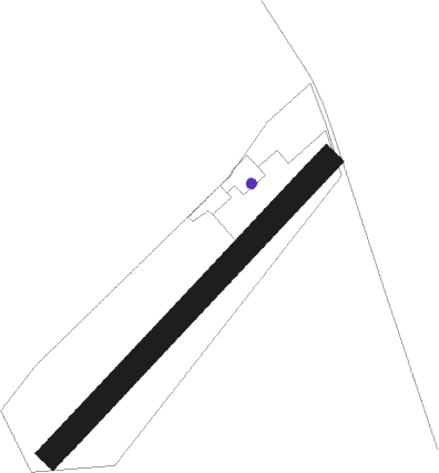
Runway info
| Runway 05 / 23 | ||
| length | 732m (2402ft) | |
| bearing | 58° / 238° | |
| width | 46m (150ft) | |
| surface | grass | |
Nearby beacons
| code | identifier | dist | bearing | frequency |
|---|---|---|---|---|
| GRE | GRENCHEN VOR/DME | 7.6 | 54° | 115.45 |
| FRI | FRIBOURG VOR/DME | 18.9 | 192° | 110.85 |
| LPS | LES EPLATURES NDB | 20.3 | 269° | 403 |
| WIL | WILLISAU VOR/DME | 25.7 | 82° | 116.90 |
| HOC | DME | 27.3 | 45° | 113.20 |
| MB | MONTBELIARD NDB | 29 | 319° | 330 |
| BS | BASLE-MULHOUSE NDB | 31.1 | 27° | 376 |
| BLM | BASLE-MULHOUSE VOR/DME | 33.7 | 21° | 117.45 |
| BN | BASLE-MULHOUSE NDB | 35.2 | 18° | 353 |
| HR | HERICOURT NDB | 36.3 | 310° | 289 |
| LAP | PRAZ DME | 43.7 | 245° | 110.65 |
| SPR | ST PREX VOR/DME | 50.8 | 234° | 113.90 |
| SIO | SION VOR/DME | 52.4 | 180° | 112.15 |
| LUL | LUXEUIL VOR | 54.1 | 301° | 117.10 |
| LXI | LUXEUIL SAINT SAUVEUR TACAN | 56.3 | 307° | 108.20 |
Disclaimer
The information on this website is not for real aviation. Use this data with the X-Plane flight simulator only! Data taken with kind consent from X-Plane 12 source code and data files. Content is subject to change without notice.