Konya - Konya Ab
Airport details
| Country | Turkey |
| State | Konya Province |
| Region | LT |
| Airspace | Ankara Ctr |
| Municipality | Konya |
| Elevation | 3377ft (1029m) |
| Timezone | GMT +3 |
| Coordinates | 37.98278, 32.57172 |
| Magnetic var | |
| Type | land |
| Available since | X-Plane v10.40 |
| ICAO code | LTAN |
| IATA code | KYA |
| FAA code | n/a |
Communication
| Konya AB ATIS | 128.350 |
| Konya AB Tower | 122.100 |
| Konya AB Approach | 122.100 |
Approach frequencies
| ILS-cat-I | RW01L | 108.9 | 18.00mi |
| 3° GS | RW01L | 108.9 | 18.00mi |
Runway info
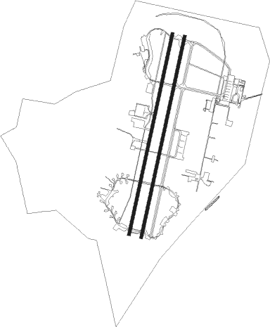
Runway 01L / 19R  | ||
| length | 3481m (11421ft) | |
| bearing | 21° / 201° | |
| width | 45m (148ft) | |
| surface | asphalt | |
| blast zone | 255m (837ft) / 255m (837ft) | |
| Runway 01R / 19L | ||
| length | 3486m (11437ft) | |
| bearing | 21° / 201° | |
| width | 45m (148ft) | |
| surface | concrete | |
| blast zone | 255m (837ft) / 255m (837ft) | |
Nearby beacons
| code | identifier | dist | bearing | frequency |
|---|---|---|---|---|
| KNY | KONYA NDB | 0.9 | 334° | 390 |
| KON | KONYA TACAN | 0.9 | 328° | 114.10 |
Departure and arrival routes
| Transition altitude | 10000ft |
| SID end points | distance | outbound heading | |
|---|---|---|---|
| RW01 (ALL) | |||
| OKEL1D, OKEL1A | 49mi | 31° | |
| OBRU1D, OBRU1A | 26mi | 86° | |
| SEHI1D, SEHI1E, SEHI1A, SEHI1B | 26mi | 228° | |
| HISA1C, HISA1A | 49mi | 277° | |
| RW19 (ALL) | |||
| OKEL1C, OKEL1B | 49mi | 31° | |
| OBRU1F, OBRU1E, OBRU1C, OBRU1B | 26mi | 86° | |
| SEHI1C, SEHI1F | 26mi | 228° | |
| HISA1D, HISA1B | 49mi | 277° | |
| STAR starting points | distance | inbound heading | |
|---|---|---|---|
| RW01 (ALL) | |||
| SEHI1T, SEHI1S | 26.4 | 48° | |
| HISA1S, HISA1T | 49.3 | 97° | |
| OKEL1S, OKEL1T | 49.4 | 211° | |
| OBRU1T, OBRU1S | 26.0 | 266° | |
| RW19 (ALL) | |||
| SEHI1V, SEHI1Y | 26.4 | 48° | |
| HISA1Z, HISA1Y, HISA1V | 49.3 | 97° | |
| OKEL1V, OKEL1Y | 49.4 | 211° | |
| OBRU1Y, OBRU1V | 26.0 | 266° | |
Instrument approach procedures
| runway | airway (heading) | route (dist, bearing) |
|---|---|---|
| RW01L | YANIK (22°) | YANIK CESUR (8mi, 21°) 7000ft |
| RW01L | YENER (351°) | YENER CESUR (8mi, 301°) 7000ft |
| RNAV | CESUR 7000ft ANZER (7mi, 21°) 5000ft LTAN (6mi, 26°) 3417ft YENER (18mi, 171°) 7000ft YENER (turn) |
Holding patterns
| STAR name | hold at | type | turn | heading* | altitude | leg | speed limit |
|---|---|---|---|---|---|---|---|
| HISA1S | KNY | NDB | left | 9 (189)° | > 8000ft | 1.0min timed | 230 |
| HISA1S | PENON | VHF | left | 274 (94)° | > 14000ft | 1.0min timed | 230 |
| HISA1T | LUMOS | VHF | right | 189 (9)° | 8500ft - 14000ft | 1.0min timed | 230 |
| HISA1T | PENON | VHF | left | 274 (94)° | > 14000ft | 1.0min timed | 230 |
| HISA1V | KNY | NDB | left | 9 (189)° | > 8000ft | 1.0min timed | 230 |
| HISA1V | PENON | VHF | left | 274 (94)° | > 14000ft | 1.0min timed | 230 |
| HISA1Y | GIPIR | VHF | right | 21 (201)° | 7500ft - 13000ft | 1.0min timed | 230 |
| HISA1Y | PENON | VHF | left | 274 (94)° | > 14000ft | 1.0min timed | 230 |
| HISA1Z | GIPIR | VHF | right | 21 (201)° | 7500ft - 13000ft | 1.0min timed | 230 |
| HISA1Z | PENON | VHF | left | 274 (94)° | > 14000ft | 1.0min timed | 230 |
| OBRU1S | KNY | NDB | left | 9 (189)° | > 8000ft | 1.0min timed | 230 |
| OBRU1T | LUMOS | VHF | right | 189 (9)° | 8500ft - 14000ft | 1.0min timed | 230 |
| OBRU1V | KNY | NDB | left | 9 (189)° | > 8000ft | 1.0min timed | 230 |
| OBRU1Y | GIPIR | VHF | right | 21 (201)° | 7500ft - 13000ft | 1.0min timed | 230 |
| OKEL1S | KNY | NDB | left | 9 (189)° | > 8000ft | 1.0min timed | 230 |
| OKEL1T | LUMOS | VHF | right | 189 (9)° | 8500ft - 14000ft | 1.0min timed | 230 |
| OKEL1V | KNY | NDB | left | 9 (189)° | > 8000ft | 1.0min timed | 230 |
| OKEL1Y | GIPIR | VHF | right | 21 (201)° | 7500ft - 13000ft | 1.0min timed | 230 |
| SEHI1S | KNY | NDB | left | 9 (189)° | > 8000ft | 1.0min timed | 230 |
| SEHI1T | LUMOS | VHF | right | 189 (9)° | 8500ft - 14000ft | 1.0min timed | 230 |
| SEHI1V | KNY | NDB | left | 9 (189)° | > 8000ft | 1.0min timed | 230 |
| SEHI1Y | GIPIR | VHF | right | 21 (201)° | 7500ft - 13000ft | 1.0min timed | 230 |
| *) magnetic outbound (inbound) holding course | |||||||
Disclaimer
The information on this website is not for real aviation. Use this data with the X-Plane flight simulator only! Data taken with kind consent from X-Plane 12 source code and data files. Content is subject to change without notice.