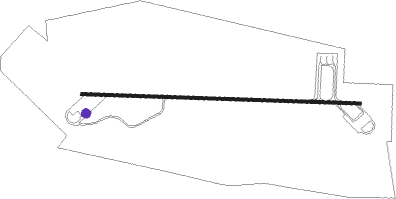
Kocaeli
Airport details
| Country | Turkey |
| State | Kocaeli Province |
| Region | LT |
| Airspace | Istanbul Ctr |
| Municipality | Kartepe |
| Elevation | 182ft (55m) |
| Timezone | GMT +3 |
| Coordinates | 40.73465, 30.06599 |
| Magnetic var | |
| Type | land |
| Available since | X-Plane v10.40 |
| ICAO code | LTBQ |
| IATA code | KCO |
| FAA code | n/a |
Communication
| Kocaeli Ground Control | 121.950 |
| Kocaeli Tower | 122.100 |
| Kocaeli YESILKOY Approach | 120.500 |
| Kocaeli YESILKOY Approach | 121.100 |
| Kocaeli YESILKOY Approach | 122.200 |
Approach frequencies
| ILS-cat-I | RW27 | 108.35 | 18.00mi |
| 3.5° GS | RW27 | 108.35 | 18.00mi |
Nearby beacons
| code | identifier | dist | bearing | frequency |
|---|---|---|---|---|
| ARF | CENGIZ TOPEL TACAN | 0.1 | 349° | 113.90 |
| CTP | CENGIZ TOPEL (KOCAELI) NDB | 0.2 | 62° | 307 |
| ARF | CENGIZ TOPEL NDB | 0.9 | 98° | 383 |
| SAB | SABIHA NDB | 34.9 | 283° | 347 |
| SBH | SABIHA (ISTANBUL) VOR/DME | 34.9 | 283° | 108.80 |
| BRY | YENISEHIR NDB | 35.6 | 225° | 352 |
| YEN | YENISEHIR TACAN | 36.7 | 227° | 113.20 |
| YAA | YALOVA VOR/DME | 42.1 | 253° | 117.70 |
| BKZ | BEYKOZ VOR/DME | 48 | 293° | 117.30 |
| ESR | ESKISEHIR NDB | 58.9 | 154° | 372 |
| ESK | ESKISEHIR TACAN | 62.2 | 150° | 114.40 |
Departure and arrival routes
| Transition altitude | 10000ft |
| SID end points | distance | outbound heading | |
|---|---|---|---|
| RW09 | |||
| ASMA1B | 30mi | 99° | |
| PIMA1B | 21mi | 199° | |
| ERKA1B | 16mi | 341° | |
| RW27 | |||
| ASMA1A | 30mi | 99° | |
| PIMA1A | 21mi | 199° | |
| ERKA1A | 16mi | 341° | |
| STAR starting points | distance | inbound heading | |
|---|---|---|---|
| RW09 | |||
| YAA1S | 42.1 | 73° | |
| ERSE1S | 28.3 | 258° | |
| TOKE1S | 40.9 | 301° | |
| RW27 | |||
| YAA1U | 42.1 | 73° | |
| ERSE1U | 28.3 | 258° | |
| TOKE1U | 40.9 | 301° | |
Instrument approach procedures
| runway | airway (heading) | route (dist, bearing) |
|---|---|---|
| RW09 | BARCI (95°) | BARCI GOHEN (5mi, 95°) 3500ft |
| RNAV | GOHEN 3500ft CAPAZ (4mi, 95°) 2100ft LTBQ (6mi, 96°) 230ft BQ091 (10mi, 94°) 3600ft UFZUN (11mi, 22°) 7000ft UFZUN (turn) 10000ft |
Disclaimer
The information on this website is not for real aviation. Use this data with the X-Plane flight simulator only! Data taken with kind consent from X-Plane 12 source code and data files. Content is subject to change without notice.
