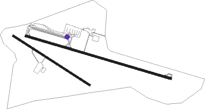
Erzincan
Airport details
| Country | Turkey |
| State | Erzincan Province |
| Region | LT |
| Airspace | Ankara Ctr |
| Municipality | Erzincan |
| Elevation | 3783ft (1153m) |
| Timezone | GMT +3 |
| Coordinates | 39.71305, 39.52056 |
| Magnetic var | |
| Type | land |
| Available since | X-Plane v10.40 |
| ICAO code | LTCD |
| IATA code | ERC |
| FAA code | n/a |
Communication
| Erzincan Ground Control | 121.900 |
| Erzincan Tower | 118.500 |
Approach frequencies
| LOC | RW28 | 108.9 | 18.00mi |
Nearby Points of Interest:
Munzur Dağları

Nearby beacons
| code | identifier | dist | bearing | frequency |
|---|---|---|---|---|
| ERN | ERZINCAN NDB | 0.4 | 118° | 430 |
| EZN | VABEL VOR/DME | 32.1 | 289° | 112.05 |
Departure and arrival routes
| Transition altitude | 15000ft |
| SID end points | distance | outbound heading | |
|---|---|---|---|
| RW10 | |||
| ORHA1D, ORHA1C, ORHA1B, ORHA1A | 14mi | 14° | |
| KONU1D, KONU1C, KONU1B, KONU1A | 12mi | 195° | |
| EZN1D, EZN1C, EZN1B, EZN1A | 32mi | 289° | |
| RW28 | |||
| ORHA1E, ORHA1F | 14mi | 14° | |
| KONU1E, KONU1F | 12mi | 195° | |
| EZN1F, EZN1E | 32mi | 289° | |
| STAR starting points | distance | inbound heading | |
|---|---|---|---|
| RW10 | |||
| KONU1T | 12.3 | 15° | |
| EZN1T | 32.1 | 109° | |
| ORHA1T | 14.3 | 194° | |
Holding patterns
| STAR name | hold at | type | turn | heading* | altitude | leg | speed limit |
|---|---|---|---|---|---|---|---|
| EZN1T | ERN | NDB | left | 85 (265)° | > 13500ft | 1.0min timed | 230 |
| KONU1T | ERN | NDB | left | 85 (265)° | > 13500ft | 1.0min timed | 230 |
| ORHA1T | ERN | NDB | left | 85 (265)° | > 13500ft | 1.0min timed | 230 |
| *) magnetic outbound (inbound) holding course | |||||||
Disclaimer
The information on this website is not for real aviation. Use this data with the X-Plane flight simulator only! Data taken with kind consent from X-Plane 12 source code and data files. Content is subject to change without notice.