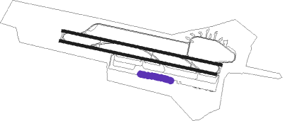
Bodrum - Milas Bodrum
Airport details
| Country | Turkey |
| State | Muğla Province |
| Region | LT |
| Airspace | Istanbul Ctr |
| Municipality | Milas |
| Elevation | 20ft (6m) |
| Timezone | GMT +3 |
| Coordinates | 37.24722, 27.68139 |
| Magnetic var | |
| Type | land |
| Available since | X-Plane v10.40 |
| ICAO code | LTFE |
| IATA code | BJV |
| FAA code | n/a |
Communication
| Milas Bodrum ATIS | 128.500 |
| Milas Bodrum Ground Control | 121.950 |
| Milas Bodrum Tower | 124.200 |
| Milas Bodrum Tower | 120.500 |
| Milas Bodrum MENDERES Approach | 119.500 |
| Milas Bodrum MENDERES Approach | 128.700 |
| Milas Bodrum Departure | 120.500 |
Approach frequencies
| ILS-cat-II | RW10L | 109.3 | 18.00mi |
| ILS-cat-II | RW28R | 108.7 | 18.00mi |
| 3.9° GS | RW28R | 108.7 | 18.00mi |
| 3.3° GS | RW10L | 109.3 | 18.00mi |
Runway info
Nearby beacons
| code | identifier | dist | bearing | frequency |
|---|---|---|---|---|
| BDR | MILAS BODRUM NDB | 2.1 | 283° | 389 |
| CLD | CILDIR (AYDIN) NDB | 35.5 | 20° | 480 |
| KOS | KOS NDB | 39.3 | 233° | 311 |
| KOS | KOS VOR/DME | 39.4 | 232° | 109 |
| LRO | LEROS NDB | 42.2 | 266° | 419 |
| SMO | SAMOS NDB | 44.9 | 300° | 375 |
| SEL | SELCUK-EFES NDB | 45.2 | 334° | 424 |
| SAM | SAMOS VOR/DME | 45.3 | 300° | 111.60 |
| ROS | RODOS NDB | 54 | 152° | 339 |
| PAR | RODOS VOR/DME | 54.1 | 156° | 108.60 |
| RDS | RODOS VOR/DME | 57.8 | 156° | 115.80 |
| ME | ADNAN MENDERES (IZMIR) NDB | 61.7 | 332° | 405 |
Departure and arrival routes
| Transition altitude | 10000ft |
| SID end points | distance | outbound heading | |
|---|---|---|---|
| RW10 (ALL) | |||
| CENG1B | 22mi | 114° | |
| YUNU1B | 34mi | 159° | |
| AKBU1N, AKBU1B | 18mi | 319° | |
| RW10L | |||
| KAVA1D | 51mi | 84° | |
| ERFE1D | 32mi | 115° | |
| YUNU1D | 34mi | 159° | |
| AKBU1D | 18mi | 319° | |
| RW28 (ALL) | |||
| CENG1E, CENG1A | 22mi | 114° | |
| YUNU1A | 34mi | 159° | |
| AKBU1E, AKBU1A | 18mi | 319° | |
| RW28R | |||
| KAVA1V | 51mi | 84° | |
| ERFE1V | 32mi | 115° | |
| YUNU1V | 34mi | 159° | |
| AKBU1V | 18mi | 319° | |
| STAR starting points | distance | inbound heading | |
|---|---|---|---|
| ALL | |||
| AKBU1S | 18.4 | 139° | |
| CENG1S | 22.4 | 294° | |
| YUNU1S | 33.7 | 339° | |
| RW10L | |||
| OKES1F | 26.9 | 142° | |
| KAVA1F | 50.6 | 264° | |
| ERFE1F | 32.2 | 295° | |
| YUNU1F | 33.7 | 339° | |
| RW28R | |||
| OKES1J | 26.9 | 142° | |
| KAVA1J | 50.6 | 264° | |
| ERFE1J | 32.2 | 295° | |
| YUNU1J | 33.7 | 339° | |
Holding patterns
| STAR name | hold at | type | turn | heading* | altitude | leg | speed limit |
|---|---|---|---|---|---|---|---|
| AKBU1S | BDR | NDB | left | 102 (282)° | > 6000ft | 1.0min timed | 230 |
| CENG1S | BDR | NDB | left | 102 (282)° | > 6000ft | 1.0min timed | 230 |
| ERFE1F | FE811 | VHF | left | 103 (283)° | > 7000ft | 1.0min timed | ICAO rules |
| KAVA1F | FE811 | VHF | left | 103 (283)° | > 7000ft | 1.0min timed | ICAO rules |
| KAVA1J | UMRON | VHF | right | 62 (242)° | > 8000ft | 1.0min timed | ICAO rules |
| OKES1F | FE813 | VHF | right | 13 (193)° | > 7000ft | 1.0min timed | ICAO rules |
| OKES1F | OKESA | VHF | right | 13 (193)° | > 8000ft | 1.0min timed | ICAO rules |
| OKES1J | EVKUS | VHF | left | 283 (103)° | > 8000ft | 1.0min timed | ICAO rules |
| YUNU1F | FE811 | VHF | left | 103 (283)° | > 7000ft | 1.0min timed | ICAO rules |
| YUNU1S | BDR | NDB | left | 102 (282)° | > 6000ft | 1.0min timed | 230 |
| *) magnetic outbound (inbound) holding course | |||||||
Disclaimer
The information on this website is not for real aviation. Use this data with the X-Plane flight simulator only! Data taken with kind consent from X-Plane 12 source code and data files. Content is subject to change without notice.

