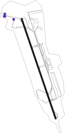
Skopje - Skopje Intl
Airport details
| Country | North Macedonia |
| State | Skopje Region |
| Region | LW |
| Airspace | Skopje Ctr |
| Municipality | Mralino |
| Elevation | 777ft (237m) |
| Timezone | GMT +1 |
| Coordinates | 41.96161, 21.62143 |
| Magnetic var | |
| Type | land |
| Available since | X-Plane v10.40 |
| ICAO code | LWSK |
| IATA code | SKP |
| FAA code | n/a |
Communication
| Skopje Intl ATIS | 130.125 |
| Skopje Intl SKOPJE Tower | 118.500 |
| Skopje Intl SKOPJE Approach | 120.300 |
| Skopje Intl SKOPJE departure | 120.300 |
Approach frequencies
| ILS-cat-I | RW34 | 108.7 | 18.00mi |
| 3.3° GS | RW34 | 108.7 | 18.00mi |
Nearby Points of Interest:
St. George's Church (Blace)
-St. George's Church (Gradovci)
-Aşık Çelebi Türbe
-Tomb of the King's Daughter
-Stara Nova Banja
-National and University Library "St. Kliment of Ohrid" Building
-Kumbarci Mansion
-Daout Pacha Hammam
-Skopje Konak
-Ottoman Post Building, Skopje
-Bey's Tower
-Dukancik Mosque
-Ristiḱ Palace
-Matejče Monastery
-Church of the Ascension of Jesus (Raštak)
-St. Nicholas Church
-Marko's Monastery
-St. George's Church
-City archive of Skopje
-Ljubanci Monastery
-Church St. Nicholas, Kumanovo
-Havzi Paša Konaks
Nearby beacons
| code | identifier | dist | bearing | frequency |
|---|---|---|---|---|
| SKJ | SKOPJE VOR/DME | 1.6 | 161° | 112.80 |
| PT | SKOPJE INTL NDB | 2.9 | 161° | 295 |
| SIN | SINKO VOR/DME | 33.2 | 89° | 111.45 |
| PEP | PRILEP NDB | 38.2 | 195° | 297 |
| PRT | PRISTINA VOR/DME | 44 | 315° | 111.05 |
| IZD | IZDEGLAVJE NDB | 51.6 | 232° | 432 |
| OHR | OHRID VOR/DME | 61.8 | 228° | 112.50 |
Departure and arrival routes
| Transition altitude | 11000ft |
| SID end points | distance | outbound heading | |
|---|---|---|---|
| RW16 | |||
| SIN2C | 33mi | 89° | |
| RUGA2C | 65mi | 118° | |
| PEP2D | 38mi | 195° | |
| GOST2C | 25mi | 254° | |
| RW34 | |||
| RAXA2D | 35mi | 61° | |
| SIN2D | 33mi | 89° | |
| RUGA2D | 65mi | 118° | |
| PEP2E | 38mi | 195° | |
| GOST2D | 25mi | 254° | |
| STAR starting points | distance | inbound heading | |
|---|---|---|---|
| RW34 | |||
| PEP2B | 38.2 | 15° | |
| GOST2B | 24.6 | 74° | |
| TETO2C | 28.2 | 91° | |
| SARA2B | 33.3 | 101° | |
| KOGA1A | 26.8 | 105° | |
| SIN2B | 33.2 | 269° | |
| RUGA2B | 64.7 | 298° | |
Holding patterns
| STAR name | hold at | type | turn | heading* | altitude | leg | speed limit |
|---|---|---|---|---|---|---|---|
| GOST2B | SKJ | NDB | right | 147 (327)° | > 15000ft | 1.5min timed | ICAO rules |
| KOGA1A | SKJ | NDB | right | 147 (327)° | > 15000ft | 1.5min timed | ICAO rules |
| PEP2B | D161T | VHF | right | 161 (341)° | 7000ft - 60000ft | DME 4.0mi | ICAO rules |
| RUGA2B | D161T | VHF | right | 161 (341)° | 7000ft - 60000ft | DME 4.0mi | ICAO rules |
| SARA2B | SKJ | NDB | right | 147 (327)° | > 15000ft | 1.5min timed | ICAO rules |
| SIN2B | SKJ | NDB | right | 147 (327)° | > 15000ft | 1.5min timed | ICAO rules |
| TETO2C | SKJ | NDB | right | 147 (327)° | > 15000ft | 1.5min timed | ICAO rules |
| *) magnetic outbound (inbound) holding course | |||||||
Disclaimer
The information on this website is not for real aviation. Use this data with the X-Plane flight simulator only! Data taken with kind consent from X-Plane 12 source code and data files. Content is subject to change without notice.