Batajnica
Airport details
| Country | Serbia |
| State | Vojvodina |
| Region | LY |
| Airspace | Belgrade Ctr |
| Municipality | Stara Pazova Municipality |
| Elevation | 265ft (81m) |
| Timezone | GMT +1 |
| Coordinates | 44.93573, 20.24224 |
| Magnetic var | |
| Type | land |
| Available since | X-Plane v10.40 |
| ICAO code | LYBT |
| IATA code | BJY |
| FAA code | n/a |
Communication
Approach frequencies
| ILS-cat-I | RW12L | 108.9 | 18.00mi |
| 3° GS | RW12L | 108.9 | 18.00mi |
Nearby Points of Interest:
Evangelička crkva
-Elementary school "Kraljica Marija"
-église Saint-Nicolas de Surduk
-Taurunum antique
-Customs Office building, Zemun
-Kuća porodice Marković
-Church of St. Archangel Michael and Gabriel
-Chapel of Saint Roch
-Magistrate in Zemun
-Air force command building
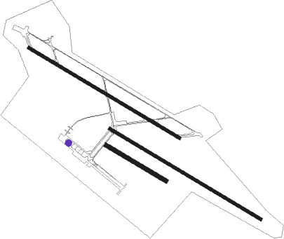
Runway info
Runway 12L / 30R  | ||
| length | 2500m (8202ft) | |
| bearing | 117° / 297° | |
| width | 45m (148ft) | |
| surface | asphalt | |
| Runway 12R / 30L | ||
| length | 2507m (8225ft) | |
| bearing | 117° / 297° | |
| width | 45m (148ft) | |
| surface | asphalt | |
| displ threshold | 76m (249ft) / 0m (0ft) | |
| Runway 12 / 30 | ||
| length | 984m (3228ft) | |
| bearing | 117° / 297° | |
| width | 58m (191ft) | |
| surface | grass | |
Nearby beacons
| code | identifier | dist | bearing | frequency |
|---|---|---|---|---|
| PZ | BATAJNICA (BELGRADE) NDB | 1.2 | 318° | 320 |
| BT | BATAJNICA (BELGRADE) NDB | 2.7 | 305° | 420 |
| EK | BATAJNICA (BELGRADE) NDB | 3.7 | 113° | 420 |
| KN | BELGRADE NDB | 5.1 | 249° | 380 |
| BGD | BELGRADE VOR/DME | 7.5 | 149° | 112.05 |
| IA | INDIJA (BELGRADE) NDB | 9.6 | 302° | 485 |
| JA | BELGRADE NDB | 15.2 | 130° | 316 |
| PA | PANCEVO (BELGRADE) NDB | 17.1 | 96° | 495 |
| OBR | BELGRADE NDB | 18 | 200° | 355 |
| PV | PETROVARADIN NDB | 27.3 | 307° | 300 |
| SMI | MITROVICA VOR/DME | 34.7 | 275° | 117 |
| VAL | VALJEVO VOR/DME | 39.9 | 211° | 116.60 |
| VAL | VALJEVO NDB | 40.1 | 211° | 390 |
| POZ | POZAREVAC NDB | 42.9 | 109° | 416 |
| TPL | TOPOLA VOR/DME | 52.2 | 148° | 116.80 |
| TPL | TOPOLA NDB | 52.4 | 148° | 348 |
| CNI | DME | 54.6 | 40° | 115.60 |
| BR | KRALJEVO NDB | 59.8 | 169° | 435 |
| TA | TIMISOARA NDB | 68.3 | 48° | 378 |
Departure and arrival routes
| Transition altitude | 10000ft |
| SID end points | distance | outbound heading | |
|---|---|---|---|
| RW12L | |||
| MAVI2G | 49mi | 74° | |
| DONI2K | 41mi | 101° | |
| VAL3R, VAL3W | 40mi | 211° | |
| SMI3G, SMI3H | 35mi | 275° | |
| KOTU2X | 26mi | 321° | |
| TISA2X | 29mi | 358° | |
| RW30R | |||
| MAVI3H | 49mi | 74° | |
| DONI2L | 41mi | 101° | |
| VAL3K, VAL3X | 40mi | 211° | |
| SMI3J, SMI3K | 35mi | 275° | |
| KOTU2Y | 26mi | 321° | |
| TISA2Y | 29mi | 358° | |
| STAR starting points | distance | inbound heading | |
|---|---|---|---|
| RW12L | |||
| VAL4T, VAL4U | 39.9 | 31° | |
| ENUP3E | 42.0 | 70° | |
| TADA2D | 34.9 | 114° | |
| TISA3W | 29.2 | 178° | |
| MAVI3E | 48.7 | 254° | |
| DONI2E | 41.0 | 281° | |
| NEPO3C | 75.7 | 308° | |
| RW30R | |||
| VAL3V | 39.9 | 31° | |
| ENUP2F | 42.0 | 70° | |
| TADA3E | 34.9 | 114° | |
| TISA3G | 29.2 | 178° | |
| MAVI2F | 48.7 | 254° | |
| DONI2F | 41.0 | 281° | |
| NEPO3D | 75.7 | 308° | |
Holding patterns
| STAR name | hold at | type | turn | heading* | altitude | leg | speed limit |
|---|---|---|---|---|---|---|---|
| DONI2F | PA | FIX | left | 68 (248)° | > 5000ft | DME 5.0mi | ICAO rules |
| ENUP2F | PA | FIX | left | 68 (248)° | > 5000ft | DME 5.0mi | ICAO rules |
| MAVI2F | PA | FIX | left | 68 (248)° | > 5000ft | DME 5.0mi | ICAO rules |
| NEPO3D | PA | FIX | left | 68 (248)° | > 5000ft | DME 5.0mi | ICAO rules |
| TADA3E | PA | FIX | left | 68 (248)° | > 5000ft | DME 5.0mi | ICAO rules |
| TISA3G | PA | FIX | left | 68 (248)° | > 5000ft | DME 5.0mi | ICAO rules |
| VAL3V | PA | FIX | left | 68 (248)° | > 5000ft | DME 5.0mi | ICAO rules |
| *) magnetic outbound (inbound) holding course | |||||||
Disclaimer
The information on this website is not for real aviation. Use this data with the X-Plane flight simulator only! Data taken with kind consent from X-Plane 12 source code and data files. Content is subject to change without notice.