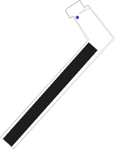
Holič - Holic
Airport details
| Country | Slovakia |
| State | Region of Trnava |
| Region | |
| Airspace | Bratislava Ctr |
| Municipality | Holíč |
| Elevation | 529ft (161m) |
| Timezone | GMT +1 |
| Coordinates | 48.80631, 17.12750 |
| Magnetic var | |
| Type | land |
| Available since | X-Plane v10.40 |
| ICAO code | LZHL |
| IATA code | n/a |
| FAA code | n/a |
Communication
| Holic INFO | 122.600 |
Nearby Points of Interest:
Mikulčice Archaeopark
-Old Jewish cemetery in Hodonín
-Plže
-Čejkovice Castle
-Category:Průžkův mlýn
-Příhradový most u cukrovaru (Břeclav)
-Chapel of Saint Wendelin
-Svatobořice concentration camp
-Chapel of Saints Cyril and Methodius
-Jewish ceremonial hall in Bzenec
-Church of Saint George
-Chateau in Kyjov
-Town hall in Kyjov
-Church of Saint Anne
-Synagogue in Veselí nad Moravou
-Church of Saint James the Greater (Želetice)
-Church of Saint James the Greater
-Lednice-Valtice Cultural Landscape
-Church of Saint Margaret
-Belvedere
-Church of Saint Andrew
-Rosenkranzpark Katzelsdorf
-Church of Saint Giles
-Jewish cemetery in Uherský Ostroh
-Valtice Monastery
Runway info
| Runway 04 / 22 | ||
| length | 1294m (4245ft) | |
| bearing | 58° / 238° | |
| width | 128m (419ft) | |
| surface | grass | |
Nearby beacons
| code | identifier | dist | bearing | frequency |
|---|---|---|---|---|
| KNE | KUNOVICE NDB | 19.2 | 54° | 434 |
| KUN | KUNOVICE NDB | 23.6 | 51° | 416 |
| B | BOREK (BRNO) NDB | 25.9 | 310° | 429 |
| BNO | BRNO VOR/DME | 26.8 | 308° | 114.45 |
| PNY | CENTR (PIESTANY) NDB | 29.9 | 106° | 297 |
| OKR | STEFANIK NORTH NDB | 35.5 | 164° | 391 |
| WGM | WAGRAM VOR/DME | 38.4 | 233° | 112.20 |
| B | BARKA (BRATISLAVA) NDB | 39.6 | 170° | 438 |
| JAN | JANOVCE VOR/DME | 41.1 | 146° | 110.80 |
| OB | STEFANIK SOUTH NDB | 42 | 166° | 330 |
| LA | NAMEST NDB | 42.3 | 289° | 514 |
| L | NAMEST NDB | 43.6 | 289° | 362 |
| FMD | FISCHAMEND VOR/DME | 46.5 | 215° | 110.40 |
| BRK | BRUCK NDB | 47.5 | 209° | 408 |
| NIT | NITRA VOR/DME | 48 | 119° | 116.50 |
| STE | STEINHOF NDB | 50 | 236° | 293 |
| R | RADA (OSTRAVA) NDB | 64.4 | 48° | 534 |
| SNU | SOLLENAU VOR/DME | 65.2 | 222° | 115.50 |
| OTA | OSTRAVA VOR/DME | 65.9 | 48° | 117.45 |
Disclaimer
The information on this website is not for real aviation. Use this data with the X-Plane flight simulator only! Data taken with kind consent from X-Plane 12 source code and data files. Content is subject to change without notice.
