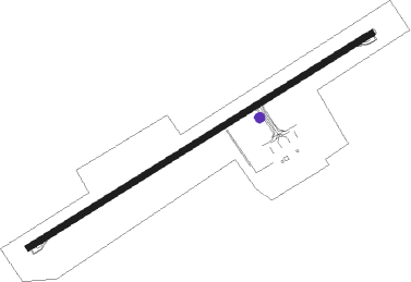
Samana - Samana El Catey Intl
Airport details
| Country | Dominican Republic |
| State | Samaná |
| Region | MD |
| Airspace | Santo Domingo Ctr |
| Municipality | Sánchez |
| Elevation | 12ft (4m) |
| Timezone | GMT -4 |
| Coordinates | 19.27000, -69.73750 |
| Magnetic var | |
| Type | land |
| Available since | X-Plane v10.40 |
| ICAO code | MDCY |
| IATA code | AZS |
| FAA code | n/a |
Communication
| Samana El Catey Intl ATIS | 132.650 |
| Samana El Catey Intl Catey Ground | 121.700 |
| Samana El Catey Intl Catey Tower | 118.350 |
Nearby beacons
| code | identifier | dist | bearing | frequency |
|---|---|---|---|---|
| DCY | EL CATEY (SAMANA) VOR/DME | 0.1 | 280° | 115.80 |
| LAS | GUERRA NDB | 41.5 | 179° | 200 |
| DHG | HIGUERO VOR/DME | 44.2 | 199° | 116.60 |
| HIJ | SAN ISIDRO NDB | 45.4 | 182° | 220 |
| SIS | SAN ISIDRO VOR/DME | 46 | 182° | 112.40 |
| SGO | SANTIAGO VOR/DME | 49.7 | 279° | 114.90 |
| CDO | PUNTA CAUCEDO (SANTO DOMI VOR/DME | 50.3 | 175° | 114.70 |
| PTA | PUERTO PLATA VOR/DME | 55.5 | 300° | 115.10 |
| LRN | LA ROMANA VOR/DME | 67.8 | 135° | 116.20 |
Instrument approach procedures
| runway | airway (heading) | route (dist, bearing) |
|---|---|---|
| RW07 | CY361 (64°) | CY361 5000ft PUSIM (5mi, 64°) 3250ft |
| RW07 | CY362 (43°) | CY362 5000ft PUSIM (5mi, 352°) 3250ft |
| RW07 | KOBET (186°) | KOBET GUBIK (19mi, 230°) 5000ft PUSIM (5mi, 131°) 3250ft |
| RW07 | PIRAL (120°) | PIRAL GUBIK (12mi, 165°) 5000ft PUSIM (5mi, 131°) 3250ft |
| RNAV | PUSIM 3250ft CY366 (5mi, 64°) 1660ft MDCY (6mi, 63°) 62ft CY368 (1mi, 43°) CY369 (5mi, 318°) GUBIK (13mi, 243°) 5000ft GUBIK (turn) 5000ft |
Disclaimer
The information on this website is not for real aviation. Use this data with the X-Plane flight simulator only! Data taken with kind consent from X-Plane 12 source code and data files. Content is subject to change without notice.
