La Isabela - La Isabela Intl
Airport details
| Country | Dominican Republic |
| State | Santo Domingo |
| Region | MD |
| Airspace | Santo Domingo Ctr |
| Municipality | Santo Domingo Norte |
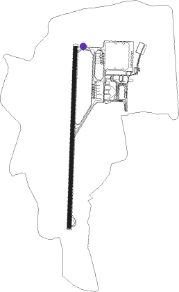
| Elevation | 98ft (30m) |
| Timezone | GMT -4 |
| Coordinates | 18.57920, -69.97909 |
| Magnetic var | |
| Type | land |
| Available since | X-Plane v10.40 |
| ICAO code | MDJB |
| IATA code | JBQ |
| FAA code | n/a |
Communication
| La Isabela Intl HIGUERO Tower | 121.700 |
Nearby beacons
| code | identifier | dist | bearing | frequency |
|---|---|---|---|---|
| DHG | HIGUERO VOR/DME | 0.5 | 209° | 116.60 |
| HIJ | SAN ISIDRO NDB | 12.7 | 107° | 220 |
| SIS | SAN ISIDRO VOR/DME | 12.9 | 110° | 112.40 |
| LAS | GUERRA NDB | 14.4 | 90° | 200 |
| CDO | PUNTA CAUCEDO (SANTO DOMI VOR/DME | 19.7 | 115° | 114.70 |
| DCY | EL CATEY (SAMANA) VOR/DME | 43.6 | 19° | 115.80 |
| SGO | SANTIAGO VOR/DME | 61 | 323° | 114.90 |
Instrument approach procedures
| runway | airway (heading) | route (dist, bearing) |
|---|---|---|
| RW01 | AIDAS (24°) | AIDAS JB122 (5mi, 68°) 2500ft |
| RW01 | ELSYS (341°) | ELSYS JB122 (5mi, 286°) 2500ft |
| RNAV | JB122 2500ft SOTOS (5mi, 357°) 1700ft MDJB (6mi, 11°) 90ft JB124 (turn) JB125 (8mi, 97°) 3000ft JB126 (6mi, 180°) 3000ft ELSYS (7mi, 215°) 3000ft ELSYS (turn) 3000ft | |
| RW19 | EUDIS (209°) | EUDIS JB112 (5mi, 258°) 2500ft |
| RW19 | KODIX (164°) | KODIX JB111 (16mi, 164°) 5000ft LOTFI (6mi, 164°) 3000ft JB112 (5mi, 116°) 2500ft |
| RNAV | JB112 2500ft MAYTE (5mi, 187°) 1700ft MDJB (5mi, 184°) 131ft JB114 (turn) EUDIS (14mi, 28°) 3000ft EUDIS (turn) 3000ft |
Disclaimer
The information on this website is not for real aviation. Use this data with the X-Plane flight simulator only! Data taken with kind consent from X-Plane 12 source code and data files. Content is subject to change without notice.