Montego Bay - Sangster Intl
Airport details
| Country | Jamaica |
| State | Saint James |
| Region | MK |
| Airspace | Kingston Ctr |
| Elevation | 2ft (1m) |
| Timezone | GMT -5 |
| Coordinates | 18.50367, -77.91338 |
| Magnetic var | |
| Type | land |
| Available since | X-Plane v10.40 |
| ICAO code | MKJS |
| IATA code | MBJ |
| FAA code | n/a |
Communication
| Sangster Intl MKJS ATIS | 127.900 |
| Sangster Intl SANGSTER Ground Control | 121.700 |
| Sangster Intl SANGSTER Tower | 120.800 |
| Sangster Intl SANGSTER Approach | 120.800 |
Approach frequencies
| ILS-cat-I | RW07 | 109.5 | 18.00mi |
| 3° GS | RW07 | 109.5 | 18.00mi |
Runway info
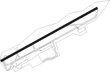
| Runway 07 / 25 | ||
| length | 2661m (8730ft) | |
| bearing | 67° / 247° | |
| width | 49m (161ft) | |
| surface | asphalt | |
| displ threshold | 67m (220ft) / 171m (561ft) | |
| blast zone | 53m (174ft) / 61m (200ft) | |
Nearby beacons
| code | identifier | dist | bearing | frequency |
|---|---|---|---|---|
| SIA | SANGSTER VOR/DME | 0.6 | 256° | 115.70 |
Departure and arrival routes
| Transition altitude | 17000ft |
| Transition level | 18000ft |
| SID end points | distance | outbound heading | |
|---|---|---|---|
| RW07 | |||
| TILUP1, ELUTU4 | 40mi | 18° | |
| IMADI1 | 45mi | 54° | |
| LIBEX2 | 33mi | 102° | |
| KEMBO3 | 36mi | 117° | |
| KESPA2 | 42mi | 129° | |
| BOSOM7 | 40mi | 191° | |
| PETSI2 | 40mi | 283° | |
| NUBOX2 | 40mi | 301° | |
| ADSEL2 | 40mi | 311° | |
| RW25 | |||
| TILUP1 | 40mi | 18° | |
| IMADI1 | 45mi | 54° | |
| LIBEX2 | 33mi | 102° | |
| KEMBO3 | 36mi | 117° | |
| KESPA2 | 42mi | 129° | |
| BOSOM7 | 40mi | 191° | |
| PETSI2 | 40mi | 283° | |
| NUBOX2 | 40mi | 301° | |
| ADSEL2 | 40mi | 311° | |
| STAR starting points | distance | inbound heading | |
|---|---|---|---|
| RW07 | |||
| LENAR5 | 11.6 | 65° | |
| OMAXI5 | 11.6 | 67° | |
Instrument approach procedures
| runway | airway (heading) | route (dist, bearing) |
|---|---|---|
| RW07 | BIMBA (203°) | BIMBA 6000ft PIDIE (28mi, 229°) 5000ft AVRAT (5mi, 154°) 3000ft |
| RW07 | GIVPE (298°) | GIVPE 6000ft TUKDE (26mi, 263°) 4600ft AVRAT (8mi, 335°) 3000ft |
| RW07 | RILDE (164°) | RILDE 6000ft PIDIE (19mi, 211°) 5000ft AVRAT (5mi, 154°) 3000ft |
| RNAV | AVRAT 3000ft ZAVKI (3mi, 66°) 2500ft FERLU (3mi, 66°) 2100ft OLIPI (3mi, 66°) 1080ft MKJS (4mi, 67°) 54ft (4717mi, 103°) 410ft RILDE (4723mi, 284°) 4000ft RILDE (turn) 4000ft | |
| RW25 | RILDE (164°) | RILDE 6000ft HIGNO (13mi, 116°) 4000ft ITNOS (5mi, 151°) 2600ft |
| RNAV | ITNOS 2600ft SATOD (5mi, 244°) 1800ft MKJS (6mi, 244°) 54ft (4717mi, 103°) 410ft RILDE (4723mi, 284°) 4000ft RILDE (turn) 4000ft |
Holding patterns
| STAR name | hold at | type | turn | heading* | altitude | leg | speed limit |
|---|---|---|---|---|---|---|---|
| LENAR5 | LENAR | VHF | left | 250 (70)° | 3000ft - 60000ft | DME 6.0mi | ICAO rules |
| OMAXI5 | OMAXI | VHF | left | 252 (72)° | 3000ft - 60000ft | DME 6.0mi | ICAO rules |
| *) magnetic outbound (inbound) holding course | |||||||
Disclaimer
The information on this website is not for real aviation. Use this data with the X-Plane flight simulator only! Data taken with kind consent from X-Plane 12 source code and data files. Content is subject to change without notice.