Acapulco - Acapulco Intl
Airport details
| Country | Mexico |
| State | Guerrero |
| Region | MM |
| Airspace | Mexico Ctr |
| Municipality | Acapulco de Juárez |
| Elevation | 16ft (5m) |
| Timezone | GMT -6 |
| Coordinates | 16.75710, -99.75382 |
| Magnetic var | |
| Type | land |
| Available since | X-Plane v10.30 |
| ICAO code | MMAA |
| IATA code | ACA |
| FAA code | n/a |
Communication
| Acapulco Intl MMAA ATIS | 122.300 |
| Acapulco Intl ACAPULCO Tower | 119.900 |
| Acapulco Intl ACAPULCO Tower | 118.500 |
| Acapulco Intl ACAPULCO Approach | 119.900 |
| Acapulco Intl ACAPULCO Departure | 119.900 |
Approach frequencies
| ILS-cat-I | RW28 | 109.9 | 18.00mi |
| ILS-cat-I | RW10 | 111.9 | 18.00mi |
| 3.1° GS | RW10 | 111.9 | 18.00mi |
| 3° GS | RW28 | 109.9 | 18.00mi |
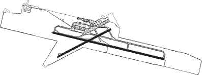
Runway info
Runway 10 / 28  | ||
| length | 3300m (10827ft) | |
| bearing | 107° / 287° | |
| width | 45m (148ft) | |
| surface | concrete | |
| blast zone | 57m (187ft) / 59m (194ft) | |
| Runway 06 / 24 | ||
| length | 1702m (5584ft) | |
| bearing | 68° / 248° | |
| width | 35m (115ft) | |
| surface | concrete | |
| blast zone | 54m (177ft) / 59m (194ft) | |
Nearby beacons
| code | identifier | dist | bearing | frequency |
|---|---|---|---|---|
| ACA | ACAPULCO VOR/DME | 0 | 354° | 115.90 |
Departure and arrival routes
| Transition altitude | 18500ft |
| Transition level | 19500ft |
| SID end points | distance | outbound heading | |
|---|---|---|---|
| RW10 | |||
| TEXC3A | 40mi | 14° | |
| AMID1A | 50mi | 86° | |
| SELIS3 | 40mi | 86° | |
| KATRA3 | 20mi | 108° | |
| AMUS1A | 50mi | 139° | |
| AGLO1A | 50mi | 320° | |
| OMVI1A | 40mi | 359° | |
| ALNU1A | 50mi | 359° | |
| RW28 | |||
| TEXC2B | 40mi | 14° | |
| AMID1B | 50mi | 86° | |
| AMUS1B | 50mi | 139° | |
| NICOS3 | 25mi | 297° | |
| AGLO1B | 50mi | 320° | |
| VIDRU1 | 40mi | 320° | |
| ALNU1B | 50mi | 359° | |
| OMVI1B | 40mi | 359° | |
| STAR starting points | distance | inbound heading | |
|---|---|---|---|
| RW10 | |||
| AVUR1A | 61.1 | 116° | |
| ANAL1A | 50.2 | 210° | |
| ANVA1A | 49.9 | 288° | |
| RW28 | |||
| AVUR1B | 61.1 | 116° | |
| ANAL1B | 50.2 | 210° | |
| ANVA1B | 49.9 | 288° | |
Instrument approach procedures
| runway | airway (heading) | route (dist, bearing) |
|---|---|---|
| RW10 | APLUR (107°) | APLUR 5500ft AA403 (5mi, 107°) 3900ft |
| RW10 | APREN (127°) | APREN 5500ft AA403 (5mi, 199°) 3900ft |
| RW10 | ATUMU (88°) | ATUMU 5500ft AA403 (5mi, 19°) 3900ft |
| RNAV | AA403 3900ft AA402 (7mi, 107°) 2300ft AA400 (2mi, 107°) 1500ft MMAA (5mi, 107°) 73ft AA407 (2mi, 107°) AVUGA (20mi, 205°) 6000ft AVUGA (turn) 6000ft | |
| RW28 | AVRIM (287°) | AVRIM 4000ft AA501 (5mi, 287°) 2400ft |
| RW28 | AVSIX (313°) | AVSIX 4000ft AA501 (5mi, 19°) 2400ft |
| RW28 | ITRAM (262°) | ITRAM 4000ft AA501 (5mi, 199°) 2400ft |
| RNAV | AA501 2400ft AA500 (5mi, 287°) 1300ft MMAA (5mi, 287°) 72ft AA514 (4mi, 287°) AVUGA (20mi, 188°) 4000ft AVUGA (turn) 4000ft |
Disclaimer
The information on this website is not for real aviation. Use this data with the X-Plane flight simulator only! Data taken with kind consent from X-Plane 12 source code and data files. Content is subject to change without notice.