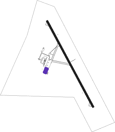
Matamoros - General Servando Canales Intl
Airport details
| Country | Mexico |
| State | Tamaulipas |
| Region | MM |
| Airspace | Monterrey Ctr |
| Municipality | Matamoros |
| Elevation | 23ft (7m) |
| Timezone | GMT -6 |
| Coordinates | 25.76808, -97.53087 |
| Magnetic var | |
| Type | land |
| Available since | X-Plane v10.40 |
| ICAO code | MMMA |
| IATA code | MAM |
| FAA code | n/a |
Communication
| General Servando Canales Intl MATAMOROS Approach/Tower | 118.000 |
Nearby Points of Interest:
Fort Brown
Nearby beacons
| code | identifier | dist | bearing | frequency |
|---|---|---|---|---|
| MAM | MATAMOROS VOR/DME | 0.4 | 68° | 114.30 |
| BRO | BROWNSVILLE VORTAC | 12.5 | 45° | 116.30 |
| BR | DEPOO (BROWNSVILLE) NDB | 12.9 | 6° | 393 |
| HRL | HARLINGEN VOR/DME | 28.4 | 345° | 113.65 |
| HR | SEBAS (HARLINGEN) NDB | 32.9 | 347° | 338 |
| REX | REYNOSA VOR/DME | 40.5 | 289° | 112.40 |
| MFE | MC ALLEN VOR/DME | 45.4 | 300° | 117.20 |
| MF | MISSI (MC ALLEN) NDB | 51.1 | 302° | 330 |
Departure and arrival routes
| Transition altitude | 18500ft |
| Transition level | 19500ft |
| SID end points | distance | outbound heading | |
|---|---|---|---|
| RW15 | |||
| RADAS2 | 27mi | 117° | |
| DARVO2 | 25mi | 171° | |
| AXIPU2 | 25mi | 185° | |
| GAGPI2 | 25mi | 199° | |
| OVEGI2 | 25mi | 215° | |
| RW33 | |||
| EBDAT2 | 25mi | 271° | |
| IRBID2 | 20mi | 290° | |
Disclaimer
The information on this website is not for real aviation. Use this data with the X-Plane flight simulator only! Data taken with kind consent from X-Plane 12 source code and data files. Content is subject to change without notice.
