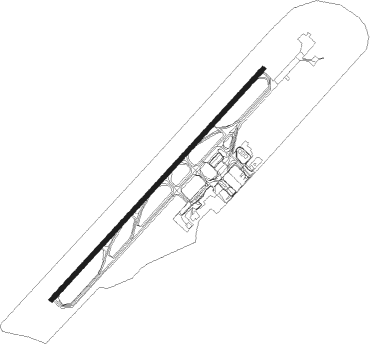
Puerto Vallarta - Lic Gustavo Diaz Ordaz Intl
Airport details
| Country | Mexico |
| State | Jalisco |
| Region | MM |
| Airspace | Mexico Ctr |
| Municipality | Puerto Vallarta |
| Elevation | 20ft (6m) |
| Timezone | GMT -6 |
| Coordinates | 20.67760, -105.25195 |
| Magnetic var | |
| Type | land |
| Available since | X-Plane v10.40 |
| ICAO code | MMPR |
| IATA code | PVR |
| FAA code | n/a |
Communication
| Lic Gustavo Diaz Ordaz Intl VALLARTA ATIS | 127.500 |
| Lic Gustavo Diaz Ordaz Intl VALLARTA DLV | 121.900 |
| Lic Gustavo Diaz Ordaz Intl VALLARTA Ramp | 134.100 |
| Lic Gustavo Diaz Ordaz Intl unnamed entity | 128.800 |
| Lic Gustavo Diaz Ordaz Intl VALLARTA Tower | 118.500 |
| Lic Gustavo Diaz Ordaz Intl VALLARTA Approach | 121.300 |
| Lic Gustavo Diaz Ordaz Intl VALLARTA Approach | 119.000 |
Nearby Points of Interest:
Marieta Islands
-Islas Marietas National Park
Nearby beacons
| code | identifier | dist | bearing | frequency |
|---|---|---|---|---|
| PVR | VALLARTA (PUERTO VALLARTA VOR/DME | 1.1 | 41° | 116.50 |
| TNY | TEPIC VOR/DME | 50.6 | 29° | 113.90 |
Departure and arrival routes
| Transition altitude | 18500ft |
| Transition level | 19500ft |
| SID end points | distance | outbound heading | |
|---|---|---|---|
| RW04 | |||
| XUDE1A | 71mi | 9° | |
| ENEMI2 | 31mi | 29° | |
| LIPE1C | 55mi | 94° | |
| VOLA1C | 57mi | 108° | |
| XOSP2A | 25mi | 299° | |
| SEKE2A | 20mi | 303° | |
| BUBE2A | 25mi | 318° | |
| BOBD1A | 50mi | 325° | |
| SILM2A | 25mi | 326° | |
| KEND2A | 21mi | 340° | |
| RW22 | |||
| XUDE1B | 71mi | 9° | |
| LIPE1D | 55mi | 94° | |
| VOLA1D | 57mi | 108° | |
| DETBO2 | 25mi | 128° | |
| ALPAP2 | 25mi | 154° | |
| XOSP2B | 25mi | 299° | |
| SEKE2B | 20mi | 303° | |
| BUBE2B | 25mi | 318° | |
| BOBD1B | 50mi | 325° | |
| SILM2B | 25mi | 326° | |
| KEND2B | 21mi | 340° | |
| STAR starting points | distance | inbound heading | |
|---|---|---|---|
| RW04 | |||
| KEDI1A | 69.8 | 120° | |
| OBRU1A | 70.8 | 158° | |
| KEDM1A | 72.0 | 209° | |
| NOTU1A | 57.1 | 260° | |
| RW22 | |||
| KEDI1B | 69.8 | 120° | |
| OBRU1B | 70.8 | 158° | |
| KEDM1B | 72.0 | 209° | |
| ESVEL1 | 51.1 | 229° | |
| NOTU1B | 57.1 | 260° | |
| LIPE1E | 55.0 | 274° | |
Instrument approach procedures
| runway | airway (heading) | route (dist, bearing) |
|---|---|---|
| RW04 | MAYTE (22°) | MAYTE 4000ft PR401 (6mi, 315°) 2300ft |
| RW04 | RORPO (76°) | RORPO 4000ft PR401 (6mi, 135°) 2300ft |
| RNAV | PR401 2300ft PR400 (5mi, 49°) 1700ft MMPR (6mi, 51°) 61ft PR409 (2mi, 44°) PR410 (9mi, 296°) PR411 (14mi, 257°) 5000ft VIMSO (17mi, 257°) 6000ft VIMSO (turn) 6000ft | |
| RW22 | MUVBA (208°) | MUVBA 5500ft PR407 (6mi, 139°) 4000ft PR405 (4mi, 229°) 2800ft |
| RW22 | VETKA (228°) | VETKA 5000ft PR407 (3mi, 229°) 4000ft PR405 (4mi, 229°) 2800ft |
| RNAV | PR405 2800ft PR404 (5mi, 229°) 1700ft MMPR (6mi, 227°) 73ft PR557 (8mi, 230°) VIMSO (31mi, 277°) 6000ft VIMSO (turn) 6000ft |
Holding patterns
| STAR name | hold at | type | turn | heading* | altitude | leg | speed limit |
|---|---|---|---|---|---|---|---|
| NOTU1A | SETLU | VHF | right | 73 (253)° | > 17000ft | 1.0min timed | 250 |
| NOTU1B | SETLU | VHF | right | 73 (253)° | > 17000ft | 1.0min timed | 250 |
| *) magnetic outbound (inbound) holding course | |||||||
Disclaimer
The information on this website is not for real aviation. Use this data with the X-Plane flight simulator only! Data taken with kind consent from X-Plane 12 source code and data files. Content is subject to change without notice.