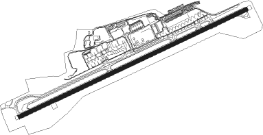
San Jose - San Jose Juan Santamaria Intl
Airport details
| Country | Costa Rica |
| State | Alajuela |
| Region | MR |
| Airspace | Central American Ctr |
| Municipality | La Guácima |
| Elevation | 3020ft (920m) |
| Timezone | GMT -6 |
| Coordinates | 9.99288, -84.21600 |
| Magnetic var | |
| Type | land |
| Available since | X-Plane v10.40 |
| ICAO code | MROC |
| IATA code | SJO |
| FAA code | n/a |
Communication
| San Jose Juan Santamaria Intl Clearance | 121.300 |
| San Jose Juan Santamaria Intl Ground Control | 121.900 |
| San Jose Juan Santamaria Intl COCO Tower | 118.600 |
| San Jose Juan Santamaria Intl COCO Approach | 120.500 |
| San Jose Juan Santamaria Intl COCO Departure | 120.500 |
Approach frequencies
| ILS-cat-I | RW07 | 109.5 | 18.00mi |
| 3° GS | RW07 | 109.5 | 18.00mi |
Nearby beacons
| code | identifier | dist | bearing | frequency |
|---|---|---|---|---|
| TIO | EL COCO (SAN JOSE) VOR/DME | 1.3 | 245° | 115.70 |
Departure and arrival routes
| Transition altitude | 18000ft |
| Transition level | 20000ft |
| SID end points | distance | outbound heading | |
|---|---|---|---|
| RW07 | |||
| POAS4, NANJ3R, RAMON4 | 44mi | 12° | |
| NANJ3C | 59mi | 40° | |
| TEJA3M | 70mi | 91° | |
| PARAI3 | 84mi | 109° | |
| TEJA3T | 111mi | 138° | |
| DOTA3D | 80mi | 171° | |
| DOTA3E | 72mi | 179° | |
| ATENA4 | 29mi | 192° | |
| NANJ3L | 87mi | 294° | |
| NANJ3U | 85mi | 318° | |
| RW25 | |||
| RAMON4, NANJ4R | 44mi | 12° | |
| NANJ4C | 59mi | 40° | |
| TEJA4M | 70mi | 91° | |
| TEJA4T | 111mi | 138° | |
| DOTA4D | 80mi | 171° | |
| DOTA4E | 72mi | 179° | |
| ATENA4 | 29mi | 192° | |
| NANJ4L | 87mi | 294° | |
| NANJ4U | 85mi | 318° | |
| STAR starting points | distance | inbound heading | |
|---|---|---|---|
| RW07 | |||
| PARI3D, PARI3E | 28.8 | 12° | |
| BARA3C, BARA3L, BARA3P | 25.9 | 111° | |
| CUAR3I, CUAR3T | 42.9 | 289° | |
| RW25 | |||
| PARI4E, PARI4D | 28.8 | 12° | |
| BARA4P, BARA4L, BARA4C | 25.9 | 111° | |
| CUAR4I, CUAR4T | 42.9 | 289° | |
Instrument approach procedures
| runway | airway (heading) | route (dist, bearing) |
|---|---|---|
| RW07 | OTINA (89°) | OTINA 10000ft TOMAS (6mi, 149°) 8000ft OC102 (6mi, 70°) 5500ft |
| RW07 | PARZA (69°) | PARZA 10000ft LOPEZ (5mi, 69°) 9000ft TOMAS (5mi, 69°) 8000ft OC102 (6mi, 70°) 5500ft |
| RW07 | TURRU (49°) | TURRU 10000ft TOMAS (6mi, 345°) 8000ft OC102 (6mi, 70°) 5500ft |
| RNAV | OC102 5500ft OC103 (4mi, 69°) 5000ft OC104 (3mi, 69°) 3950ft OC105 (2mi, 69°) 3303ft OC106 (4mi, 70°) 3980ft OC107 (6mi, 89°) 5500ft OC108 (5mi, 179°) 6250ft OC109 (10mi, 259°) 7750ft TURRU (14mi, 244°) 10000ft TURRU (turn) 10000ft | |
| RW25-E | OKOPU (306°) | OKOPU 12000ft DIEGO (13mi, 311°) 8200ft OC263 (4mi, 311°) 6900ft OC262 (5mi, 321°) 5500ft OC256 (2mi, 321°) 4700ft |
| RNAV | OC256 4700ft OC067 (2mi, 285°) 3800ft MROC (3mi, 251°) 3077ft COYOL (19mi, 249°) 7000ft COYOL (turn) 7000ft | |
| RW25-W | COLON (12°) | COLON 8000ft OC300 (3mi, 70°) 7300ft |
| RW25-W | TABAR (5°) | TABAR 9000ft OC319 (3mi, 357°) 8000ft OC300 (4mi, 39°) 7300ft |
| RNAV | OC300 7300ft OC259 (3mi, 70°) 6400ft OC261 (2mi, 41°) 5500ft OC256 (2mi, 346°) 4700ft OC067 (2mi, 285°) 3800ft MROC (3mi, 251°) 3077ft COYOL (19mi, 249°) 7000ft COYOL (turn) 7000ft |
Holding patterns
| STAR name | hold at | type | turn | heading* | altitude | leg | speed limit |
|---|---|---|---|---|---|---|---|
| BARA3C | BARRA | VHF | right | 331 (151)° | > 10000ft | 1.0min timed | ICAO rules |
| BARA3L | BARRA | VHF | right | 331 (151)° | > 10000ft | 1.0min timed | ICAO rules |
| BARA3P | BARRA | VHF | right | 331 (151)° | > 10000ft | 1.0min timed | ICAO rules |
| BARA4C | BARRA | VHF | right | 331 (151)° | > 10000ft | 1.0min timed | ICAO rules |
| BARA4L | BARRA | VHF | right | 331 (151)° | > 10000ft | 1.0min timed | ICAO rules |
| BARA4P | BARRA | VHF | right | 331 (151)° | > 10000ft | 1.0min timed | ICAO rules |
| CUAR3I | TOBIC | VHF | left | 88 (268)° | > 15000ft | 1.5min timed | 250 |
| CUAR3T | TOBIC | VHF | left | 88 (268)° | > 15000ft | 1.5min timed | 250 |
| CUAR4I | TOBIC | VHF | left | 88 (268)° | > 15000ft | 1.5min timed | 250 |
| CUAR4T | TOBIC | VHF | left | 88 (268)° | > 15000ft | 1.5min timed | 250 |
| *) magnetic outbound (inbound) holding course | |||||||
Disclaimer
The information on this website is not for real aviation. Use this data with the X-Plane flight simulator only! Data taken with kind consent from X-Plane 12 source code and data files. Content is subject to change without notice.
