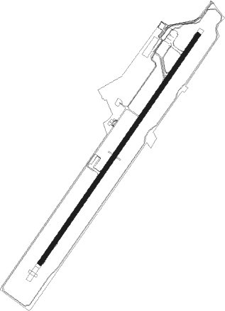
Cap Haitien - Cap Haitien Intl
Airport details
| Country | Haiti |
| State | Département du Nord |
| Region | MT |
| Airspace | Port-au-prince Ctr |
| Municipality | Commune Cap-Haïtien |
| Elevation | 6ft (2m) |
| Timezone | GMT -5 |
| Coordinates | 19.73266, -72.19481 |
| Magnetic var | |
| Type | land |
| Available since | X-Plane v10.40 |
| ICAO code | MTCH |
| IATA code | CAP |
| FAA code | n/a |
Communication
| Cap Haitien Intl Tower | 118.700 |
Nearby Points of Interest:
Monte Cristi
Nearby beacons
| code | identifier | dist | bearing | frequency |
|---|---|---|---|---|
| HCN | CAP HAITIEN VOR/DME | 1.3 | 221° | 113.90 |
Departure and arrival routes
| Transition altitude | 17000ft |
| SID end points | distance | outbound heading | |
|---|---|---|---|
| RW05 | |||
| RETA1N | 40mi | 47° | |
| SEDE1N | 35mi | 184° | |
| SAVA1N | 45mi | 212° | |
| MEDO1N | 46mi | 273° | |
| NOSO1N | 34mi | 310° | |
| ALBE1N | 41mi | 355° | |
| STAR starting points | distance | inbound heading | |
|---|---|---|---|
| RW05 | |||
| SEDE1N | 34.5 | 4° | |
| SAVA1N | 44.9 | 32° | |
| MEDO1N | 46.1 | 93° | |
| NOSO1F, NOSO1L, NOSO1N | 33.7 | 130° | |
| TUMA1N, TUMA1L | 37.1 | 211° | |
| RW23 | |||
| SEDE1S | 34.5 | 4° | |
| SAVA1S | 44.9 | 32° | |
| MEDO1S | 46.1 | 93° | |
| NOSO1S | 33.7 | 130° | |
| TUMA1S | 37.1 | 211° | |
| RETA1S | 39.7 | 227° | |
Instrument approach procedures
| runway | airway (heading) | route (dist, bearing) |
|---|---|---|
| RW05-Y | FOSET (127°) | FOSET 3400ft CH606 (6mi, 133°) CH604 (4mi, 149°) |
| RW05-Y | LACUL (139°) | LACUL 3400ft CH604 (10mi, 164°) |
| RNAV | CH604 3200ft CH603 (5mi, 164°) 3200ft CH602 (2mi, 164°) CH601 (4mi, 102°) MTCH (4mi, 41°) 64ft CH612 (2mi, 41°) CH614 (5mi, 10°) CH616 (11mi, 338°) LACUL (10mi, 253°) 3400ft LACUL (turn) | |
| RW05-Z | CH412 (13°) | CH412 DALCY (5mi, 333°) 6500ft CH406 (9mi, 333°) 5100ft |
| RW05-Z | PBORO (61°) | PBORO 5400ft CH406 (7mi, 128°) 5100ft |
| RNAV | CH406 5100ft CH408 (5mi, 41°) 4600ft MTCH (14mi, 41°) 64ft CH409 (3mi, 55°) CH410 (11mi, 137°) CH411 (16mi, 199°) CH412 (12mi, 245°) DALCY (5mi, 333°) 6500ft DALCY (turn) 6500ft | |
| RW23 | HOCAP (201°) | HOCAP 2500ft PODPE (5mi, 128°) 2500ft |
| RW23 | PODPE (221°) | PODPE 2500ft |
| RW23 | ZAMMI (241°) | ZAMMI 2500ft PODPE (5mi, 308°) 2500ft |
| RNAV | PODPE 2500ft CH508 (6mi, 221°) 2500ft MTCH (8mi, 221°) 60ft CH524 (8mi, 116°) CH525 (17mi, 36°) CH526 (6mi, 308°) PODPE (5mi, 221°) 2500ft PODPE (turn) |
Holding patterns
| STAR name | hold at | type | turn | heading* | altitude | leg | speed limit |
|---|---|---|---|---|---|---|---|
| MEDO1N | PBORO | VHF | left | 319 (139)° | > 5400ft | 1.0min timed | 220 |
| NOSO1L | LACUL | VHF | left | 355 (175)° | > 3400ft | 1.0min timed | 220 |
| NOSO1N | PBORO | VHF | left | 319 (139)° | > 5400ft | 1.0min timed | 220 |
| RETA1S | PODPE | VHF | left | 49 (229)° | > 2500ft | 1.0min timed | 230 |
| SAVA1N | DALCY | VHF | right | 164 (344)° | > 6500ft | 1.0min timed | 220 |
| SEDE1N | DALCY | VHF | right | 164 (344)° | > 6500ft | 1.0min timed | 220 |
| TUMA1L | LACUL | VHF | left | 355 (175)° | > 3400ft | 1.0min timed | 220 |
| TUMA1N | PBORO | VHF | left | 319 (139)° | > 5400ft | 1.0min timed | 220 |
| TUMA1S | PODPE | VHF | left | 49 (229)° | > 2500ft | 1.0min timed | 230 |
| *) magnetic outbound (inbound) holding course | |||||||
Disclaimer
The information on this website is not for real aviation. Use this data with the X-Plane flight simulator only! Data taken with kind consent from X-Plane 12 source code and data files. Content is subject to change without notice.
