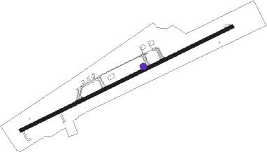
Camaguey - Ignacio Agramonte Intl
Airport details
| Country | Cuba |
| State | Camagüey |
| Region | MU |
| Airspace | Havana Ctr |
| Elevation | 413ft (126m) |
| Timezone | GMT -5 |
| Coordinates | 21.42028, -77.84750 |
| Magnetic var | |
| Type | land |
| Available since | X-Plane v10.40 |
| ICAO code | MUCM |
| IATA code | CMW |
| FAA code | n/a |
Communication
| Ignacio Agramonte Intl AGRAMONTE Tower | 118.500 |
| Ignacio Agramonte Intl CAMAGUEY RDO | 126.900 |
| Ignacio Agramonte Intl CAMAGUEY Approach | 121.300 |
Nearby beacons
| code | identifier | dist | bearing | frequency |
|---|---|---|---|---|
| UCM | CAMAGUEY VOR/DME | 2.8 | 70° | 114.10 |
| USR | SIMONES NDB | 57.2 | 289° | 315 |
Departure and arrival routes
| Transition altitude | 3000ft |
| SID end points | distance | outbound heading | |
|---|---|---|---|
| RW08 | |||
| BOKTO2 | 131mi | 13° | |
| DELB2A | 76mi | 290° | |
| DASUG5, PETMU5 | 68mi | 336° | |
| RW26 | |||
| TAGO4B | 46mi | 251° | |
| KANID5, SATOG7 | 68mi | 336° | |
| STAR starting points | distance | inbound heading | |
|---|---|---|---|
| RW08 | |||
| TAGO4A | 20.3 | 83° | |
| SATOG5, SATOG6 | 32.2 | 145° | |
| NOXE4A | 16.5 | 340° | |
| RW26 | |||
| DELB2B | 27.4 | 111° | |
| PETMU4 | 24.8 | 191° | |
| DASUG4 | 29.1 | 206° | |
| KANNO2 | 19.9 | 300° | |
Instrument approach procedures
| runway | airway (heading) | route (dist, bearing) |
|---|---|---|
| RW08 | CM500 (97°) | CM500 3000ft KAXOS (6mi, 157°) 2000ft |
| RW08 | CM501 (41°) | CM501 3000ft KAXOS (6mi, 337°) 2000ft |
| RNAV | KAXOS 2000ft CM507 (5mi, 70°) 2000ft MUCM (6mi, 70°) 450ft (4726mi, 105°) 1500ft NOXET (4720mi, 285°) NOXET (turn) | |
| RW26 | CM503 (221°) | CM503 3000ft DUMTU (6mi, 157°) 2000ft |
| RW26 | CM504 (250°) | CM504 3000ft DUMTU (6mi, 250°) 2000ft |
| RW26 | CM505 (277°) | CM505 3000ft DUMTU (6mi, 337°) 2000ft |
| RNAV | DUMTU 2000ft CM525 (5mi, 250°) 2000ft MUCM (6mi, 250°) 450ft (4726mi, 105°) 1500ft CM506 (4731mi, 285°) CM506 (turn) |
Holding patterns
| STAR name | hold at | type | turn | heading* | altitude | leg | speed limit |
|---|---|---|---|---|---|---|---|
| DASUG4 | DASUG | VHF | right | 342 (162)° | 4000ft - 14000ft | DME 4.2mi | 230 |
| DELB2B | DELBA | VHF | right | 279 (99)° | 4000ft - 14000ft | DME 4.2mi | 230 |
| KANNO2 | KANNO | VHF | right | 159 (339)° | 4000ft - 14000ft | DME 4.2mi | 230 |
| NOXE4A | NOXET | VHF | right | 123 (303)° | 4000ft - 14000ft | DME 4.2mi | 230 |
| PETMU4 | PETMU | VHF | right | 354 (174)° | 4000ft - 14000ft | DME 4.2mi | 230 |
| SATOG5 | SATOG | VHF | right | 356 (176)° | 4000ft - 14000ft | DME 4.2mi | 230 |
| SATOG6 | SATOG | VHF | right | 356 (176)° | 4000ft - 14000ft | DME 4.2mi | 230 |
| SATOG6 | TAGON | VHF | right | 285 (105)° | 4000ft - 14000ft | DME 4.2mi | 230 |
| TAGO4A | TAGON | VHF | right | 285 (105)° | 4000ft - 14000ft | DME 4.2mi | 230 |
| *) magnetic outbound (inbound) holding course | |||||||
Disclaimer
The information on this website is not for real aviation. Use this data with the X-Plane flight simulator only! Data taken with kind consent from X-Plane 12 source code and data files. Content is subject to change without notice.
