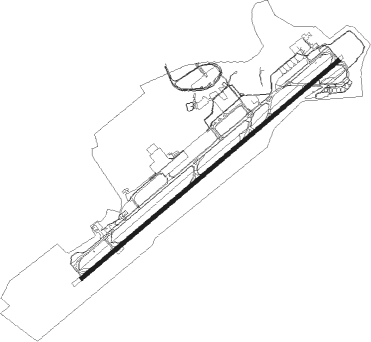
Havana - Havana Jose Marti Intl
Airport details
| Country | Cuba |
| State | Havana |
| Region | MU |
| Airspace | Havana Ctr |
| Municipality | Boyeros |
| Elevation | 208ft (63m) |
| Timezone | GMT -5 |
| Coordinates | 22.98917, -82.40916 |
| Magnetic var | |
| Type | land |
| Available since | X-Plane v10.40 |
| ICAO code | MUHA |
| IATA code | HAV |
| FAA code | n/a |
Communication
| Havana Jose Marti Intl ATIS | 132.500 |
| Havana Jose Marti Intl Ground Control | 121.900 |
| Havana Jose Marti Intl MARTI Tower | 118.100 |
| Havana Jose Marti Intl HABANA Approach | 119.350 |
Approach frequencies
| ILS-cat-I | RW06 | 110.5 | 18.00mi |
| 3° GS | RW06 | 110.5 | 18.00mi |
Nearby Points of Interest:
Old Havana
Nearby beacons
| code | identifier | dist | bearing | frequency |
|---|---|---|---|---|
| UHA | HAVANA VOR/DME | 1.1 | 239° | 116.10 |
| UBP | PLAYA BARACOA (HAVANA) NDB | 9.7 | 281° | 250 |
| UPB | PLAYA BARACOA (HAVANA) VOR/DME | 9.7 | 281° | 109.20 |
| UZG | ZARAGO NDB | 20.7 | 98° | 283 |
| UCY | CAYABO (CAYAJABO) NDB | 25.7 | 254° | 380 |
| UVA | VARDER VOR/DME | 52.8 | 88° | 114.80 |
Departure and arrival routes
| Transition altitude | 3000ft |
| SID end points | distance | outbound heading | |
|---|---|---|---|
| RW06 | |||
| AFFIL3 | 16mi | 56° | |
| KAVU5A | 59mi | 109° | |
| KAVU1C | 96mi | 148° | |
| JUGAR4 | 181mi | 288° | |
| EMUPA2 | 61mi | 354° | |
| RW24 | |||
| FARAC4 | 171mi | 70° | |
| DUTA4B | 53mi | 88° | |
| BELBY3 | 181mi | 288° | |
| STAR starting points | distance | inbound heading | |
|---|---|---|---|
| RW06 | |||
| HUTE4A | 49.9 | 33° | |
| BELBY2 | 38.7 | 69° | |
| ENTRY3 | 28.8 | 101° | |
| AVERA2 | 35.0 | 147° | |
| JUGAR3 | 20.6 | 211° | |
| DUTA9A | 21.5 | 330° | |
| BENON2 | 50.7 | 357° | |
| RW24 | |||
| FARAC3 | 15.7 | 136° | |
| JUGAR2 | 20.6 | 211° | |
| AFFIL3 | 16.0 | 236° | |
| KAVU4B | 16.8 | 257° | |
Instrument approach procedures
| runway | airway (heading) | route (dist, bearing) |
|---|---|---|
| RW06 | HA410 (82°) | HA410 3000ft JANSE (6mi, 142°) 2000ft |
| RW06 | HA411 (29°) | HA411 3000ft JANSE (6mi, 322°) 2000ft |
| RNAV | JANSE 2000ft HA402 (5mi, 56°) 2000ft MUHA (7mi, 56°) 260ft (4986mi, 106°) 2000ft DUTAN (4975mi, 285°) DUTAN (turn) |
Holding patterns
| STAR name | hold at | type | turn | heading* | altitude | leg | speed limit |
|---|---|---|---|---|---|---|---|
| AFFIL3 | AFFIL | VHF | right | 59 (239)° | 3000ft - 14000ft | DME 4.1mi | 230 |
| AVERA2 | AVERA | VHF | right | 336 (156)° | > 4000ft | 1.0min timed | ICAO rules |
| BELBY2 | HA407 | VHF | left | 259 (79)° | 4000ft - 14000ft | DME 4.2mi | 230 |
| BENON2 | BENON | VHF | right | 182 (2)° | > 4000ft | 1.0min timed | ICAO rules |
| DUTA9A | DUTAN | VHF | right | 153 (333)° | > 4000ft | 1.0min timed | ICAO rules |
| ENTRY3 | HA407 | VHF | left | 259 (79)° | 4000ft - 14000ft | DME 4.2mi | 230 |
| FARAC3 | AFFIL | VHF | right | 59 (239)° | 3000ft - 14000ft | DME 4.1mi | 230 |
| FARAC3 | JUGAR | VHF | left | 345 (165)° | 3000ft - 14000ft | DME 4.1mi | 230 |
| HUTE4A | HA407 | VHF | left | 259 (79)° | 4000ft - 14000ft | DME 4.2mi | 230 |
| HUTE4A | HA408 | VHF | left | 165 (345)° | 4000ft - 14000ft | DME 4.2mi | 230 |
| JUGAR2 | AFFIL | VHF | right | 59 (239)° | 3000ft - 14000ft | DME 4.1mi | 230 |
| JUGAR2 | JUGAR | VHF | left | 345 (165)° | 3000ft - 14000ft | DME 4.1mi | 230 |
| JUGAR3 | HA407 | VHF | left | 259 (79)° | 4000ft - 14000ft | DME 4.2mi | 230 |
| KAVU4B | KAVUL | VHF | right | 118 (298)° | 3000ft - 14000ft | DME 4.1mi | 230 |
| *) magnetic outbound (inbound) holding course | |||||||
Disclaimer
The information on this website is not for real aviation. Use this data with the X-Plane flight simulator only! Data taken with kind consent from X-Plane 12 source code and data files. Content is subject to change without notice.