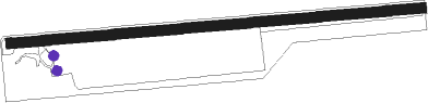
Bemidji - Cloverleaf-east Bemidji
Airport details
| Country | United States of America |
| State | Minnesota |
| Region | |
| Airspace | Minneapolis Ctr |
| Municipality | Beltrami County |
| Elevation | 1443ft (440m) |
| Timezone | GMT -6 |
| Coordinates | 47.43829, -94.81222 |
| Magnetic var | |
| Type | land |
| Available since | X-Plane v10.40 |
| ICAO code | MY54 |
| IATA code | n/a |
| FAA code | MY54 |
Communication
Nearby Points of Interest:
Nymore Bridge
-Great Northern Depot
-Beltrami County Courthouse
-David Park House
-Lake Bemidji State Park CCC/NYA/Rustic Style Historic Resources
-Rabideau CCC Camp
-Itasca State Park
-Minnesota State Sanatorium for Consumptives
Runway info
| Runway 09 / 27 | ||
| length | 1228m (4029ft) | |
| bearing | 90° / 270° | |
| width | 30m (100ft) | |
| surface | grass | |
Nearby beacons
| code | identifier | dist | bearing | frequency |
|---|---|---|---|---|
| IDJ | LAKE BEMIDJI VOR/DME | 6.1 | 302° | 110 |
| PKD | RAPIDS DME | 34.1 | 206° | 110.60 |
| PK | SPIDA (PARK RAPIDS) NDB | 36.8 | 195° | 269 |
| BR | LAREW (BRAINERD) NDB | 67.2 | 141° | 251 |
Disclaimer
The information on this website is not for real aviation. Use this data with the X-Plane flight simulator only! Data taken with kind consent from X-Plane 12 source code and data files. Content is subject to change without notice.