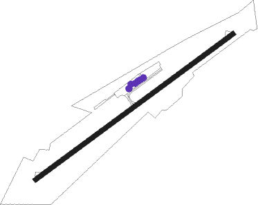
Sidney Municipal
Airport details
| Country | United States of America |
| State | New York |
| Region | K6 |
| Airspace | Boston Ctr |
| Municipality | Town of Bainbridge |
| Elevation | 1024ft (312m) |
| Timezone | GMT -5 |
| Coordinates | 42.30258, -75.41597 |
| Magnetic var | |
| Type | land |
| Available since | X-Plane v10.40 |
| ICAO code | N23 |
| IATA code | n/a |
| FAA code | n/a |
Communication
| Sidney Municipal AWOS 3 | 118.275 |
| Sidney Municipal CTAF/UNICOM | 122.800 |
Nearby Points of Interest:
Bainbridge Historic District
-Charles C. Hovey House and Strong Leather Company Mill
-Rockdale Community Church
-Roswell Wright House
-Unadilla Village Historic District
-Guilford Center Presbyterian Church
-Holden B. Mathewson House
-New Stone Hall
-Franklin Village Historic District
-Oxford Village Historic District
-Theodore Burr House
-United States Post Office
-Harpursville United Methodist Church
-Loomis Family Farm
-Eaton Family Residence — Jewish Center of Norwich
-Chenango County Courthouse District
-Rock Rift Fire Observation Tower
-Methodist-Episcopal Church of Norwich
-Schoolhouse No. 5
-Gardiner Place Historic District
-Walton Grange No. 1454
-Clinton-Rosekrans Law Building
-Greene Historic District
Nearby beacons
| code | identifier | dist | bearing | frequency |
|---|---|---|---|---|
| RKA | ROCKDALE VOR/DME | 12.5 | 47° | 112.60 |
| HNK | HANCOCK VOR/DME | 15 | 157° | 116.80 |
| DNY | DE LANCEY VOR/DME | 21.7 | 105° | 112.10 |
| CFB | BINGHAMTON VOR/DME | 33.2 | 259° | 112.20 |
| GGT | GEORGETOWN TACAN | 34.4 | 320° | 117.80 |
| IT | VRNAH (ITHACA) NDB | 42.9 | 278° | 266 |
| UCA | UTICA TACAN | 44.8 | 19° | 111.20 |
| SYR | SYRACUSE VORTAC | 62.1 | 317° | 117 |
| HUO | HUGUENOT VOR/DME | 65 | 137° | 116.10 |
| FZ | FALLN (FULTON) NDB | 70.9 | 318° | 220 |
Instrument approach procedures
| runway | airway (heading) | route (dist, bearing) |
|---|---|---|
| RW07 | GROWS (91°) | GROWS INADY (7mi, 139°) 3600ft |
| RW07 | HNK (337°) | HNK OTHID (11mi, 287°) 3900ft INADY (5mi, 320°) 3600ft |
| RNAV | INADY 3600ft LOTMY (5mi, 65°) 2700ft N23 (5mi, 65°) 1075ft (4761mi, 119°) 1427ft ODEBY (4752mi, 299°) 3700ft ODEBY (turn) | |
| RW25 | ODEBY (245°) | ODEBY 4500ft |
| RW25 | UZUBO (267°) | UZUBO 5200ft ODEBY (6mi, 319°) 4500ft |
| RW25 | ZAYAZ (217°) | ZAYAZ 4500ft ODEBY (7mi, 140°) 4500ft |
| RNAV | ODEBY 4500ft SIBJI (7mi, 245°) 3000ft UJTAP (1mi, 245°) 2440ft N23 (4mi, 245°) 1070ft (4761mi, 119°) 1427ft INADY (4768mi, 299°) 3500ft INADY (turn) |
Disclaimer
The information on this website is not for real aviation. Use this data with the X-Plane flight simulator only! Data taken with kind consent from X-Plane 12 source code and data files. Content is subject to change without notice.