Wellsboro - Wellsboro Johnston
Airport details
| Country | United States of America |
| State | Pennsylvania |
| Region | K6 |
| Airspace | New York Ctr |
| Municipality | Tioga County |
| Elevation | 1895ft (578m) |
| Timezone | GMT -5 |
| Coordinates | 41.72799, -77.39544 |
| Magnetic var | |
| Type | land |
| Available since | X-Plane v10.40 |
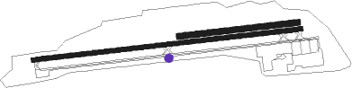
| ICAO code | N38 |
| IATA code | n/a |
| FAA code | n/a |
Communication
| Wellsboro Johnston CTAF/UNICOM | 122.800 |
| Wellsboro Johnston ELMIRA Approach/Departure | 119.450 |
Nearby Points of Interest:
Colton Point State Park Historic District
-Jesse Robinson House
-Robinson House
-Wellsboro Armory
-Mansfield Armory
-Bridge in Brown Township
-Parkhurst Memorial Presbyterian Church
-Cherry Springs Picnic Pavilion
-James Ford House
-Judge John Ryon House
-Addison Village Hall
-Main Street Historic District
-Maple Street Historic District
-William Wombough House
-Bridge in Lewis Township
-Northrup Hill School District 10
-Pine Creek Gorge
-Van Dyne Civic Building
-Sunbury Historic District
-Potter County Courthouse
-Coudersport and Port Allegany Railroad Station
-Coudersport Historic District
-Southside Historic District
-World War Memorial Library
-United States Post Office

Nearby beacons
| code | identifier | dist | bearing | frequency |
|---|---|---|---|---|
| SFK | STONYFORK VOR/DME | 2.2 | 217° | 108.60 |
| ULW | ELMIRA VOR/DME | 27.5 | 45° | 109.65 |
| SLT | SLATE RUN VORTAC | 28.8 | 249° | 113.90 |
| ELZ | DME | 34.6 | 301° | 111.40 |
| FQM | WILLIAMSPORT VOR/DME | 36.4 | 122° | 114.40 |
| ALP | ALPINE (ELMIRA) NDB | 41.6 | 51° | 245 |
| ETG | KEATING VORTAC | 45.6 | 236° | 116 |
| UN | PENUE (STATE COLLEGE) NDB | 51.5 | 203° | 388 |
| MIP | MILTON VORTAC | 53.6 | 134° | 109.20 |
| PSB | PHILIPSBURG VORTAC | 55.6 | 216° | 115.50 |
| PYA | PENN YAN NDB | 57 | 20° | 260 |
| SEG | SELINSGROVE VOR/DME | 60.8 | 151° | 110.40 |
| ITH | DME | 62.1 | 51° | 111.80 |
Instrument approach procedures
| runway | airway (heading) | route (dist, bearing) |
|---|---|---|
| RW10 | ODPOJ (88°) | ODPOJ 6000ft ODPOJ (turn) 4900ft |
| RNAV | ODPOJ 4900ft ZEGOK (5mi, 88°) 3400ft N38 (5mi, 88°) 1929ft (4842mi, 118°) 2292ft ITEHO (4837mi, 298°) WUDUL (9mi, 13°) 4500ft WUDUL (turn) | |
| RW28 | NOZVY (268°) | NOZVY 6000ft NOZVY (turn) 4900ft |
| RNAV | NOZVY 4900ft COVOJ (5mi, 268°) 3500ft N38 (5mi, 268°) 1931ft (4842mi, 118°) 2292ft WUDUL (4837mi, 298°) 4500ft WUDUL (turn) |
Disclaimer
The information on this website is not for real aviation. Use this data with the X-Plane flight simulator only! Data taken with kind consent from X-Plane 12 source code and data files. Content is subject to change without notice.