Jaars - Jaars-townsend
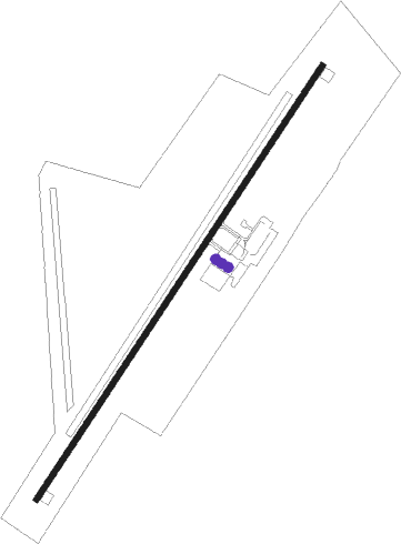
Airport details
| Country | United States of America |
| State | North Carolina |
| Region | K7 |
| Airspace | Atlanta Ctr |
| Municipality | Union County |
| Elevation | 602ft (183m) |
| Timezone | GMT -5 |
| Coordinates | 34.86382, -80.74799 |
| Magnetic var | |
| Type | land |
| Available since | X-Plane v10.40 |
| ICAO code | N52 |
| IATA code | n/a |
| FAA code | n/a |
Communication
| JAARS-Townsend CTAF/UNICOM | 123.000 |
| JAARS-Townsend CHARLOTTE Approach/Departure | 120.050 |
Nearby Points of Interest:
Thomas Walker Huey House
-North Carolina-South Carolina Cornerstone
-Massey-Doby-Nisbet House
-Cureton House
-Craig House
-Waxhaw Presbyterian Church Cemetery
-William Harrison Sapp House
-Landsford Canal
-Lancaster County Jail
-Leroy Springs House
-Lancaster County Courthouse
-Robert Barnwell Allison House
-Lancaster Presbyterian Church
-Lancaster Cotton Oil Company
-Catawba Rosenwald School
-Landsford Plantation House
-Buford's Massacre Site
-Waxhaw-Weddington Roads Historic District
-Monroe Residential Historic District
-Monroe Downtown Historic District
-Union County Courthouse
-Monroe City Hall
-Perry-McIlwain-McDow House
-Providence Presbyterian Church and Cemetery
-Piedmont Buggy Factory
Nearby beacons
| code | identifier | dist | bearing | frequency |
|---|---|---|---|---|
| LKR | LANCASTER NDB | 10 | 218° | 400 |
| UZ | RALLY (ROCK HILL) NDB | 16.4 | 274° | 227 |
| CLT | CHARLOTTE VOR/DME | 22 | 328° | 115 |
| DCM | CHESTER NDB | 22.8 | 260° | 220 |
| CTF | CHESTERFIELD VOR/DME | 26.6 | 114° | 108.20 |
| GHJ | STONIA (GASTONIA) NDB | 28.1 | 309° | 260 |
| HVS | HARTSVILLE NDB | 41.4 | 126° | 341 |
| UOT | UNION COUNTY NDB | 45.4 | 259° | 326 |
| SLP | FIRST RIVER (SHELBY) NDB | 47.9 | 295° | 417 |
| UDG | DARLINGTON NDB | 49.4 | 116° | 245 |
| VU | ALLER (ALBEMARLE) NDB | 49.7 | 47° | 346 |
| RU | ROVDY (SALISBURY) NDB | 53.7 | 17° | 275 |
| EOE | ENOREE (NEWBERRY) NDB | 55 | 238° | 278 |
| SSC | SHAW (SUMTER) TACAN | 55 | 162° | 110.10 |
| SMS | SUMTER NDB | 55.8 | 156° | 252 |
| MMT | MC ENTIRE (COLUMBIA) VORTAC | 56.5 | 183° | 113.20 |
| CA | MURRY (COLUMBIA) NDB | 59.2 | 209° | 362 |
| FL | ALCOT (FLORENCE) NDB | 60.6 | 128° | 335 |
| HK | TAWBA (HICKORY) NDB | 61.7 | 329° | 332 |
| FIQ | FIDDLERS (MORGANTON) NDB | 68 | 313° | 391 |
Departure and arrival routes
| Transition altitude | 18000ft |
| Transition level | 18000ft |
| STAR starting points | distance | inbound heading | |
|---|---|---|---|
| ALL | |||
| CHPTR3 | 42.7 | 66° | |
| UNARM6 | 45.8 | 77° | |
| LIINN3 | 69.8 | 121° | |
| MAJIC4 | 58.9 | 198° | |
| RASLN3 | 22.9 | 277° | |
Instrument approach procedures
| runway | airway (heading) | route (dist, bearing) |
|---|---|---|
| RW04 | CLT (148°) | CLT PENNE (29mi, 172°) 2500ft PENNE (turn) 2500ft |
| RW04 | CTF (294°) | CTF PENNE (30mi, 276°) 2500ft PENNE (turn) 2500ft |
| RW04 | RICHE (56°) | RICHE PENNE (5mi, 80°) 2500ft |
| RNAV | PENNE 2500ft WIXXU (6mi, 43°) 2200ft N52 (5mi, 43°) 642ft (4950mi, 113°) 1002ft PENNE (4956mi, 293°) 2500ft PENNE (turn) | |
| RW22 | CLT (148°) | CLT WUXVO (23mi, 119°) 2500ft WUXVO (turn) 2500ft |
| RW22 | CTF (294°) | CTF WUXVO (24mi, 319°) 2500ft WUXVO (turn) 2500ft |
| RW22 | LOCAS (222°) | LOCAS WUXVO (15mi, 209°) 2500ft |
| RNAV | WUXVO 2500ft JUDOB (6mi, 238°) 2300ft HISOD (3mi, 238°) 1180ft REFRI (1mi, 238°) 798ft (4950mi, 113°) 1002ft WUXVO (4942mi, 293°) 2500ft WUXVO (turn) |
Holding patterns
| STAR name | hold at | type | turn | heading* | altitude | leg | speed limit |
|---|---|---|---|---|---|---|---|
| CHPTR3 | EYPAD | VHF | right | 218 (38)° | DME 10.0mi | ICAO rules | |
| CHPTR3 | GRD | NDB | right | 227 (47)° | < 17999ft | 1.0min timed | ICAO rules |
| LIINN3 | LIINN | VHF | right | 302 (122)° | DME 10.0mi | ICAO rules | |
| MAJIC4 | KELLS | VHF | right | 39 (219)° | DME 15.0mi | ICAO rules | |
| MAJIC4 | MAJIC | VHF | left | 39 (219)° | DME 10.0mi | ICAO rules | |
| RASLN3 | DSTEE | VHF | left | 141 (321)° | DME 4.0mi | ICAO rules | |
| RASLN3 | FLO | NDB | left | 140 (320)° | 1.0min timed | ICAO rules | |
| RASLN3 | RODEZ | VHF | left | 141 (321)° | DME 5.0mi | ICAO rules | |
| UNARM6 | GRD | NDB | right | 227 (47)° | < 17999ft | 1.0min timed | ICAO rules |
| UNARM6 | LOCKS | VHF | right | 232 (52)° | < 17999ft | 1.0min timed | ICAO rules |
| UNARM6 | UNARM | VHF | right | 233 (53)° | DME 4.0mi | ICAO rules | |
| *) magnetic outbound (inbound) holding course | |||||||
Disclaimer
The information on this website is not for real aviation. Use this data with the X-Plane flight simulator only! Data taken with kind consent from X-Plane 12 source code and data files. Content is subject to change without notice.