Wurtsboro - Wurtsboro Sullivan County
Airport details
| Country | United States of America |
| State | New York |
| Region | K6 |
| Airspace | Boston Ctr |
| Municipality | Town of Mamakating |
| Elevation | 560ft (171m) |
| Timezone | GMT -5 |
| Coordinates | 41.59714, -74.45834 |
| Magnetic var | |
| Type | land |
| Available since | X-Plane v10.40 |
| ICAO code | N82 |
| IATA code | n/a |
| FAA code | n/a |
Communication
| Wurtsboro Sullivan County CTAF/UNICOM | 122.800 |
Nearby Points of Interest:
Delaware and Hudson Canal
-Masten-Quinn House
-Chetolah
-Shorter House (Crawford, New York)
-Robert A. Thompson House
-Andrew Thompson Farmstead
-Cragsmoor Historic District
-Alexander Thompson House
-John I Crawford Farm
-Sam's Point Preserve
-Hebrew Congregation of Mountaindale Synagogue
-Anshei Glen Wild Synagogue
-Taylor-Corwin House
-Glen Wild Methodist Church
-Benjamin Van Keuren House Ruin
-United States Post Office
-Thomas Jansen House
-Dodge-Greenleaf House
-Miller's House at Red Mills
-Ohave Shalom Synagogue
-Moses Mould House
-New York, Ontario & Western Railway Company Middletown Station
-Pearl Street Schoolhouse
-William Decker House
-Dill Farm
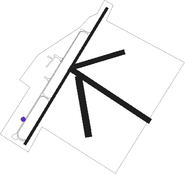
Runway info
Runway 5 / 23  | ||
| length | 1094m (3589ft) | |
| bearing | 44° / 224° | |
| width | 18m (60ft) | |
| surface | asphalt | |
| displ threshold | 71m (233ft) / 0m (0ft) | |
| Runway 14 / 32 | ||
| length | 637m (2090ft) | |
| bearing | 120° / 300° | |
| width | 37m (120ft) | |
| surface | grass | |
| Runway 18 / 36 | ||
| length | 382m (1253ft) | |
| bearing | 173° / 353° | |
| width | 46m (150ft) | |
| surface | grass | |
| Runway 09 / 27 | ||
| length | 335m (1099ft) | |
| bearing | 81° / 261° | |
| width | 34m (110ft) | |
| surface | grass | |
Nearby beacons
| code | identifier | dist | bearing | frequency |
|---|---|---|---|---|
| SW | NEELY (NEWBURGH) NDB | 12.3 | 116° | 335 |
| HUO | HUGUENOT VOR/DME | 12.7 | 215° | 116.10 |
| SKU | STANWYCK (NEWBURGH) NDB | 19 | 99° | 261 |
| IGN | KINGSTON VOR/DME | 28.8 | 84° | 117.60 |
| SAX | SPARTA VORTAC | 32 | 189° | 115.70 |
| PWL | PAWLING (POUGHKEEPSIE) VOR/DME | 39.8 | 79° | 114.30 |
| STW | STILLWATER VOR/DME | 40.5 | 214° | 109.60 |
| DNY | DE LANCEY VOR/DME | 41.4 | 319° | 112.10 |
| MM | MOREE (MORRISTOWN) NDB | 43.4 | 170° | 392 |
| CMK | CARMEL VOR/DME | 43.8 | 110° | 116.60 |
| HNK | HANCOCK VOR/DME | 47.5 | 299° | 116.80 |
| TEB | TETERBORO VOR/DME | 48.3 | 152° | 108.40 |
| TE | TORBY (TETERBORO) NDB | 49.8 | 158° | 214 |
| BWZ | BROADWAY (SCHOOLEY'S MT) VOR/DME | 50.7 | 204° | 114.20 |
| PFH | PHILMONT (HUDSON) NDB | 51.2 | 48° | 272 |
| CAT | CHATHAM NDB | 51.4 | 178° | 254 |
| LGA | LA GUARDIA (NEW YORK) VOR/DME | 55.6 | 144° | 113.10 |
| RKA | ROCKDALE VOR/DME | 62.7 | 318° | 112.60 |
| CRI | CANARSIE VOR/DME | 64.4 | 150° | 112.30 |
| JFK | KENNEDY (NEW YORK) VOR/DME | 65.7 | 145° | 115.90 |
| FR | FRIKK (FARMINGDALE) NDB | 66.1 | 130° | 407 |
| FJC | ALLENTOWN VORTAC | 69 | 229° | 117.50 |
Disclaimer
The information on this website is not for real aviation. Use this data with the X-Plane flight simulator only! Data taken with kind consent from X-Plane 12 source code and data files. Content is subject to change without notice.