Nuku'alofa - Fua'amotu Intl.
Airport details
| Country | Tonga |
| State | Tongatapu |
| Region | NF |
| Municipality | Vahe Tatakamotonga |
| Elevation | 127ft (39m) |
| Timezone | GMT +13 |
| Coordinates | -21.24105, -175.13963 |
| Magnetic var | |
| Type | land |
| Available since | X-Plane v10.40 |
| ICAO code | NFTF |
| IATA code | TBU |
| FAA code | n/a |
Communication
| FUA'AMOTU Intl. GROUND | 121.900 |
| FUA'AMOTU Intl. FUA'AMOTU TOWER | 118.500 |
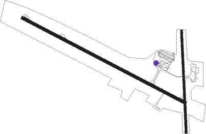
Runway info
Runway 11 / 29  | ||
| length | 2674m (8773ft) | |
| bearing | 120° / 300° | |
| width | 45m (148ft) | |
| surface | asphalt | |
| blast zone | 60m (197ft) / 60m (197ft) | |
| Runway 17 / 35 | ||
| length | 1501m (4925ft) | |
| bearing | 182° / 2° | |
| width | 30m (98ft) | |
| surface | hard surface | |
| displ threshold | 240m (787ft) / 345m (1132ft) | |
Nearby beacons
| code | identifier | dist | bearing | frequency |
|---|---|---|---|---|
| FM | FUA'AMOTU (TONGA) NDB | 0.5 | 210° | 245 |
| TBU | FUA'AMOTU VOR/DME | 0.5 | 251° | 114.50 |
Departure and arrival routes
| Transition altitude | 13000ft |
| Transition level | 15000ft |
| SID end points | distance | outbound heading | |
|---|---|---|---|
| RW11 | |||
| ADNE1P | 75mi | 209° | |
| RW29 | |||
| ANGO1Q | 75mi | 209° | |
| STAR starting points | distance | inbound heading | |
|---|---|---|---|
| RW11 | |||
| KETU1A | 75.3 | 29° | |
| IBAK1A | 75.0 | 72° | |
| HOBA1A | 75.0 | 116° | |
| GOBI1A | 75.2 | 203° | |
| EKED1A | 75.1 | 213° | |
| DALD1A | 74.8 | 248° | |
| AGEX1A | 74.8 | 272° | |
| RW29 | |||
| KETU1B | 75.3 | 29° | |
| IBAK1B | 75.0 | 72° | |
| HOBA1B | 75.0 | 116° | |
| GOBI1B | 75.2 | 203° | |
| EKED1B | 75.1 | 213° | |
| DALD1B | 74.8 | 248° | |
| AGEX1B | 74.8 | 272° | |
Instrument approach procedures
| runway | airway (heading) | route (dist, bearing) |
|---|---|---|
| RW11 | KILEK (139°) | KILEK LURGA (5mi, 193°) 2500ft |
| RW11 | LEMAS (100°) | LEMAS LURGA (5mi, 54°) 2500ft |
| RW11 | LURGA (119°) | LURGA 2500ft |
| RNAV | LURGA 2500ft TF762 (5mi, 120°) 1740ft NFTF (6mi, 118°) 142ft DORNI (10mi, 122°) 2500ft | |
| RW29 | BETLI (281°) | BETLI DORNI (5mi, 234°) 2500ft |
| RW29 | DORNI (302°) | DORNI 2500ft |
| RW29 | OLPER (323°) | OLPER DORNI (5mi, 13°) 2500ft |
| RNAV | DORNI 2500ft TF982 (5mi, 300°) 1760ft NFTF (5mi, 303°) 164ft LURGA (11mi, 299°) 2500ft |
Disclaimer
The information on this website is not for real aviation. Use this data with the X-Plane flight simulator only! Data taken with kind consent from X-Plane 12 source code and data files. Content is subject to change without notice.