La Foa - La Foa Oua Tom
Airport details
| Country | France |
| State | [Other] |
| Region | NW |
| Municipality | La Foa |
| Elevation | 98ft (30m) |
| Timezone | GMT +11 |
| Coordinates | -21.81972, 165.86084 |
| Magnetic var | |
| Type | land |
| Available since | X-Plane v10.40 |
| ICAO code | NWWT |
| IATA code | n/a |
| FAA code | n/a |
Communication
Nearby Points of Interest:
Passerelle Marguerite
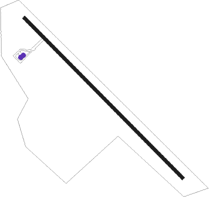
Runway info
| Runway 13 / 31 | ||
| length | 800m (2625ft) | |
| bearing | 138° / 318° | |
| width | 12m (39ft) | |
| surface | asphalt | |
Nearby beacons
| code | identifier | dist | bearing | frequency |
|---|---|---|---|---|
| NW | TONTOUTA (NOUMEA) NDB | 13.9 | 119° | 325 |
| FND | TONTOUTA (NOUMEA) NDB | 21.1 | 119° | 354 |
| LTO | TONTOUTA (NOUMEA) VOR/DME | 22.5 | 118° | 112.90 |
| HL | HOUAILOU NDB | 36.4 | 336° | 284 |
| MG | MAGENTA (NOUMEA) NDB | 43.5 | 126° | 394 |
| MGA | OUERE (NOUMEA) VOR/DME | 45.2 | 129° | 113 |
| MD | MAGENTA (NOUMEA) NDB | 51.9 | 137° | 383 |
| KQ | KONE NDB | 69.9 | 306° | 305 |
Disclaimer
The information on this website is not for real aviation. Use this data with the X-Plane flight simulator only! Data taken with kind consent from X-Plane 12 source code and data files. Content is subject to change without notice.