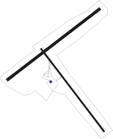
Hokitika
Airport details
| Country | New Zealand |
| State | West Coast |
| Region | NZ |
| Municipality | Westland District |
| Elevation | 145ft (44m) |
| Timezone | GMT +12 |
| Coordinates | -42.71361, 170.98528 |
| Magnetic var | |
| Type | land |
| Available since | X-Plane v10.40 |
| ICAO code | NZHK |
| IATA code | HKK |
| FAA code | n/a |
Communication
| Hokitika ASOS | 127.100 |
| Hokitika CTAF | 119.100 |
| Hokitika CHRISTCHURCH FIS | 118.500 |
Nearby Points of Interest:
Government Buildings/Courthouse
-Okitiki Building
-Hokitika Savings Bank Building (Former)
-Hokitika Customhouse
-Dispatch & Garlick
-Hannah's Buildings
-Runanga Miners' Hall
-Brunner Mine
-Kotuku Model Bungalow
Nearby beacons
| code | identifier | dist | bearing | frequency |
|---|---|---|---|---|
| HK | HOKITIKA NDB | 1.5 | 242° | 310 |
| WS | WESTPORT NDB | 64 | 31° | 278 |
| WS | PORT DME | 64.1 | 31° | 116.90 |
Departure and arrival routes
| Transition altitude | 13000ft |
| Transition level | 15000ft |
| STAR starting points | distance | inbound heading | |
|---|---|---|---|
| RW03 | |||
| DUBO3A | 47.2 | 1° | |
| DAMI2A | 53.7 | 193° | |
| BOSL3A | 38.3 | 238° | |
| BELE2A | 28.5 | 298° | |
| RW21 | |||
| DUBO3B | 47.2 | 1° | |
| DAMI2B | 53.7 | 193° | |
| BOSL3B | 38.3 | 238° | |
| BELE2B | 28.5 | 298° | |
Instrument approach procedures
| runway | airway (heading) | route (dist, bearing) |
|---|---|---|
| RW03 | ANDEP (40°) | ANDEP KARVO (5mi, 319°) 2500ft |
| RW03 | BEDAV (85°) | BEDAV KARVO (5mi, 139°) 2500ft |
| RNAV | KARVO 2500ft HK406 (5mi, 65°) 1770ft NZHK (5mi, 66°) 174ft (8199mi, 284°) 1000ft BEDAV (8196mi, 104°) 2500ft BEDAV (turn) 2500ft | |
| RW21 | AGTUR (255°) | AGTUR MAKOS (8mi, 268°) 3000ft |
| RW21 | EKVIL (219°) | EKVIL MAKOS (5mi, 139°) 3000ft |
| RNAV | MAKOS 3000ft HK407 (5mi, 244°) 1760ft NZHK (5mi, 243°) 167ft (8199mi, 284°) 1000ft EKVIL (8210mi, 104°) 3000ft EKVIL (turn) 3000ft |
Disclaimer
The information on this website is not for real aviation. Use this data with the X-Plane flight simulator only! Data taken with kind consent from X-Plane 12 source code and data files. Content is subject to change without notice.

