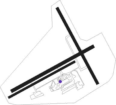
New Plymouth
Airport details
| Country | New Zealand |
| State | Taranaki |
| Region | NZ |
| Municipality | New Plymouth |
| Elevation | 97ft (30m) |
| Timezone | GMT +12 |
| Coordinates | -39.00861, 174.17917 |
| Magnetic var | |
| Type | land |
| Available since | X-Plane v10.40 |
| ICAO code | NZNP |
| IATA code | NPL |
| FAA code | n/a |
Communication
| NEW PLYMOUTH ATIS | 127.050 |
| NEW PLYMOUTH CTAF | 124.700 |
| NEW PLYMOUTH Tower | 118.100 |
| NEW PLYMOUTH Tower | 124.700 |
| NEW PLYMOUTH CHRISTCHURCH CON | 123.700 |
| NEW PLYMOUTH Approach | 118.100 |
| NEW PLYMOUTH Approach | 124.700 |
Nearby Points of Interest:
The Taranaki Cathedral Church of St Mary
-Cape Egmont Lighthouse
Nearby beacons
| code | identifier | dist | bearing | frequency |
|---|---|---|---|---|
| NP | NEW PLYMOUTH VOR/DME | 0.2 | 74° | 114.40 |
| OR | DME | 31.2 | 74° | 113 |
| WU | DME | 69.2 | 138° | 116 |
| WU | WHANGANUI NDB | 69.3 | 138° | 382 |
Departure and arrival routes
| Transition altitude | 13000ft |
| Transition level | 15000ft |
| SID end points | distance | outbound heading | |
|---|---|---|---|
| RW05 | |||
| HARV2P | 30mi | 46° | |
| SAVL3P | 27mi | 146° | |
| RW23 | |||
| HARV1Q | 30mi | 46° | |
| LATI2Q | 27mi | 146° | |
| SOUTH5 | 103mi | 171° | |
| GUSU2Q | 30mi | 207° | |
| STAR starting points | distance | inbound heading | |
|---|---|---|---|
| RW05 | |||
| MUMO2A | 27.3 | 29° | |
| RW23 | |||
| HARV2B | 30.2 | 226° | |
| BUGN1B | 29.9 | 266° | |
| SELT2B | 26.9 | 326° | |
Instrument approach procedures
| runway | airway (heading) | route (dist, bearing) |
|---|---|---|
| RW05 | VARMA (71°) | VARMA 4400ft |
| RNAV | VARMA 2500ft LUTUX (4mi, 71°) 1410ft NZNP (4mi, 72°) 139ft UPDAL (8mi, 70°) 3000ft UPDAL (turn) | |
| RW23 | UPDAL (250°) | UPDAL 2500ft |
| RNAV | UPDAL 2500ft DOVED (4mi, 251°) 1410ft NZNP (4mi, 250°) 132ft (8446mi, 283°) 600ft PEXUR (8445mi, 103°) 3000ft PEXUR (turn) |
Holding patterns
| STAR name | hold at | type | turn | heading* | altitude | leg | speed limit |
|---|---|---|---|---|---|---|---|
| BUGN1B | BUGNO | VHF | right | 63 (243)° | > 3100ft | 1.0min timed | ICAO rules |
| BUGN1B | UPDAL | VHF | right | 45 (225)° | > 2200ft | 1.0min timed | 200 |
| HARV2B | HARVO | VHF | right | 17 (197)° | > 3800ft | DME 6.0mi | ICAO rules |
| HARV2B | UPDAL | VHF | right | 45 (225)° | > 2200ft | 1.0min timed | 200 |
| MUMO2A | MUMOX | VHF | left | 157 (337)° | > 9200ft | 1.0min timed | ICAO rules |
| MUMO2A | VARMA | VHF | left | 242 (62)° | > 4400ft | DME 6.0mi | 200 |
| PEXU2A | DOBBO | VHF | right | 348 (168)° | > 1200ft | 1.0min timed | ICAO rules |
| PEXU2A | HARVO | VHF | right | 17 (197)° | > 3800ft | DME 6.0mi | ICAO rules |
| PEXU2A | PEXUR | VHF | right | 315 (135)° | > 2600ft | 1.0min timed | 200 |
| PEXU2A | UPDAL | VHF | right | 45 (225)° | > 2200ft | 1.0min timed | 200 |
| PEXU2A | VARMA | VHF | left | 242 (62)° | > 4400ft | DME 6.0mi | 200 |
| SELT2B | UPDAL | VHF | right | 45 (225)° | > 2200ft | 1.0min timed | 200 |
| SUBR3B | DOBBO | VHF | right | 348 (168)° | > 1200ft | 1.0min timed | ICAO rules |
| SUBR3B | MUMOX | VHF | left | 157 (337)° | > 9200ft | 1.0min timed | ICAO rules |
| SUBR3B | PEXUR | VHF | right | 315 (135)° | > 2600ft | 1.0min timed | 200 |
| SUBR3B | UPDAL | VHF | right | 45 (225)° | > 2200ft | 1.0min timed | 200 |
| VANS2B | IGDOT | VHF | right | 111 (291)° | > 3600ft | DME 6.0mi | ICAO rules |
| VANS2B | MANGA | VHF | right | 170 (350)° | > 2500ft | 1.0min timed | ICAO rules |
| VANS2B | UPDAL | VHF | right | 45 (225)° | > 2200ft | 1.0min timed | 200 |
| VISA3A | BUGNO | VHF | right | 63 (243)° | > 3100ft | 1.0min timed | ICAO rules |
| VISA3A | IGDOT | VHF | right | 111 (291)° | > 3600ft | DME 6.0mi | ICAO rules |
| VISA3A | MANGA | VHF | right | 170 (350)° | > 2500ft | 1.0min timed | ICAO rules |
| VISA3A | VARMA | VHF | left | 242 (62)° | > 4400ft | DME 6.0mi | 200 |
| *) magnetic outbound (inbound) holding course | |||||||
Disclaimer
The information on this website is not for real aviation. Use this data with the X-Plane flight simulator only! Data taken with kind consent from X-Plane 12 source code and data files. Content is subject to change without notice.

