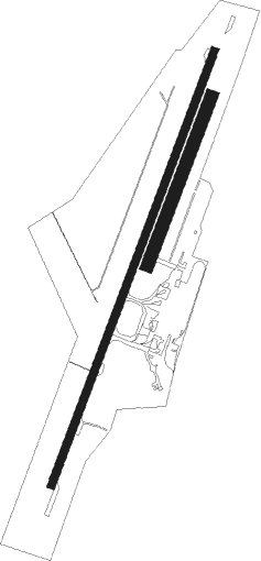
Rotorua
Airport details
| Country | New Zealand |
| State | Bay of Plenty |
| Region | NZ |
| Municipality | Rotorua |
| Elevation | 935ft (285m) |
| Timezone | GMT +12 |
| Coordinates | -38.10917, 176.31721 |
| Magnetic var | |
| Type | land |
| Available since | X-Plane v10.40 |
| ICAO code | NZRO |
| IATA code | ROT |
| FAA code | n/a |
Communication
| Rotorua ATIS | 128.800 |
| Rotorua CTAF | 121.200 |
| Rotorua Tower | 121.200 |
| Rotorua CHRISTCHURCH Approach | 119.500 |
Nearby Points of Interest:
Te Hāhi o te Whakapono / St Faith's Anglican Church Ohinemutu

Nearby beacons
| code | identifier | dist | bearing | frequency |
|---|---|---|---|---|
| RO | ROTORUA VOR/DME | 0.1 | 289° | 112.10 |
| TG | TAURANGA NDB | 26.5 | 344° | 346 |
| WK | WHAKATANE NDB | 30.3 | 73° | 362 |
| WK | DME | 30.4 | 73° | 117.70 |
| AP | TAUPO NDB | 39.7 | 201° | 230 |
| HN | HAMILTON VOR/DME | 48.8 | 285° | 114 |
Departure and arrival routes
| Transition altitude | 13000ft |
| Transition level | 15000ft |
| SID end points | distance | outbound heading | |
|---|---|---|---|
| RW18 | |||
| TOTR3P | 25mi | 183° | |
| TOTRA5 | 12mi | 237° | |
| ORAK2P | 30mi | 320° | |
| RW36 | |||
| OKERE4 | 12mi | 31° | |
| DOLS2R | 25mi | 183° | |
| NIKO2R | 30mi | 320° | |
| STAR starting points | distance | inbound heading | |
|---|---|---|---|
| RW18 | |||
| REVE1A | 13.1 | 184° | |
| ABTU2A | 12.9 | 235° | |
| RW36 | |||
| INTO1B | 30.0 | 38° | |
| SURK2B | 12.7 | 39° | |
| IBAM1B | 25.0 | 51° | |
| LALA1B | 19.1 | 105° | |
Instrument approach procedures
| runway | airway (heading) | route (dist, bearing) |
|---|---|---|
| RW18-Z | OKERE (211°) | OKERE NIKOR (3mi, 214°) 3000ft |
| RNAV | NIKOR 3000ft ELKOB (4mi, 211°) 2260ft NZRO (5mi, 209°) 985ft TOTRA (12mi, 237°) 5000ft TOTRA (turn) | |
| RW36-Y | TOTRA (57°) | TOTRA 4000ft |
| RNAV | TOTRA 4000ft ADKAG (2mi, 63°) 4000ft SEKBU (2mi, 63°) 3500ft RO366 (5mi, 63°) 1900ft RO364 (turn) 1570ft NZRO (2mi, 33°) 988ft RO362 (7mi, 30°) OKERE (5mi, 33°) 4000ft OKERE (turn) 4000ft | |
| RWNVB | TOTRA (57°) | TOTRA 4000ft |
| RNAV | TOTRA 4000ft FF031 (6mi, 57°) 2820ft MA031 (4mi, 57°) 1321ft OKERE (13mi, 34°) 4000ft OKERE (turn) 4000ft |
Holding patterns
| STAR name | hold at | type | turn | heading* | altitude | leg | speed limit |
|---|---|---|---|---|---|---|---|
| ABTU2A | OKERE | VHF | right | 6 (186)° | > 4000ft | 1.0min timed | ICAO rules |
| DUBA1B | OKERE | VHF | right | 6 (186)° | > 4000ft | 1.0min timed | ICAO rules |
| DUBA1B | TOTRA | VHF | right | 210 (30)° | > 4000ft | 1.0min timed | 200 |
| IBAM1B | TOTRA | VHF | right | 210 (30)° | > 4000ft | 1.0min timed | 200 |
| INTO1B | INTOX | VHF | left | 178 (358)° | > 4500ft | 1.0min timed | ICAO rules |
| INTO1B | TOTRA | VHF | right | 210 (30)° | > 4000ft | 1.0min timed | 200 |
| LALA1B | ESKER | VHF | right | 292 (112)° | > 5500ft | 1.0min timed | ICAO rules |
| LALA1B | TOTRA | VHF | right | 210 (30)° | > 4000ft | 1.0min timed | 200 |
| LEDA2A | ESKER | VHF | right | 292 (112)° | > 5500ft | 1.0min timed | ICAO rules |
| LEDA2A | INTOX | VHF | left | 178 (358)° | > 4500ft | 1.0min timed | ICAO rules |
| LEDA2A | OKERE | VHF | right | 6 (186)° | > 4000ft | 1.0min timed | ICAO rules |
| LEDA2A | TOTRA | VHF | right | 210 (30)° | > 4000ft | 1.0min timed | 200 |
| LEDA2C | ESKER | VHF | right | 292 (112)° | > 5500ft | 1.0min timed | ICAO rules |
| LEDA2C | INTOX | VHF | left | 178 (358)° | > 4500ft | 1.0min timed | ICAO rules |
| LEDA2C | TOTRA | VHF | right | 210 (30)° | > 4000ft | 1.0min timed | 200 |
| REVE1A | OKERE | VHF | right | 6 (186)° | > 4000ft | 1.0min timed | ICAO rules |
| SURK2B | TOTRA | VHF | right | 210 (30)° | > 4000ft | 1.0min timed | 200 |
| *) magnetic outbound (inbound) holding course | |||||||
Disclaimer
The information on this website is not for real aviation. Use this data with the X-Plane flight simulator only! Data taken with kind consent from X-Plane 12 source code and data files. Content is subject to change without notice.