Wellsford - Springhill
Airport details
| Country | New Zealand |
| State | Auckland |
| Region | NZ |
| Municipality | Rodney |
| Elevation | 99ft (30m) |
| Timezone | GMT +13 |
| Coordinates | -36.32500, 174.55556 |
| Magnetic var | |
| Type | land |
| Available since | X-Plane v10.40 |
| ICAO code | NZSL |
| IATA code | n/a |
| FAA code | n/a |
Communication
Nearby Points of Interest:
Smelting House ruins
-Ruatuna
-Auckland volcanic field
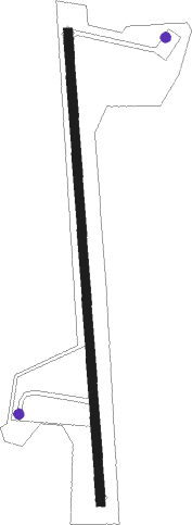
Runway info
| Runway 16 / 34 | ||
| length | 869m (2851ft) | |
| bearing | 181° / 1° | |
| width | 16m (52ft) | |
| surface | asphalt | |
| displ threshold | 182m (597ft) / 163m (535ft) | |
Nearby beacons
| code | identifier | dist | bearing | frequency |
|---|---|---|---|---|
| WP | WHENUAPAI (AUCKLAND) VOR/DME | 27.9 | 171° | 116.40 |
| SF | SPRINGFIELD (WHANGAREI) NDB | 28 | 336° | 366 |
| WR | WHANGAREI NDB | 34.5 | 341° | 326 |
| AA | AUCKLAND VOR/DME | 42.6 | 159° | 114.80 |
| WI | WAIUKU NDB | 57.9 | 165° | 254 |
| SY | SURREY NDB | 62.2 | 146° | 350 |
Disclaimer
The information on this website is not for real aviation. Use this data with the X-Plane flight simulator only! Data taken with kind consent from X-Plane 12 source code and data files. Content is subject to change without notice.